Last Updated on October 29, 2025 by foxintheforest
I’ve lived in Colorado for 15 years. During that time, I’ve walked hundreds of trails to find the state’s best hikes. Colorado offers jaw-dropping mountain vistas. It also has quirky sandstone monoliths. There is a wide variety of trails in Colorado.
This guide to the best hikes in Colorado gives you my personal hiking recommendations for all abilities, gathered from 2 decades of exploring these trails.
I want you to have access to on-the-ground, local knowledge (hello, beating the crowds!).
As a Colorado local and writer for the outdoor industry, I’ve gotten pretty damn good at finding the most amazing hikes in Colorado without the crowds.
I want to get you out on the best Colorado hiking trails like a local, not a tourist.
At a Glance
| Best for… | Hike Name (click/tap the link for details) | Highlights | Lowlights |
| Best hike for beginners | Lake Hayiaha | 4 alpine lakes for the price of one. | The most crowded hike in the state. Special timed entry permit required. |
| Best summit hike | Mt Bierstadt | Great beginner summit hike with easy access from Denver | EXTREME crowds |
| Prettiest alpine lake | Cascade Creek to Mirror Lake | Stunning views of Colorado’s most dramatic mountain | Long |
| Best secret hike | Devil’s Canyon | Unexpected red rock views | Mt Bierstadt |
| Best Waterfall | Hanging Lake | Stunning lake with a bonus hidden waterfall! | Permit required |
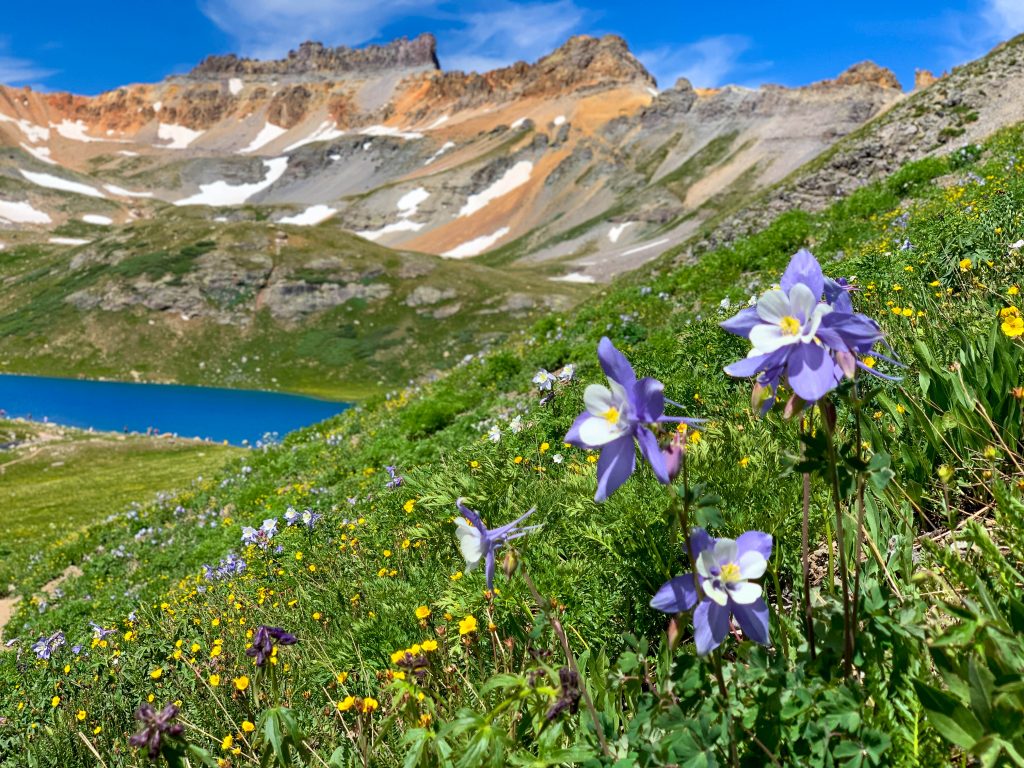
| Best wildflowers | Scarp Ridge | Incredible wildflowers and alpine scenery | STEEP |
| Best winter jaunt | Mayflower Gulch | Dramatic ridgelines and snowy picture-perfect old cabin | CROWDED |
| Top fall hike | Maroon Bells Scenic Loop Trail | Postcard-worthy views at a classic location (read my description for a secret viewpoint!) | CROWDED and complicated to book permits. Sunrise strongly recommended. |
| Most unique | Rattlesnake Arches | The biggest concentration of rock arches outside of Arches National Park | 4×4 vehicle required or the hike is 15-plus miles |
Best time to hike in Colorado
When is the best time to hike in Colorado?
The best months to hike in Colorado are from late June through late September when most of the best hikes in Colorado are devoid of snow.
Early to mid-June still has quite a bit of snow, so don’t plan to hike unless you’re visiting lower-elevation areas (such as Grand Junction, Evergreen, or the Lost Creek Wilderness).
Late June and July are plagued by afternoon thunderstorms, which means an early start is essential to stay safe.
In August, the storms start to taper off, and drier days are ahead. September marks the start of fall. The aspens are quivering and the weather is typically sunny, but it can snow.
October is another great time to hike – but the weather is a little unpredictable. However, it’s one of the least-crowded months on the trail.
Amazing Colorado Trails You’ve Never Heard of
These are still pretty popular trails, but they aren’t always on the tourist radar or they have far more popular counterparts nearby.
These are a few incredible hiking trails that you won’t find on other best-of lists. My personal stash of favorites that I keep coming back to.
Gem Lake via Lumpy Ridge in Rocky Mountain National Park
This one has gotten busier over the years, but I still love a good hike to Gem Lake. Yet another spot frequented by my climbing antics, I’ve been here a few times.
It’s a great alternative to the main area of RMNP, Lumpy Ridge – where you’ll find Gem Lake – has a different feel.
Check out the famous Gem Lake for stunning views of strange rock pinnacles and mountain vistas.
Distance: 3.1
Elevation Gain: 990
Difficulty: easy to moderate
Red Tape and Local Tips: No dogs. It’s free, but you need a timed entry.
Crowds: Crowded. Plan to start your hike by 7 am if you want to avoid crowds.
Location: Lumpy Ridge in Rocky Mountain National Park
Trailhead: Lumpy Ridge
Where to Stay: Estes Park is a great home base or day trip from Denver/Boulder.
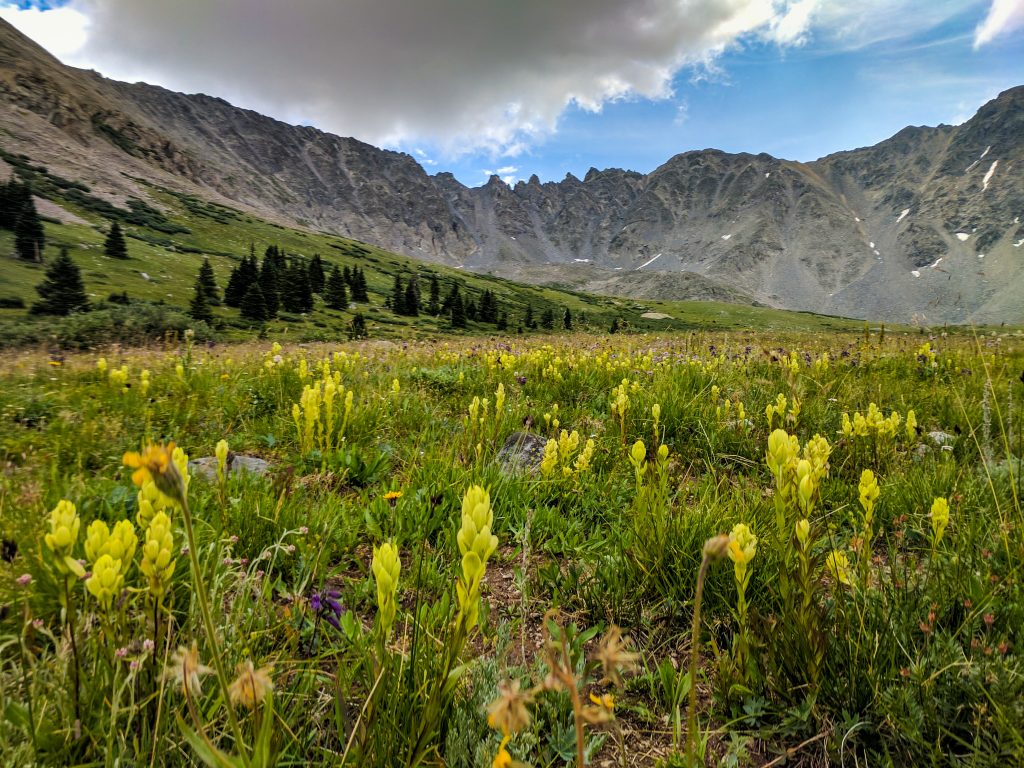
Scarp Ridge in Crested Butte
Hello, wildflowers! This is a butt-busting, but highly rewarding hike outside of Crested Butte.
You’ve got views pretty much the entire way which makes this a great bang for your buck.
It is STEEP, but worth it. At the top of the ridge, you can see the Maroon Bells – what a treat!
And did I mention there were TONS of wildflowers? Seriously. Crested Butte is the wildflower capital of the state and this trail really delivers.
Local Tip: Go clockwise to get the steeper, looser uphill out of the way.
Distance: 3.9 miles
Elevation Gain: 1490 feet
Difficulty: moderate/difficult
Red Tape and Local Tips: dog-friendly. High clearance is required to reach the trailhead
Crowds: Busy. It’s quite pleasant in the mornings.
Location: Crested Butte
Trailhead: Scarp Ridge (4×4 with higher clearance recommended, daring folks could take a crossover SUV)
Where to Stay: Dispersed camping along Kebbler Pass, or stay in nearby Crested Butte (the resort area is slightly more affordable in the summer).

Mount Sniktau at Loveland Pass
So long-time locals might roll their eyes at me saying Mt Sniktau is lesser-known, but compared to nearby Grays and Torreys, this one sees less traffic.
I hike Sniktau every year. I’ve done it in all of the seasons, but a late summer sunset jaunt is my personal favorite. We love to pack a picnic burrito and head up here to watch the sunset. It’s worth it to ramble around on the other side of Loveland Pass too if this hike isn’t enough for you.
If you’re just getting into summiting mountains, then head up to the top of Mount Sniktau. Even seasoned mountain hikers will love the glorious views.
Distance: 3.5 miles
Elevation Gain: 1,530 feet
Difficulty: moderate/difficult
Red Tape and Local Tips: dog-friendly.
Crowds: Busy to crowded. It can be packed at the start of the trail, but most people are just venturing a few hundred yards from their car. If you want some solitude, consider a sunset jaunt.
Trailhead: Loveland Pass
Location: Loveland Pass
Where to Stay: Idaho Springs or day trip from Denver
Ptarmigan Lake near Buena Vista
People do know about Ptarmigan Lake, but it doesn’t show up on many best-of lists, which is why I included it here.
We stumbled across this gem of a hike and it was such a beautiful discovery. One of my fondest memories was from this hike was the water color and the dusting of snow made for a magical scene!
This is one of the best fall hikes in Colorado that doesn’t get smashed with people. The beautiful scenery passes by a few small lakes and ponds before the final push to Ptarmigan Lake.
Distance: 6 miles
Elevation gain: 1,469 feet
Difficulty: Moderate
Red Tape and Local Tips: Dog-friendly
Crowds: Busy to crowded. Plan an 8 am start.
Trailhead: Ptarmigan Lake
Location: Cottonwood Pass in the Sawatch Range
Where to Stay: Dispersed camping and some campgrounds along Cottonwood Pass or nearby Buena Vista
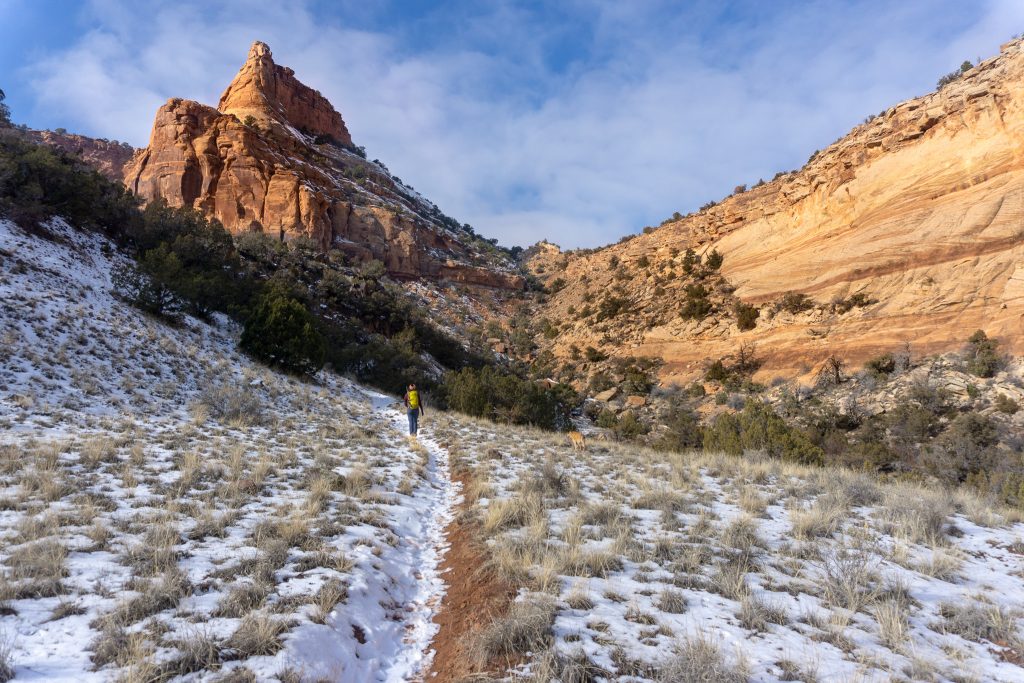
Devil’s Canyon near Fruita, Colorado
I bumped into Devil’s Canyon on accident, but I’m glad I found this diamond in the rough. We hiked this after a snowy night and seeing the red sandstone cliffs dusted in snow was just magic.
Devil’s Canyon is one of my favorite Winter hikes in Colorado because it’s a break from dangerous, cold, snow-filled mountains. We try to come out here at least once a year.
The canyon itself features gorgeous sandstone formations and plenty of beautiful scenery. Seeing it dusted in snow is a true treat.
Distance: 6.7 miles
Elevation gain: 764 feet
Difficulty: Moderate
Red Tape and Local Tips: dog-friendly
Crowds: Busy
Trailhead: Devil’s Canyon
Location: Outside of Fruita.
Where to Stay: We love the Balanced Rock Inn or camping (reservation required) near Rabbit Valley.
Rattlesnake Arches in McInnis Canyons National Conservation Area
I love to escape to the red sandstone canyons outside of Fruita, Colorado multiple times a year. Rattlesnake Arches in McInnis Canyons National Conservation Area is a varied challenge that can be done in a day by an avid hiker, or you can opt to do the Upper Route, which I recommend the most!
This incredible trail features stunning arches (we counted 8) in a red rock canyon that you have to see to believe. You really won’t believe you’re actually in Colorado.
Local Tip: The upper access road is open from April 15th – August 15th and the lower access road is open from August 15 – Feb 14th. You can only access this trail within that timeframe.
Distance: 3.8 miles
Elevation gain: 318 feet
Difficulty: Easy
Red Tape and Local Tips: Dog-friendly. You need high clearance (and most will want low gears) to reach the trailhead.
Crowds: Slightly busy.
Location: Near Fruita
Trailhead: 2 Options. 1) Rattlesnake Arches upper TH (4×4 with high clearance required) or Pollock Bench TH
Where to Stay: Balanced Rock Inn near Fruita or the Saddlehorn Campground in the Colorado National Monument.

The Most Scenic Hikes in Colorado That Are Worth the Effort
There are over 17,000 named trails in Colorado and here are the standouts. But here’s the catch – EVERYONE knows these are beautiful, so they are insanely popular.
I’ve done each of these hikes multiple times over many years. I keep coming back either for the unique nature of the hike, multiple options for side trips, or simply because I love them!
However, I’m often the only one here when I go (yes, I’ve been to all of these, multiple times). Planning to arrive at the highlight of the hike usually brings fewer crowds in my experience.
Chicago Lakes Trail near Breckenridge
I can name about 15 alpine lakes in Colorado that are prettier than Chicago Lakes. I’ve hiked this trail in the winter and the summer and found it to be mediocre.
I much prefer heading to Crystal Lakes one basin over. Father Dyer is an awesome peak, and it’s a quieter experience, which is saying something because there’s a 4×4 road that goes to the lakes.
But a TON of people love this one, so check it out and see for yourself.
Chicago Lakes starts off steep and mellows out as it meanders down a valley toward the backside of Mount Blue Sky. When it comes to hikes in Colorado, Chicago Lakes delivers varied scenery.
Combine this hike with one of the most scenic drives near Denver for an epic day outside.
Distance: 8.7 miles
Elevation Gain: 1,860 feet
Difficulty: moderate/difficult
Red Tape and Local Tips: dog-friendly.
Crowds: Extremely crowded. Start by 6 am.
Garden of the Gods Loop near Colorado Springs
So the Garden of the Gods isn’t so much a hike as it is a trip to a city park, but it’s worth mentioning because this is not your average city park.
I’ve been on this trail a bunch, I have friends in Colorado Springs so I usually opt to do a quick trail run early in the morning before I go see them. Honestly, early in the morning is the only way you should see this spot. Just set your expectations correctly – this isn’t totally a hike, but it’s not a walk either.
Hiking at Garden of the Gods is one of the top-rated things to do in Colorado. These stunning sandstone monoliths inspire the imagination.
Most trails are suitable for beginners, and there are even paved trails for accessible hiking, making it worth the trip.
Distance: 3.7 miles
Elevation gain: 416 feet
Difficulty: easy
Red Tape and Local Tips: Beat the crowds and go early. Dog-friendly.
Crowds: Extremely crowded. Plan for a sunrise walk or visit during the week to avoid the crowds.
Trailhead: Garden of the Gods
Location: Colorado Springs
Where to Stay: Colorado Springs or day trip from Denver
Fountain Valley Trail in Roxborough State Park
Roxborough State Park is arguably the prettiest state park in Colorado. If you want to hike this trail, get here early because once the parking is full in the park, you’ll have to wait to get in!
When I do this hike it’s usually during the week later in spring, early in the morning. I love to run this one, but I’d never venture here on a weekend. After work isn’t a bad time to swing by either.
This trail is so lovely that is popular among hikers, birders, and cross-country skiers alike.
Along the hike, take in the Fountain and Lyons rock formations that surround you.
You’ll also experience medium elevation changes as you ascend the loop and see historic buildings created by Henry S. Persse in the early 1900s.
Distance: 2.6 miles
Elevation Gain: 344 feet
Difficulty: Easy
Red Tape and Local Tips: It costs $4.00 per person to enter this park and dogs/bikes are not allowed.
Crowds: Extremely crowded. The park does fill up on weekends and wait times are long. Be here by 8 am to avoid crowds.
Trailhead: Roxborough Drive end of the road
Location: Roxborough State Park
Where to Stay: Littleton, Denver works too

Mayflower Gulch near Copper Mountain
This is my favorite place to take out-of-town visitors on a scenic jaunt. I’ve been here probably 6 or so times during all seasons of the year. In fact, I’ve actually climbed all of the mountains you see along this hike too, so I’ve thoroughly explored Mayflower Gulch. My favorite time to go is early in the morning in July on a weekday.
Mayflower Gulch is a spectacular wildflower hike in Colorado and is home to some of the best Colorado wildflowers of them all.
The low mileage and incredibly dramatic scenery make for a great hike. Afterward, check out the sights in nearby Dillon, Frisco, and Breckenridge.
Pro Tip: If you’re into hiking up peaks, this trailhead offers access to some of the best 13ers in Colorado.
Distance: 2.6 miles
Elevation gain: 1,141 feet
Difficulty: Easy to Moderate
Red Tape and Local Tips: Dog-friendly
Crowds: Busy throughout the year. Start by 8 am.
Location: Near Copper Mountain
Trailhead: Mayflower Gulch (in the summer you can drive the first part of the trail if you have a high-clearance vehicle)
Where to Stay: Copper Mountain Resort area or dispersed camping along Freemont Pass. Also able to day trip from Denver.
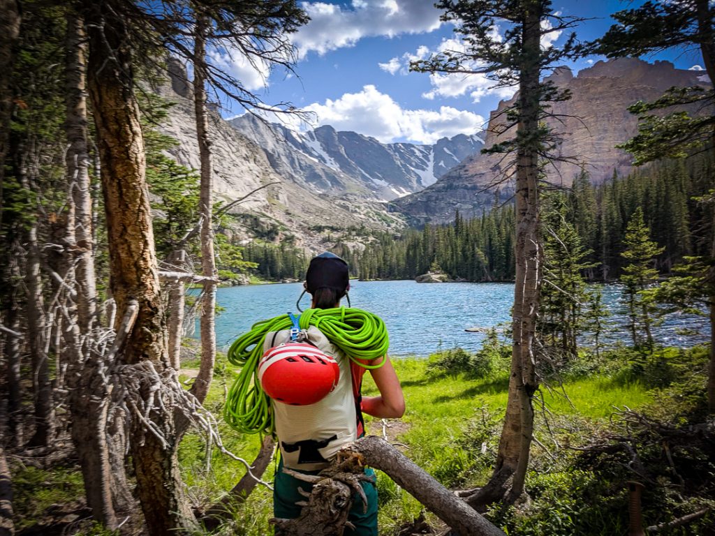
Dream Lake, Nymph Lake, Emerald Lake, and Lake Haiyaha in Rocky Mountain National Park
I’ve done this loop probably close to 10 times at this point in one way, shape, or form. There is a lot of alpine climbing in the area. I’m usually here before the sun comes up so I can climb all the mountains that make up the backdrop of these stunning lakes.
Typically, I’m passing by around sunrise, and no one is around. So if you want to see what many claim is one of the busiest trails in the country without 100s of people, sunrise is the way to go.
It’s a stunning area. My advice would be to go to Emerald Lake for sunrise, then swing back down to dream and head up to Haiyaha before returning to your car.
If that’s too much, then skip Haiyaha.
One of my favorite times I’ve ever been out hiking was when we experienced a sunrise on a windless day at Dream Lake in the winter.
For a mellow introduction to hiking in the park, hit up the 4 iconic alpine lakes, including the famous Emerald Lake, along this famous hiking trail. In fact, this is one of the best lake hikes in Colorado and hiking Lake Haiyaha is a real treat for winter.
Distance: 3.6 miles
Elevation Gain: 864
Difficulty: easy
Red Tape and Local Tips: This trail gets crowded and if you can’t park in the Bear Lake Lot, you’ll be taking the bus in. Arrive at the TH before 7 am. No dogs. It’s $25 to enter the park.
Crowds: Extremely crowded. This is one of the most popular trails in the state and the lake of parking doesn’t stop anyone. If you want any sense of solitude, start by 4:30 am and see a sunrise here. Even still, expect people, but you’ll be hanging out with handfuls instead of hundreds.
Trailhead: Bear Lake
Location: Rocky Mountain National Park
Where to Stay: Estes Park or day trip from Boulder/Denver.
Maroon Bells Scenic Loop near Aspen, Colorado
The Maroon Bells is one of those places that took me far too long to see. I’ve since been back a few times for burly trail runs and backpacking trips – there’s a lot to do here.
The area is easily one of the most beautiful places in Colorado, and as such there is a confusing permit system to access the area.
We had this place to ourselves when we arrived at 5:30 am on the 4th of July. Yes, you read that correctly.
Parking the Maroon Bells Scenic Area and figuring out how to visit is a bit of a pain, so you’ll need to do your homework.
Local Tip: It’s worth it to continue on to Crater Lake and a bit beyond on the West Maroon Pass trail to get a top-down view of the lake. If you’re really up for it, hiking to the top of West Maroon Pass is easily doable in a day (but is a difficult 11-ish mile round-trip hike)
Distance: 1.9 miles with options for more challenging hikes.
Elevation Gain: 49 feet
Difficulty: Easy
Red Tape and Local Tips: No dogs are allowed and you’ll need an advanced parking reservation or shuttle reservation when the road to the trailhead is open.
Crowds: Crowded with permits. The reservations make this not-so-bad, but it can be extremely crowded with tourists if you’re here in the middle of the day when the busses are running.
Trailhead: Maroon Bells Scenic Area
Location: Aspen
Where to Stay: Silverqueen Campground (reservations required) or nearby Carbondale (pricey, but nice). For budget-friendly options, the Glenwood Springs Inn is within an hour’s drive

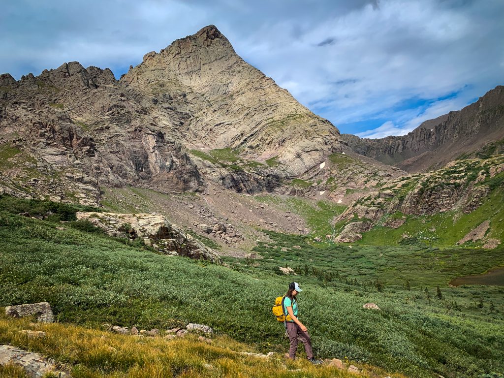
South Colony Lakes in the Crestones
This is one of my favorite beginner backpacking trips to recommend to folks. I’ve spent many nights here, mostly to climb the nearby 14ers, but we love to soak up the views at South Colony Lakes too.
Every time I’ve been here, we’ve encountered aggressive mountain sheep, so keep your head on a swivel!
What I love so much about South Colony Lakes are the views of the Crestones – which is one of the prettiest mountain cirques in the state.
South Colony Lakes holds a special place in my heart. Crestone Peak and the Crestone Needle, two of Colorado’s most famous 14ers (peaks above 14,000 feet high), create a beautifully dramatic backdrop. Most people opt to backpack this trail since you’ll find it hard to leave.
Distance: 8.9 miles
Elevation gain: 2,286 feet
Difficulty: easy to difficult depending on the trailhead you use.
Red Tape and Local Tips: This trail mostly follows a road and requires a high-clearance 4WD vehicle to reach the upper trailhead.
Busy to crowded: If you’re backpacking here, it’s considered crowded.
Trailhead: Upper South Colony Lakes TH (High clearance 4×4 required) or the Lower TH (dirt, no high clearance required)
Location: South of Westcliffe
Where to Stay: Westcliffe or camp at the trailhead (upper trailhead only). This is also a great beginner backpacking route!
Local Tip: If you can make it to the upper TH, you’ll knock off about 1,000 feet of gain and 3-ish miles of hiking round trip.
Keep in mind WAG bags are required here. If you aren’t cozy pooping in a bag and packing it out, stay home.
Loch Lake Trail in Rocky Mountain National Park
I really love the Loch – it doesn’t get enough love. Although it’s well-known and crowded, many people use it as a stepping stone to other areas of the park. But if you don’t want to hike a whole ton and still want to enjoy some of the best scenery in Rocky Mountain National Park, the Loch is the way to go.
You’ll pass by other famous hikes such as Alberta Falls, making it a lot of bang for your buck!
The hike to Loch Lake is quite stunning, and a must-visit for any moderate hiker. The trail varies in terrain, going from forested canyons to eye-opening alpine vistas. You can even continue on to the famous Sky Pond.
Distance: 5.4 miles
Elevation Gain: 1,072
Difficulty: Moderate
Red Tape and Local Tips: No dogs. It’s $25 to enter the park as of 2025.
Crowds: Extremely crowded. Plan a pre-dawn hike if you want solitude. However, if you want to do this, I’d suggest linking the Loch with a few other points of interest in the neighborhood!
Trailhead: Glacier Gorge. You can get here from Bear Lake, but it adds around 4 miles round trip.
Location: Glacier Gorge, Rocky Mountain National Park
Where to Stay: Estes Park or as a day trip from Boulder/Denver
Hanging Lake near Glenwood Springs
As one of the topmost scenic hikes in Colorado, Hanging Lake is on everyone’s to-do list. There’s a good reason for it: Hanging Lake looks like a place where fairies and gnomes would live.
And I’ll admit it, I actually kept this one off my list for a long time because of the crowds. Once the hike got permitted, I finally decided to check it out.
The first time I went was during a 6 am timeslot on a Tuesday in May. My friend and I had the entire place to ourselves. It was absolute magic.
I’ve been back 3 times since during different times of the year. Even when it’s busy during the day in the summer, it never really feels totally packed thanks to the permits.
Drones and dogs are not allowed, and there’s no swimming at the lake. You can only access this trail via a gated highway exit and you must have a permit in order to be let in the gate.
Distance: 3 miles
Elevation gain: 1,135 feet
Difficulty: Moderate
Red Tape and Local Tips: Beat the crowds and go for sunrise. There’s a $12 per-person permit required to hike. No dogs.
Crowds: Busy with permits. I’ve done this multiple times – the 6 am timeslot is best.
Trailhead: Hanging Lake. Note: The gates close outside of permit times.
Location: Near Glenwood Springs
Where to Stay: Glenwood Springs Inn (see the Maroon Bells for details)
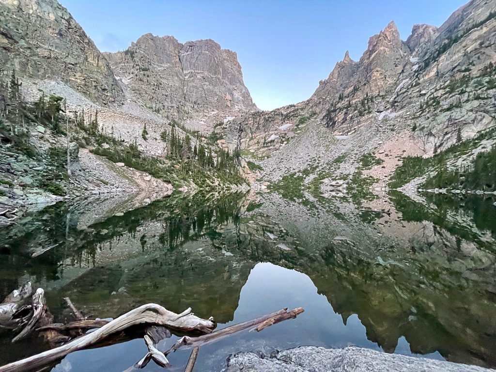
Cascade Creek to Mirror Lake and Lone Eagle Peak in the Indian Peaks Wilderness
So this might actually be my all-time favorite hike on this list. The Indian Peaks Wilderness is stunning and nothing quite captures that like the dramatic Lone Eagle Peak.
We started at 5 am from the trailhead and had this place to ourselves. Moose are frequent visitors on the trail – I’ve seen up to 5 in one day here – so if you do bring your dog, make sure they are on a leash.
When we went early, we got to see that perfect reflection on the lake before the morning breeze picked up. There were quite a few people heading up when we left.
One of the best hikes in Colorado is the iconic Mirror Lake and Lone Eagle Peak. Head up early to catch a perfect reflection of the stunning Lone Eagle Peak on Mirror Lake. The trail to the lake isn’t particularly difficult, but it is long.
Distance: 14.6 miles
Elevation Gain: 2,375 feet
Difficulty: moderate/difficult
Red Tape and Local Tips: Dog-friendly. Permits are required for an overnight.
Crowds: Busy to crowded. Start by 8 am.
Trailhead: Monarch Lake TH
Location: Indian Peaks Wilderness
Where to Stay: Grand Lake or Granby. There are a LOT of camping options (reservation required) in the Arapaho Forest National Recreation Area. Day tripping from Denver is long, but possible!
Mount Bierstadt, a 14,065-foot peak in the Front Range
I have a soft spot in my heart for Mt Bierstadt. This was my first Colorado 14er (almost a decade ago – wow!). It’s also a beautiful hike. If you want to beat the crowds, start at 3 AM or go for a sunset summit. Super awesome!
Don’t be like me – I forgot to pack gloves and a hat. It was well below freezing at the top – in July!
I’ve done every route on Bierstadt and they are all great, but the standard route is a classic hiking summit.
Located a little over an hour away from Denver, near Silver Plume, Colorado is this amazing trail. It’s a popular, but challenging, 7.5-mile, out-and-back hike that will take you through the gorgeous, Mt Blue Sky (formerly Mt Evans) Wilderness area.
It’s also an iconic beginner Colorado 14er so if you can, come early (6 am to hike safely and avoid summer storm cycles, 3 am to find parking and beat the crowds on a weekend).
Local Tip: The road to the trailhead closes every winter, so check conditions before heading out. Typically the trail is snow-free from late-June through mid-October.
Distance: 7.5 miles
Elevation gain: 2,782 feet
Difficulty: Difficult
Red Tape and Local Tips: Dogs allowed on a leash. Parking here is strict. Please follow the rules, many cars get towed here.
Crowds: Extremely crowded. In my opinion, Bierstadt is better than Quandary overall as a 14er, but this peak borders on over-rated.
Trailhead: Mt Bierstadt TH
Location: Guanella Pass
Where to stay: Designated dispersed camping along Guanella Pass (busy) or Georgetown. You can day trip from Denver too!

Sky Pond via Glacier Gorge Trail in Rocky Mountain National Park
I’ve climbed a lot in the Sky Pond basin and it still never ceases to amaze me. Lots of people don’t know it, but the spires that make up that iconic view? Home to some of the best alpine rock climbing in the country.
The hike can be a bit slick towards the top, but if you take your time, it’s very doable. Don’t stop at the first lake – keep going. Once you get to the second lake that’s Sky Pond!
Nearly every hiker who visits Rocky takes on the challenge of reaching Sky Pond. This is by far one of the best hikes in Rocky Mountain National Park.
Living up to its namesake, this beautiful alpine lake hosts an array of skyscraping rock formations that seem to defy gravity.
Distance: 8.2 miles
Elevation Gain: 2,870
Difficulty: Difficult
Red Tape and Local Tips: This hike becomes impassible in winter due to avalanche terrain and steep ice. No dogs. It’s $25 to enter the park.
Crowds: Extremely crowded. Start at 3:30 am if you want solitude (and parking). The early start is for parking, the lot will fill, then you’ll be forced to wait for the bus or start at the Bear Lake Trail, which adds quite a bit of mileage.
Trailhead: Glacier Gorge
Location: Rocky Mountain National Park
Where to stay: Estes Park or day trip from Denver/Boulder.
Classic Colorado hikes that aren’t worth the hype
Admittedly, these are pretty hot takes since this is a bit subjective, but hear me out. Each of these hikes often appears on other generic “best of” lists you’ll find on the internet, but I think that there’s something seriously lacking in each one.
Of course, you may enjoy them and that’s totally okay, but my experiences here weren’t great. I’ll explain why each of these is overrated in their descriptions, but I definitely encourage you to get out there and see for yourself. These are still beautiful hikes.
Star Dune in Great Sand Dunes National Park
So my idea of a good time is NOT walking up a giant sand hill. Personally, I think that the Great Sand Dunes National Park is stunning, but Star Dune is a huge pain in the ass. In my opinion, there are better ways to enjoy the dunes. But if you REALLY like suffering, this one is for you.
The Great Sand Dunes rise almost randomly out of the base of the Sangre de Cristo Mountains. As a sacred site for nearby Native Americans, these sand dunes boast magical scenery. Star Dune is the largest of them all.
Distance: 3 miles
Elevation gain: 629 feet
Difficulty: Difficult
Red Tape and Local Tips: This isn’t so much of a trail, as it is walking up a steep, squishy sand hill – hence the difficulty. This trail is dog-friendly, but dogs are not allowed past this point.
Crowds: Not too busy. Climbing sand hills kind of sucks.
Location: Great Sand Dunes National Park
Where to Stay: Alma is close-ish, but you’re better off camping at the campground (reservation required) or finding dispersed camping nearby.
Herman Gulch
Herman Gulch used to be really great hike, 6 years ago. Again, another hike I’ve had plenty of experience with (I’ve climbed the Citadel and the other nearby peaks you see along the hike). But with such easy access from Denver, this place is PACKED with people year-round at all hours of the day.
I’m talking about expecting to park on the highway off-ramp, even early in the morning. The throngs of folks have REALLY ruined this place. Not to mention, people love to pick the wildflowers (don’t, it’s horrible for the alpine environment) and act disrespectfully.
Herman Gulch is one of the most accessible high-alpine hiking trails in Colorado. This trail offers amazing hiking year-round. One of the best times to go is for the July wildflower bloom, but you’ll be dealing with hordes of humans.
Distance: 6.3 miles
Elevation Gain: 1,755 feet
Difficulty: Moderate
Red Tape and Local Tips: Don’t pick or prance around in the wildflowers. Enjoy the scenery from the trail to avoid tramping this beloved environment. Dog-friendly.
Crowds: Extremely crowded (year-round at this point). This is one of the most crowded trailheads in all of Colorado. Plan a pre-dawn hike if you want a sense of solitude, otherwise this trail is over-rated.
Location: Near Silver Plume
Where to stay: Idaho Springs or day trip from the Denver area.
Ice Lake, San Juan Mountains
Okay, so I’m probably going to catch a lot of hate for this one, but I thought Ice Lake was overrated. Yes, it’s gorgeous – not going to argue that at all.
But Instagram has completely ruined this spot. First, you’re not allowed to camp at the lake and lots of people do.
I saw so much trash on the trail, people ignoring signs, going unprepared, people influencing everywhere, etc. It was just awful and it ruined the experience for me. Check out the nearby Columbine Lake instead.
It’s probably worth doing once but get to the trailhead by 4 am to miss the riff-raff.
The unbelievable electric blue waters of Ice Lake are impressive to see – that’s definitely true.
Climb your way up to Island Lake (another 15 to 20-minute walk) for a scene that is simply jaw-dropping.
Distance: 8.1 miles
Elevation gain: 3,093 feet
Difficulty: Difficult
Red Tape and Local Tips: This is a well-known spot. Opt to get there early or make it an overnight to get more time.
Crowds: Extreme crowds. Honestly, it’s a shame. It’s a lovely hike – super beautiful, but the Insta-hungry, disrespectful visitors make this hike pretty overrated. We started at 6 am and the parking lot was almost full. Plan to start before dawn if you want to miss the bad behavior.
Location: Near Ouray
Where to stay: Ouray, Ridgeway, or Silverton. Ironton has free dispersed camping and there is a campground (always full) at the trailhead.
Tips for Hiking in Colorado: Important Safety Info
Hiking safely and responsibly in the mountains is your responsibility. I have a complete guide to hiking in Colorado that gives you the inside scoop on everything you need to know, including when it’s safe to hike, how to time your hike, and more. So certainly check that out if you’re new to hiking in Colorado (yes, other mountains are different).
But if you’re too lazy to read another post, here are a few quick tips:
Start early! Afternoon thunderstorms are dangerous and kill hikers each year. Not to mention, if you start before the sun rises, you’ll have these popular Colorado hikes to yourself.
Acclimatize properly. Hiking at altitude is tough work. Plan on resting more and drinking water often.
Follow Leave No Trace and pick up after yourself (bonus points if you pick up other’s waste too!).
Don’t poop above treeline. Waste does not break down this high up. Carry a wag bag and pack your poop out or stay below the trees!
Check and double-check the weather. Storms come in quickly and the weather changes on a dime here. Always understand that the weather generally comes from the west, and keep an eye on storms.
Frequently asked questions
Got burning questions about hiking in Colorado? I’ve got answers. As a local, here’s what you need to know to enjoy your hikes in Colorado. And, of course, respect nature along the way.
Do I need a permit or reservation for popular Colorado trails?
It depends on the trail. Some areas, such as Rocky Mountain National Park may require a timed entry (not a permit) if you want to hike during certain times of the day from spring through fall.
However, most hikes don’t require a permit. Notable hikes that do require a permit or reserved parking are Hanging Lake and the Maroon Bells Scenic Area.
What is the prettiest hike in Colorado?
That’s so subjective! Many popular answers include Hanging Lake, Emerald Lake, and Ice Lake. But my personal favorites are Gore Lake, Hanging Lake, and Lone Eagle Peak.
What Town in Colorado has the Best Hiking?
It’s hard to select just one town in Colorado with the best hiking. However, top towns in Colorado for hiking include:
- Crested Butte: Fall colors, wildflowers
- Aspen: Fall colors, wildflowers
- Buena Vista: Access to lots of trails. Warmer weather in town. Hotsprings adjacent.
- Colorado Springs: Close to an urban area. Unique desert environment right against the mountains.
- Breckenridge: Access to hikes with public transport (once you are there). Lively mountain town vibe. Lots of post-hike entertainment.
- Ouray: Beautiful mountain town. Tougher hikes with steeper elevation profiles. Near lots of scenic drives. Fall colors. Wildflowers. Dramatic mountain range.
- Telluride: Iconic mountain town with a picture-perfect feel. Steeper hikes. More isolated. Fall colors. Wildflowers.
- Golden: Easy access from Denver. Great for families. Good to acclimatize to the altitude. Excellent for late fall through early spring.
Are Colorado Hikes Crowded?
Listen, this is a list of the best hikes in Colorado, not the least crowded. However, these hikes are crowded for a reason. But if you’re like me and you don’t enjoy hiking with tons of other people, I wanted to put in a nod to how to handle the crowds.
Each hike will have a crowd-level designation. Here’s what it breaks down to if you want a sense of solitude.
- Not too busy: you will see people, but fewer crowds than the rest of the list.
- Busy: Does see crowds, but it’s never too overwhelming.
- Crowded permit: Snag the first timeslot to have the least amount of crowds
- Crowded: Start before 8 am
- Extreme crowds: some of the busiest trails on the list. See each trail for a start time.
What to Bring
Don’t get caught unprepared, here’s what you should bring with you:
What to wear:
- Sunshirt
- Noncotton socks
- Hiking footwear with good traction that you are comfortable wearing all day.
- Non-cotton shorts for hiking
- Or non-cotton, pants for hiking. Convertible pants are great too!
- Non-cotton shirt for hiking
What to bring:
- Hiking day pack. I love the REI Flash 22 for an affordable day pack.
- Water and snacks for the car – it’s always nice to have a treat at the end!
- Sunscreen, sunhat, sunglasses
- First Aid Kit
- Electrolyte powder – optional but nice to have!
- A water bladder capable of carrying at least 2 liters of water.
- Camera
- Camera clip to strap to your back
- Beanie
- Glove liners
- Fleece layer
- Puffy layer
- Hiking poles (optional)
- A toilet kit: shovel, WAG Bag (if you plan to travel above treeline), hand sanitizer, TP/baby wipes, a small plastic baggy to pack out TP and sanitary items
- Pee funnel – optional
- Pee rag – optional.
- Headlamp
- GPS navigation
- emergency communication device
- Wind/rain layer
- Pocket knife
Catch me on YouTube!
Want more secret backpacking trips? Ultralight hacks that every hiker can adapt? Experience the top outdoor destinations in the world without the crowds? If you want to get insider knowledge of all things outdoors, then you’ll wanna subscribe to my YouTube channel, where I am giving away my DECADES of knowledge as an outdoor professional. I’ll see ya there!
Meg Atteberry
Meg is a long-time Colorado local and outdoor industry professional. She’s spent the last 15 years hiking, climbing, mountaineering, and canyoneering all over Colorado, Utah, Arizona, and Nevada in search of the best views. She’s written for Outside Magazine, REI, Backpacker Magazine, and appeared on the Weather Channel.