Last Updated on September 9, 2025 by foxintheforest
There’s a lot to love about Colorado’s high country and nothing highlights the beauty of this landscape quite like these Guanella Pass hikes.
Guanella Pass is one of the most scenic drives near Denver, but it’s loaded with amazing lakes, mountains, and alpine meadows. The best way to experience this pass is to get out and hike!
If you’re looking to explore the best Guanella Pass hikes like a local, not a tourist then you’re in the right place. I live less than an hour from here and I’m hiking these trails each and every week.
About this Guide to Guanella Pass Hiking
Inside this local’s guide to Guanella Pass hiking trails you’ll find:
- Local insight on the best time to hike
- Info about the Guanella Pass Scenic Byway
- An in-depth list of Guanella Pass hikes, organized by difficulty
- Additional things to do nearby
- Quick tips for hiking in Colorado like a pro!

When is the Best Time to Hike?
When it comes to hiking in Guanella Pass, you’ll want to plan your hikes between June and October. Gaunella Pass closes over winter. There is a gate just above Georgetown at Naylor Lake and a gate near the Burning Bear Trail. The pass usually closes around November 26th and opens after Memorial Day
Guanella Pass is no secret either. If you want solitude, you’ll want to start your hikes before 7 am (and before 5 am for Mt Bierstadt). Even on weekdays, popular trails like Silver Dollar Lake, and Mt Bierstadt are packed with people.
Parking can be an issue – especially at the Mt Bierstadt trailhead and Silver Dollar Lake. Weekends are especially crowded at Mt Bierstadt, the trailhead here typically fills by 5 am.
Colorado wildflowers are popping along Guanella Pass from mid-June through July most years, while the Colorado fall colors come to life towards the end of September. You can also avoid the crowds by visiting Colorado in November.
The Guanella Pass Scenic Byway
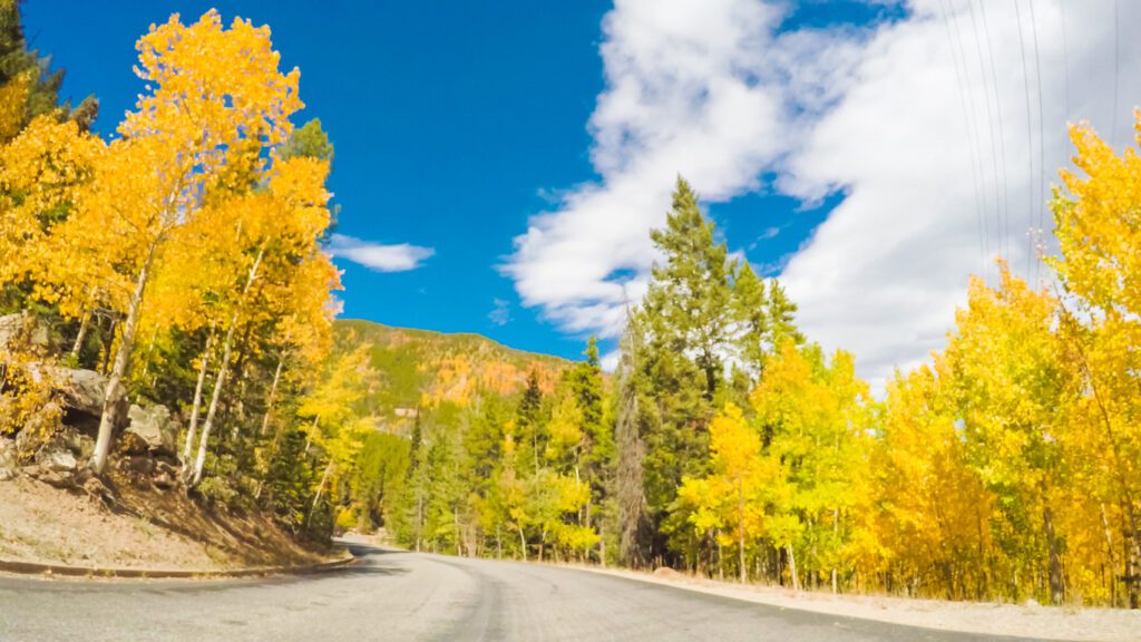
As one of the top scenic drives in Colorado driving Guanella Pass is a fun way to spend a few hours of your day. The pass itself climbs from Georgetown along I-70, up and over toward the base of Kenosha Pass on Highway 285.
It’s a 22-mile stretch of tarmac that winds its way up and above treeline before dropping down again. Overall, it’s about an hour if you drive straight through, but most people will want to stop and check out the sites.
Many of the trailheads are accessible with paved parking or a simple dirt pull-out. But there are a few trailheads that are found by winding your way a few miles up a dirt road. All of the trails listed here are accessible with a passenger vehicle unless otherwise noted – look for the “Red Tape” section for vehicle info.
It’s also worth noting that Guanella Pass is not usually maintained in the winter and is typically closed from November through March due to snow.
Local Tip About the Mt Bierstadt Trailhead
Okay, I’ll level with you here. The Mt Bierstadt Trailhead is a real pain to deal with. It will fill up by 6 am during the week and even earlier on weekends. Many people park on the side of the road, but it’s a bit of a zoo. If you’re doing the following trails, you will want to keep in mind that this lot fills up fast!
- Mt Bierstadt
- Geneva Mountain
- Square Top Mountain
- Square Top Lakes
- Abyss Lake
- Abyss Trail to Helms Lake
Easy Guanella Pass Hiking
Okay, so there isn’t a plethora of easy hikes near Guanella Pass, but there are a few. And if you’re not up for a big day, you can always start a hike, and turn around.
1. Burning Bear Trail
Not only a popular winter hike in Colorado but also an easy jaunt in the Guanella Pass area, Burning Bear is a must-do. It’s a bit long, but the elevation gain is mellow compared to other hikes on this list. You’ll be treated to beautiful scenery along this creekside jaunt.
Distance: 7.5 miles out and back
Elevation Gain: 1,253 feet
Difficulty: Easy
Estimated Time: 4 hours
Dog Friendly: Yes but on a leash
Moderate Guanella Pass Hikes
Most of the hiking trails at Guanella Pass are more moderate in difficulty. What makes these hikes great is that you’ll get a workout in but you don’t have to commit to a full-on peak climb.
Local Tip: A few of these routes lead to some amazing Colorado 13ers, so if you’re feeling strong and conditions are favorable, you can extend your day.
2. Silver Dollar Lake and Murray Lake
I absolutely love to run to Murray Lake every year. This route is a great trail run or moderate hike. You’ll pass by 3 distinct lakes until you reach Murray Lake at the end of the trail. During wildflower season, this basin comes to life with a variety of wonderful blooms.
Local Tip: From November through May, Guanella Pass Road closes. However, you can access this trail via the gate on Naylor Lake Road.
Distance: 4.3 miles out and back
Elevation Gain: 1,112 feet
Difficulty: Moderate
Estimated Time: 2.5 hours
Dog Friendly: Yes, on leash

3. Geneva Mountain
If you don’t want to contend with the hordes of people on Mt Bierdstadt, consider hiking Geneva Mountain instead. 12ers (peaks over 12,000 feet high) don’t get nearly enough of the attention they deserve. These are usually quiet summits that still have a lot to offer.
Geneva Mountain makes for an excellent training hike to tackle one of Colorado’s 14ers. Or let it be its own adventure.
Just be aware that Pike – San Isabel National Forest requires a permit to visit the Mount Blue Sky Wilderness. Click here for more info.
Distance: 7.8 miles out and back
Elevation Gain: 1,207 feet
Difficulty: Moderate
Estimated Time: 4 hours
Dog Friendly: Yes but must be on a leash
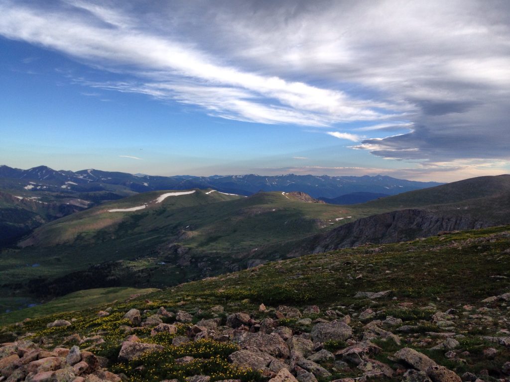
4. Square Top Lakes
You don’t want to miss these stunning Colorado alpine lakes. This trail is above the treeline and gives you stunning views of nearby Mt Bierstadt and Blue Sky (formerly Mt Evans).
Square Top Lakes are twin lakes at the base of Square Top Mountain. You can continue on the trailed route up to the summit of Square Top too!
Just be aware that Guanella Pass Road is closed during the winter. Therefore, this trail cannot be accessed since hikers need to use Guanella Pass Road to reach the trailhead.
Distance: 4.9 miles out and back
Elevation Gain: 935 feet
Difficulty: Moderate
Estimated Time: 2 hours and 40 minutes
Dog Friendly: Yes on leash

5. Shelf Lake Trail
This trail is guarded by a 4×4 road that requires 4WD and a bit of clearance to manage. The Shelf Lake Trail works its way from the trees up a bench as it winds its way up to the lakes.
Again, this is another great Colorado wildflower hike that doesn’t get nearly as much attention as it should!
Distance: 7.1 miles out and back
Elevation Gain: 1,968 feet
Difficulty: Moderate
Estimated Time: 4 hours and 15 minutes
Dog Friendly: Yes, but on a leash
Red Tape: This trail requires a 4WD vehicle to reach the trailhead. Although you can walk the road.
Challenging Guanella Pass Hikes (Real Butt-Busters)
These amazing Guanella Pass hikes are a real challenge. Plan on early starts, long days, and plenty of uphill elevation!
6. Abyss Lake Trail
One of the more popular hikes along Guanella Pass, the Abyss Lake Trail takes you right up against Mount Bierstadt. Abyss Lake offers plenty of dramatic mountain views, including an up-close look at the Sawtooth.
What makes this hike extra hard is the high mileage. Many people opt to visit Abyss Lake as a backpacking overnight trip.
Before visiting in the winter, research local road closures due to snow. You will also need a permit to visit the Mount Blue Sky Wilderness and can learn more here.
Distance: 16.9 miles out and back
Elevation Gain: 3,389 feet
Difficulty: Very difficult
Estimated Time: 9 hours and 15 minutes
Dog Friendly: Yes but must be on a leash
7. Three Mile Creek Trail
This shady trail offers a great challenge on a hot day! Most of the trail is in the trees (which can obstruct the views) but you’ll still get a peek here and there of the surrounding scenery.
The trail follows a creek upstream. With plenty of wildflowers and aspen groves, this makes for a fun romp in spring or fall.
It’s also great for snowshoeing but just know that the bathrooms close in the winter.
Distance: 9.4 miles out and back
Elevation Gain: 2,703 feet
Difficulty: Moderately Difficult
Estimated Time: 5 hours and 45 minutes
Dog Friendly: Yes but must be on a leash
8. Mount Bierstadt
By far the most popular trail on this list, Mount Bierstadt is a must-do for many people. However, despite the traffic, it shouldn’t be underestimated. This was my first 14er summit, and I turned around the first time I tried to go for it.
As one of the “easier” Colorado 14ers, many people have Bierstadt on their bucket list. The trail grinds its way up the northwest slope until finally topping out at 14,065′.
It’s also worth noting that you’ll need a permit to enter the Mount Blue Sky Wilderness Area and that the Guanella Pass Road to this trailhead closes seasonally in the winter.
Local Tip: My advice, go on a weekday in September or start your hike at 3 am to beat the conga line of people along this trail.
Distance: 7.2 miles out and back
Elevation Gain: 2,736 feet
Difficulty: Difficult
Estimated Time: 5 – 6 hours
Dog Friendly: Yes but must be on a leash and not recommended
9. Abyss Trail to Helms Lake
If you don’t want to tackle the entire Abyss Lake hike, then opt to hike to Helms instead. You’ll find Helms Lake right along the Abyss Trail, making it an easier (but still challenging!) lake hike in the Guanella Pass area.
You’ll just need a permit to enter Mount Blue Sky Wilderness and won’t be able to access this trail in the winter since Guanella Pass Road will be closed. It’s a cool hike in Colorado.
Distance: 11.7 miles out and back
Elevation Gain: 2,404 feet
Difficulty: Difficult
Estimated Time: 6 hours and 30 minutes
Dog Friendly: Yes but must be on a leash
10. Square Top Mountain
Square Top Mountain is a fantastic 13er that doesn’t require any technical skill. There’s a trail to the summit, making it a manageable way to break into hiking and climbing 13ers.
The summit is broad, but you’ll get stunning views of Bierstadt, Evans, Wilcox, and Argentine mountains. AND you’ll get to snag views of Silver Dollar Lake, Murray Lake, as well as Square Top Lakes from the top! Wowza!
There’s a special place in my heart for Square Top. Mostly because I originally did this route as part of a 3-peak trail run I was doing. It was the last summit of the day and a real challenge to reach the top. But it felt so good to relax and eat some Swedish Fish at the top!
This is also a hike you won’t be able to do between November and March since Guanella Pass Road will be closed.
Distance: 7.0 miles out and back
Elevation Gain: 2,454 feet
Difficulty: Difficult
Estimated Time: 5 hours
Dog Friendly: Yes but must be on a leash

Things to Do Nearby
There are lots of awesome things to do in Georgetown and around. A few of my favorite nearby activities include:
- Going for a ride on the Georgetown Railway (great for toddlers and young kiddos)
- Fall hiking at Kenosha Pass
- Eating BBQ at Smokin Yards in Idaho Springs
Quick Tips for Hiking in Colorado
If you’re new to town, you’ll want to be in the know when it comes to hiking in the mountains. Colorado can be a dangerous place to hike if you’re not familiar with our (unpredictable) weather. Here’s a look at a few quick tips.
Hike early. Plan for early hikes in the summer. You want to be below the treeline by 12 pm in order to stay safe from lightning strikes that plague Colorado daily. We have a monsoon cycle here where dangerous thunderstorms roll in daily around noon.
Pack plenty of layers. It can snow in July on the tops of mountains here. Be sure to pack a fleece layer, puffy layer, beanie, glove liners, and a rain/wind layer when you hike.
Acclimatize safely. Remember you’re at altitude! It takes a minute to acclimatize to the altitude. Drink plenty of water, eat salty snacks, and avoid alcohol your first few days here.
Pack it out. Pack out all of your trash, toilet paper, fruit peels, wrappers, and dog poop! Waste doesn’t break down at altitude, so if you’re above the treeline, be sure to carry a wag bag.
Catch me on YouTube!
Want more secret backpacking trips? Ultralight hacks that every hiker can adapt? Experience the top outdoor destinations in the world without the crowds? If you want to get insider knowledge of all things outdoors, then you’ll wanna subscribe to my YouTube channel, where I am giving away my DECADES of knowledge as an outdoor professional. I’ll see ya there!
What to Bring
What to wear:
- Hiking footwear with good traction that you are comfortable wearing all day.
- Non-cotton shorts for hiking
- Or non-cotton, pants for hiking. Convertible pants are great too!
- Non-cotton shirt for hiking
- Sunshirt
- Noncotton socks
What to pack:
- Hiking day pack. I love the REI Flash 22 for an affordable day pack.
- Water and snacks for the car – it’s always nice to have a treat at the end!
- A toilet kit: shovel, WAG Bag (if you plan to travel above treeline), hand sanitizer, TP/baby wipes, a small plastic baggy to pack out TP and sanitary items
- Pee funnel – optional
- Pee rag – optional.
- Headlamp
- GPS navigation
- emergency communication device
- Wind/rain layer
- Pocket knife
- Sunscreen, sunhat, sunglasses
- First Aid Kit
- Electrolyte powder – optional but nice to have!
- A water bladder capable of carrying at least 2 liters of water.
- Camera
- Camera clip to strap to your back
- Beanie
- Glove liners
- Fleece layer
- Puffy layer
- Hiking poles (optional)
Additional Local Colorado Travel Resources
Looking to enjoy Colorado like a local, not a tourist? Check out these local hiking resources:
