Last Updated on February 29, 2024 by foxintheforest
Over the 15 years I’ve been hiking in Colorado, I’ve stopped counting the miles on the trail. From backcountry routes through the rugged Gore Range to desert scenes along the Western Slope. But I’ve got a few aces up my sleeves that are simply incredible hikes that no one knows about. These trails represent some of the most challenging hikes in Colorado, but they also see very few travelers.
These awesome secret Colorado hikes are all very challenging, but worth the effort. Yes, I do enjoy getting out on the best hikes in Colorado, but there is always that surprising trail that doesn’t show up on any list.
So how did I find these incredibly scenic mountain gems?
I stumbled upon a lot of these by chance. Some were approaches to mountains I’ve climbed. One or two were found by looking at maps of the area. And one on this list is hidden in plain sight.
If you’re looking for a short (but mighty) list of hidden Colorado hikes, then you’ve found the jackpot! Here are a handful of challenging trails that you’re not going to find on any best-of lists.
About this guide to amazing hidden hikes in Colorado
Inside this guide to challenging Colorado hikes you’ll get expert, local advice about:
- Insider info on each trail, including practical information
- Where to find each trail
- A look at what makes it so great
- Additional Colorado hiking resources
Challenging Colorado Hikes without any Crowds
First off, this list of secret Colorado hikes only includes hefty challenges. That’s by design. This is my creme-de-la-creme list of stunning trails. And I love a solid challenge.
You shouldn’t attempt these hikes and explore these Colorado hidden gems without some solid mountain hiking skills and experience, especially the routes that don’t have a defined trail.
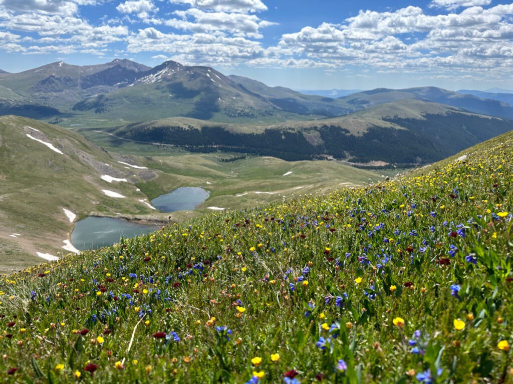
Sand Creek Lakes in the Sangre de Cristos
I stumbled upon this area of the Sangre de Cristos last year and wow – have I been missing out!
This 9.9-mile hike visits 2 separate lakes (each with stunning peaks) and offers tranquility and plenty of stellar views. Many of the 14er basins get all the hype in the Sangres, but this corner of the range has multiple different rock types, which makes the peaks particularly interesting for the area.
Mileage: 9.9 miles
Elevation gain: 2,395
Estimated Time: 5 hours
Difficulty: Challenging, but one of the easier hikes on this list.
Dog Friendly: Yes, on leash.
Red Tape: 4WD high clearance is required to reach the trailhead.
Highlights: 2 alpine lakes, stunning peaks, and awesome backpacking potential.
Mill-Castle Trail near Gunnison
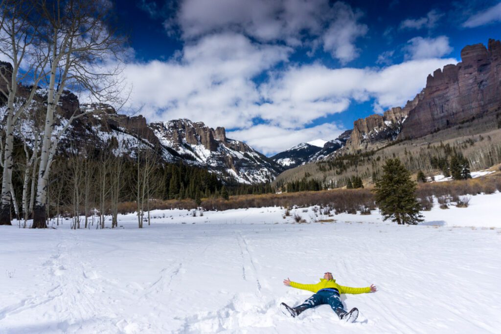
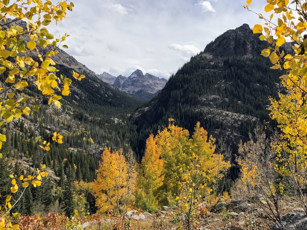
We stumbled upon this trail while on a ski trip to Crested Butte. The trail winds up a stunning valley filled with aspens (this would be a serious fall treat). Dramatic rock formations flank one side of the valley, which makes for a few awesome photo opportunities.
What I love about this one is that it doesn’t take long to reach the views, so you can go for as long or as short as you want. But if you’re up for the challenge, reaching the top of Storm Pass is totally worth the effort!
Mileage: 14.8 miles
Elevation gain: 3,776 feet
Estimated Time: 7.5 hours
Difficulty: Challenging.
Dog Friendly: Yes, on leash.
Red Tape:
Highlights: Aspen groves, high alpine pass, and awesome rock formations.
Columbine Lake in the San Juan Mountains
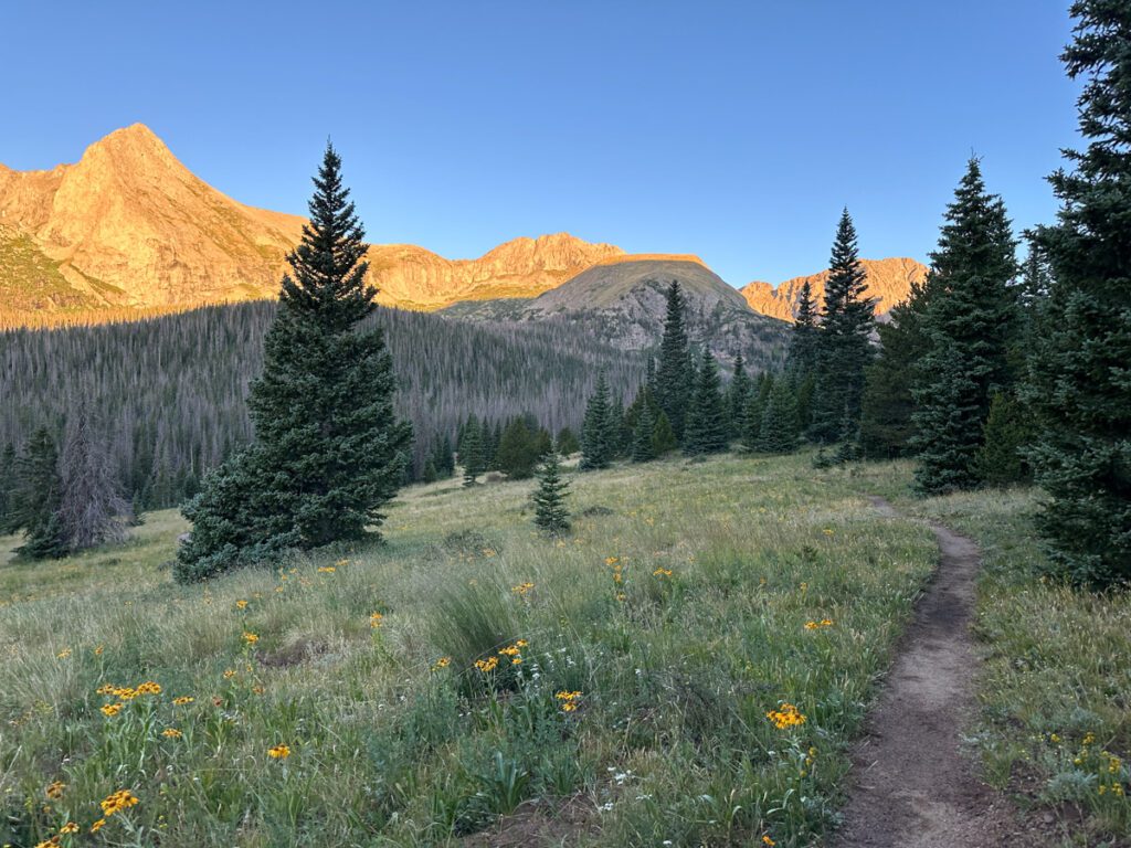
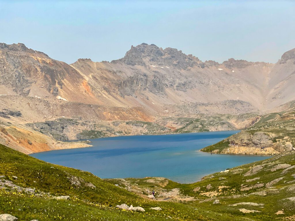
Columbine Lake is an excellent alternative to the over-run Ice Lake trail. Overall, this is probably the most crowded hike on the list, but it’s still got lots of options for solitude.
There are countless steep switchbacks in the trees that guard the upper portion of this hike. You’ll reach an alpine valley, then, in true San Juan fashion, you’ll bump up to another ridge before a stunning (and relatively gentle) tundra walk to the lake.
Local Tip: Be sure to check out some of the social trails in the area – they head up to amazing sub-peaks with stellar views of the area.
Mileage: 7.9 miles
Elevation gain: 2,837 feet
Estimated Time: 5 hours
Difficulty: Challenging
Dog Friendly: Yes, on leash.
Red Tape: There is very limited parking at the trailhead, so expect to park along the road and walk.
Highlights: Bright blue alpine lake, stunning peaks, and awesome backpacking potential.
Andrews Tarn in Rocky Mountain National Park
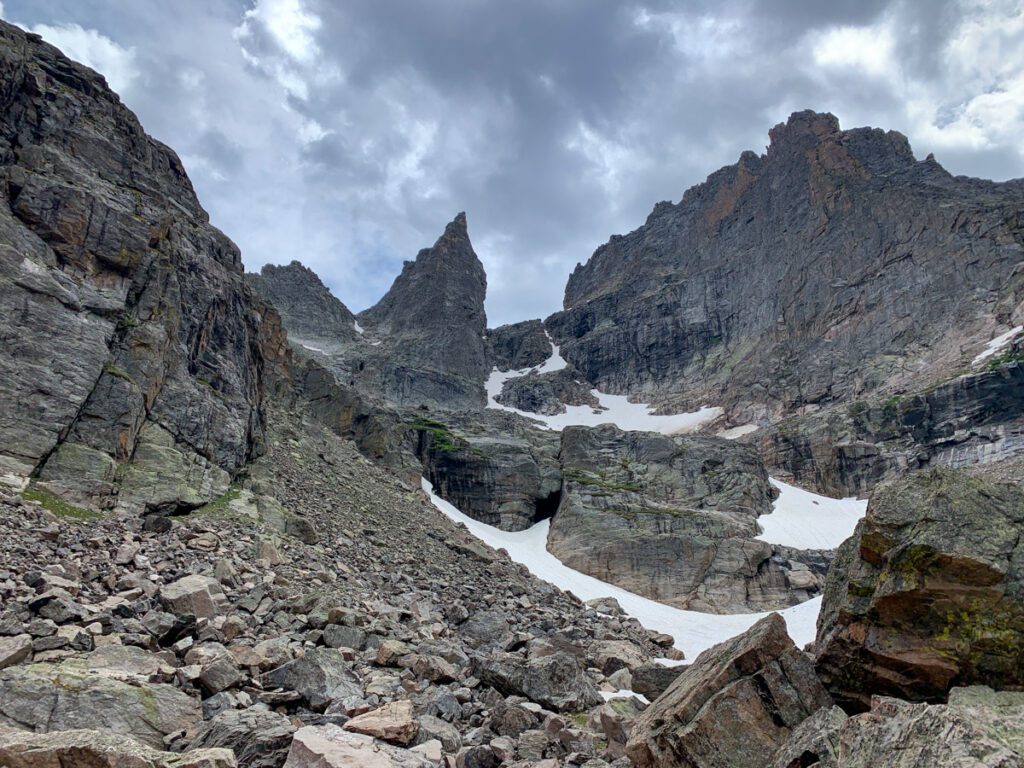
I’m stoked to share my favorite secret Colorado hike. What I love about this hike is that it’s hidden in plain sight. You’ll travel on one of the busiest trails of Rocky Mountain National Park as you make your way to the Loch from the Glacier Gorge Trailhead.
Just past the Loch, there’s a small trail that leaves the throngs of people and heads up towards Andrews Glacier. The crowds melt away.
From here the going gets tough (by headlamp we have completely missed the trail). You’ll pass by the climber’s turnoff for the Sharkstooth and continue up and over a rocky pass (read: you’ll be scrambling over some boulders) to reach the insanely peaceful Andrews Tarn.
You can also check for timed entry and reservation requirements here.
Mileage: 9.2 miles
Elevation gain: 2,267
Estimated Time: 5 hours
Difficulty: Very challenging – expect to do some rock hopping and scrambling over large boulders.
Dog Friendly: No dogs allowed
Red Tape: You need a timed entry permit to access Bear Lake Road from 5 am to 6 pm late spring through fall.
Highlights: 2 alpine lakes, stunning peaks, and awesome backpacking potential.
Mount Wilcox, Argentine Peak, and Squaretop Mountain near Guanella Pass
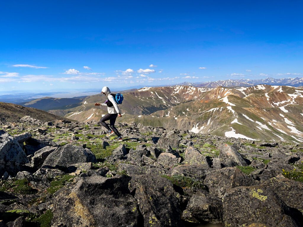
Silver Dollar Lake may be one of the top Guanella Pass hikes, but this three-peak loop is typically crowd-free (I was the only one on each of these summits when I did it). However, in true Colorado 13er fashion, there is not a distinct route.
You’ll need to do your homework before you set out, but if you’re looking for some summit solitude in a classically busy area, look no further.
Mileage: 9.8 miles
Elevation gain: 4,200 feet
Estimated Time: 8.5 hours
Difficulty: Extremely challenging. No real trail and route finding is obvious, but required.
Dog Friendly: Dogs are allowed on leash, but this trail is a bit rugged (and steep scree to get up to Mt Wilcox) so it may not the best for Fido.
Red Tape: The trailhead will fill up, as the trailed hike in the valley is popular. Arrive by 6 am to avoid parking issues.
Highlights: Multiple alpine lakes. 3 distinct peaks, and the potential to trail run this trail.
Knee Knocker Pass in the Gore Range
The Gore Range is home to countless quiet adventures, but one of my favorites is Knee Knocker Pass. Again, you’ll follow a popular Colorado fall hike – Piney River Trail, but then you’ll divert into a challenging wonderland that just keeps getting better the harder you push forward.
This “trail” (it comes and goes), terminates at the top of Knee Knocker Pass, squeezed between Mount Powell and Peak C, two iconic Gore Range Peaks.
Mileage: 9.5 miles
Elevation gain: 3,225 feet
Estimated Time: 7 hours
Difficulty: Extremely challenging. This trail follows a climber’s trail that comes and goes. Climbing up steep gullies and willow bashing are required.
Dog Friendly: Dogs are allowed on leash.
Red Tape: None.
Highlights: Dreamy aspen groves, stunning mountain views.
Additional Colorado Hiking Resources
Looking to up your trail game? Check out these amazing resources:
