Last Updated on September 9, 2025 by foxintheforest
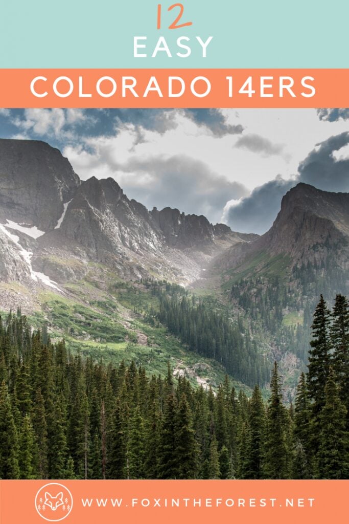
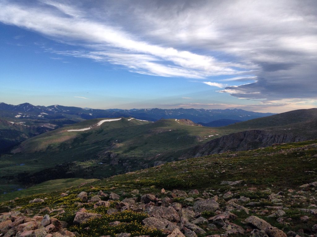
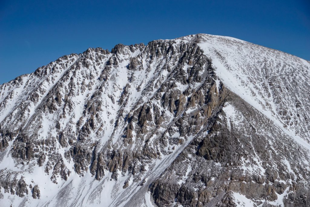
Colorado’s famed 14,000-plus foot peaks draw a crowd of hiking and mountain climbing enthusiasts. Luckily, several of the easiest 14ers are super-obtainable for avid hikers.
With a list of over 50 Colorado 14ers, there is a lot of hiking, scrambling, and mountaineering to be had.
For those looking to get into beginner 14ers, there is a wide range of beautiful peaks to choose from.
This list of the easiest 14ers can help you plan for everything from your first 14er all the way to tougher terrain such as snow climbs and scrambles.
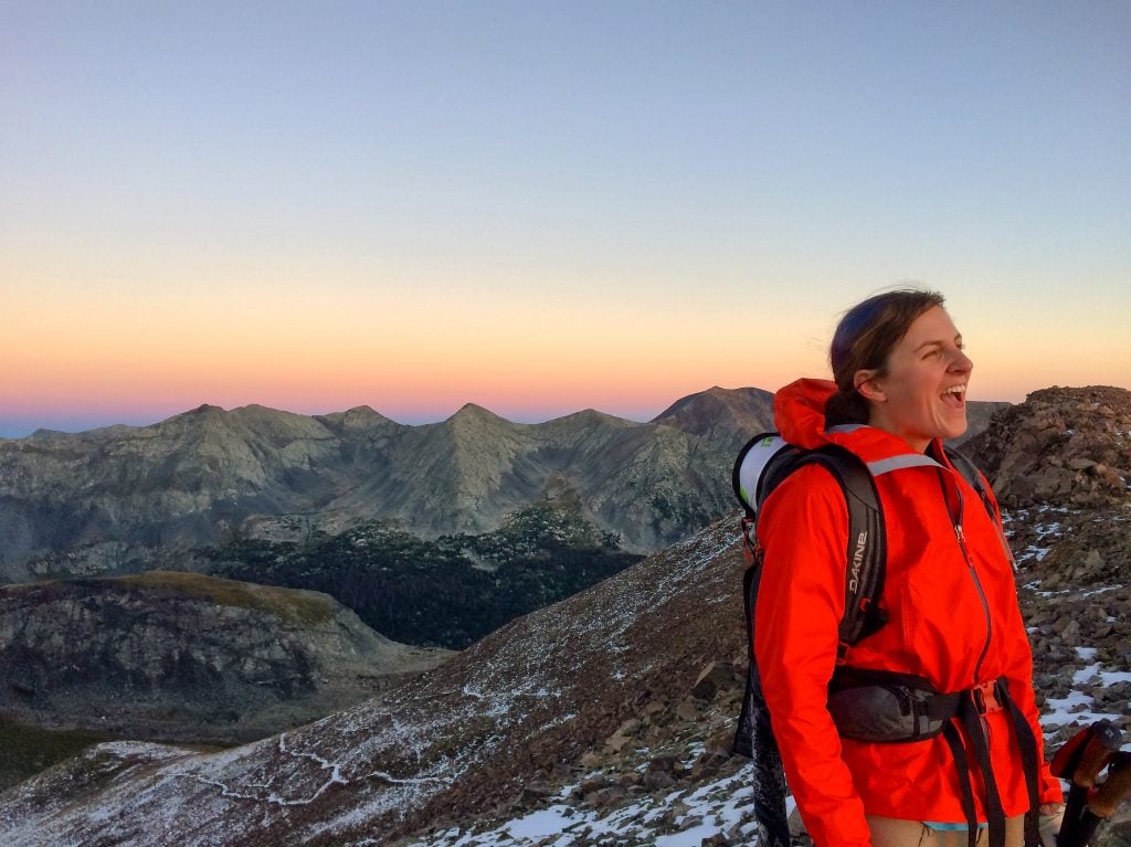
When it comes to the best beginner 14ers in Colorado, you’ve got a wide variety of peaks to choose from. We’ll dive into every time of beginner climb, including how to start scrambling and climbing snow.
About this Guide to the Easiest Colorado 14ers
As a local of over13 years, I’ve been up quite a few mountains here in Colorado (I stopped counting at 50 summits). In fact, mountaineering is my passion, and I’ve spent a tremendous amount of time on 14ers in Colorado, including all of the easiest 14ers. In this guide you’ll find:
- What is a 14er?
- A complete list of the easiest 14ers in Colorado
- Route information, distance, and difficulty for each peak.
- Where to stay to hike a 14er
- Tips for hiking the easy Colorado 14ers
- Additional 14er planning resources
What is a 14er?
A 14er is a slang word for a mountain that is over 14,000 feet high. For those of us in the United States, especially the Lower 48 states, that is one tall mountain!
Our tallest mountains in the Lower 48 are typically over 14,000 feet tall, with the tallest one being Mount Whitney in California at a whopping 14,505 feet above sea level.
In terms of 14ers, Colorado has over 50 of these famous peaks. That’s quite a few mountains that are over 14,000 feet tall! The tallest mountain in Colorado is Mount Elbert at 14,439 feet tall.
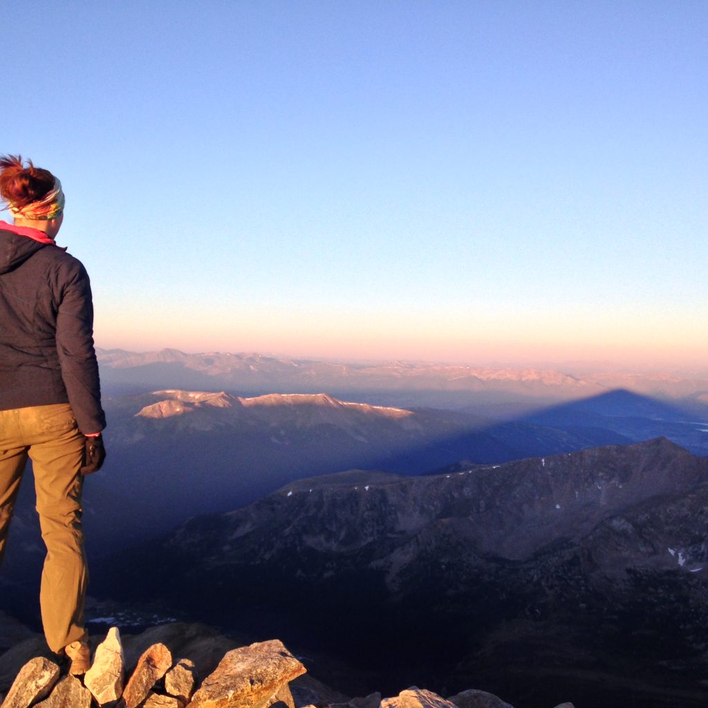
No Colorado 14er is “Easy”
No hike up steep elevation gains along a windy, rocky trail to high places is easy. In fact, it would be naive to call any hike up a mountain an easy task.
Certainly take hiking a Colorado 14er, or any mountain seriously. Prepare properly, be informed, train up, and be ready for adverse conditions (both physically and mentally).
Before you hike up any mountain, be sure to get plenty of regular hiking experience under your belt.
When we talk about the easiest 14ers, typically this refers to not needing to use your hands to climb up the rock, no special gear outside of regular hiking gear, and typically a well-described route.
These fourteeners are great for beginner mountain climbers and advanced hikers.
The easiest 14ers in Colorado still demand the respect of an extra-tough hike, so be sure to be prepared before you set out.
Map of Easy 14ers in Colorado
Choose the perfect Colorado 14er for your first summit. Use this map to find a 14er that best fits in with your hiking plans.
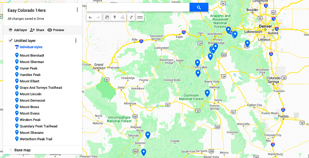
The 18 Easiest Colorado 14ers
For this guide, I didn’t list the easiest 14ers by rank, but instead by category to help you fit the mountain climb that best fits your ability level and personality.
The 14ers towards the bottom of this list offer a look at more advanced Colorado 14er routes. These are some of the easier Colorado 14ers if you are looking to break into more technical mountain climbs.
The Easiest 14er in Colorado for First-Timers: Mt. Bierstadt
Miles: 7 round-trip
Elevation gain: 2,850 feet
Class: 2
Highlights: A hike with beautiful views but very popular. Therefore, arrive early to avoid crowds.
Located in Colorado’s Front Range, about an hour and a half from Denver, Mt. Bierstadt’s West Slopes is an excellent easier 14er.
Mt Bierstadt’s scenery surrounding the peak is absolutely gorgeous (I’ll let you decide on the view from the top).
The Mt Bierstadt trail winds its way through willows and greenery before making the steep ascent up towards the summit.
At the top you’ll have to hop over big rocks and boulders to reach the summit.
However, this is one of Colorado’s most popular hiking trails. Plan on arriving early (well before 6 am) if you want to snag a parking spot and not be caught in a conga line to the top.
Mt. Sherman- The Southwest Ridge (1st Trail Run Summit)
Miles: 5.25 miles starting at the 12,000-foot gate, 8.5 miles starting at Leavick Site, 10.5 miles starting at the 11,100-foot winter closure
Elevation gain: 2, 100 feet starting at the 12,000-foot gate, 2,850 feet starting at Leavick Site, 3,100 feet starting at the 11,100-foot winter closure
Class: 2
Highlights: You’ll need to drive over some rough roads to get to this trailhead. But once you get there, you’ll hike along a local road surrounded by wildflowers in the spring.
When I broke into running up 14ers, I started with Mt Sherman. The low milage and broad, wide trail to the ridge was surprisingly great for running. But if you’re not there yet, no worries, it’s a great intro to 14er hikes.
Located near Leadville, Colorado, this popular and strenuous hike features large swaths of wildflowers all along the trail throughout the spring.
To get here, you’ll also have to drive up a long road that is rough, but doable for most cars with four-wheel drive.
Best traversed between May and September, this is one of Colorado’s easiest 14ers where you’ll start your hike up a road and continue to the Dauntless Mine.
Once there, turn right and follow the road, eventually turning left to the upper mine area.
Continue on into this flat area, eventually passing a pile of gray rock. Once here, find a cairn and ascend the trail toward the slope. Continue on the cairned trail and turn right to see Sherman’s southwest ridge.
Climb the ridge, continuing until you reach a small notch in the ridge and follow the ridge crest.
This is where you’ll find the most difficult section of the trail, which is filled with loose rock, and continue on to the stunning views at the true summit.
Local Tip: Please do not attempt to climb over any cornice that may be blocking the trail. It’s much safer to hike around it because you could get seriously hurt if it collapses.
Huron Peak – Northwest Slopes
Miles: 6.5 miles, 10.75 miles if you hike the road from Winfield
Elevation gain: 3,500 feet, 3,800 feet if you hike the road from Winfield
Class: 2
Highlights: An easy-to-follow hike with beautiful views of the Three Apostles. You’ll just need a four by four vehicle to get to the trailhead.
Located near Buena Vista, Colorado, this stunning out and back trail is best used any time between May and September and is one of those easiest Colorado 14ers that won’t be difficult to follow.
Although, you will need a solid four-by-four vehicle to get to the trailhead. Once there, hike your way through a vast forest, eventually crossing a stream and then ascending several switchbacks uphill.
Stop for an epic view of the Three Apostles and then continue your approach to a high basin. Follow the trail to the center of the basin, eventually climbing out and onto Huron’s upper slopes.
From here, you’ll zig-zag your way up the crest of the north ridge, finally ascending a steep rocky pitch to the top.
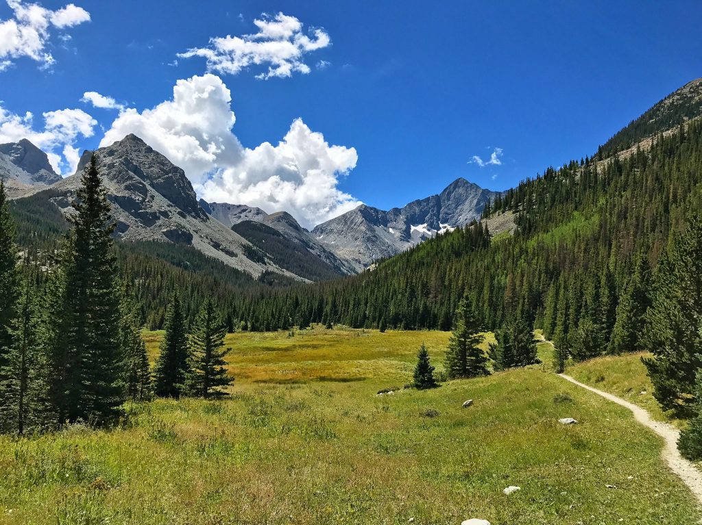
The Prettiest “Easy” Colorado 14er: Handies Peak
Miles: 5.5 from the upper trailhead, 7.5 from the 2WD trailhead (round trip)
Elevation gain: 2,500 from the upper trailhead, 2,800 from the lower
Class: 1
Highlights: Enjoy stunning panoramas of Colorado as you hike up Southwest Slopes.
Nestled in Colorado’s most stunning mountain range, the San Juans, Handies Peak takes the cake for the most beautiful of the easiest Colorado 14ers.
As one of the best 14ers for beginners, the dramatic views go on for days as you make your way up the grassy Southwest Slopes. The approach (or trail before the real grind starts) offers beautiful views of the mountain cirque.
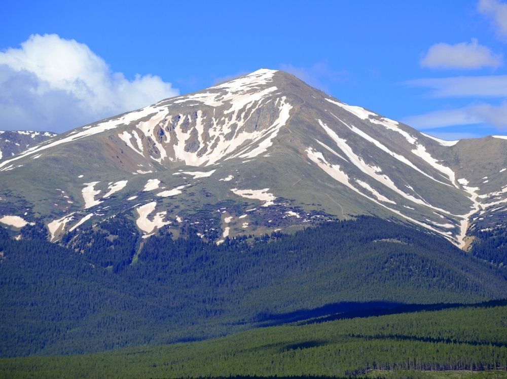
The Tallest Mountain in Colorado: Mt Elbert
Miles: 9.5 round trip
Elevation gain: 4,700 feet
Class: 1
Highlights: This is the highest peak in the state so it’s worth the 5+ hour arduous hike to the top.
At 14,433 feet tall, Mt. Elbert marks the high point for the Colorado Rockies.
Although the standard route up Mt Elbert is considered one of the easiest Colorado 14ers, with little exposure, commitment, and rock navigation, it is still a long, grueling hike to the top it is also the tallest mountain in Colorado.
4,700 feet of gain is no joke, so budget plenty of time (at least 5 hours) until you’ll reach the summit.
However, there’s something magical about standing at the highest point in the state, so go ahead and snag that high point!
The Best Colorado 14er Near Denver: Grays or Torrey’s Peak
Miles: 8.5 round trip
Elevation gain: 3,600 feet
Class: 2
Highlights: A crowded hike but pretty straightforward so good for beginners.
Alright, so I’ve got a confession to make. As much as I enjoyed hiking Grays and Torreys Peak, being only 45 minutes from Denver comes at a cost.
The 4wd road in is a hot mess on a summer weekend, so much so, that it can be quite dangerous with the way all of the cars are parked.
This is one of the most crowded mountains in Colorado, if not America, so certainly start as early as possible when hiking these easier 14ers.
With that being said, Grays and Torreys are two straightforward peaks that can be done individually or as a pair. The entire hike offers gorgeous views of the surrounding mountain ranges.
Hike Three 14ers in One Day: Mt. Lincoln, Mt. Democrat, and Mt. Bross
Miles: 7.25 round-trip
Elevation gain: 3,700 feet
Class: 2
Highlights: A tough route up and down various slopes. You’ll also find loose rock as you descend Mount Bross.
Local Tip: These mountains have been opening and closing frequently due to lawsuits. Be sure to check 14ers.com for the most up-to-date info on mountain closures.
The famous Decalibron loop summits four peaks (only three are official) in one giant loop. Not recommended as an easy 14er for first-timers, this set of mountains offers a great ridge run for those who have a few beginner mountain climbs under their belt.
The route is certainly tough, simply because you’ll be going up and down steep slopes quite a bit.
The real grind is on the descent off of Mount Bross, where the rock is loose, it’s easy to misstep and slide down a scree field that will cut you up like a cheese grater. However, it’s a rewarding hike and one of the best hikes in Colorado.
If three peaks are too many, you can do Mt Lincoln and Mt Democrat separately, making it one of the better beginner mountain climbing routes in Colorado.
Local Tip: Please note that Lincoln, Democrat, and Bross have been closed in 2023 due to the owner’s concerns about liability issues.
Mt. Evans – West Ridge from Summit Lake
Miles: 5.50 miles round-trip
Elevation gain: 2,000 feet
Class: 2
Highlights: A short out-and-back hike through the M. Evans Wilderness Area where you can summit Mt. Spalding and Mt. Evans before exploring Chicago Lakes too.
Red Tape: You need a permit to park at Summit Lake, it does not matter when you are visiting. The road also closes seasonally, weather-depending but usually mid-October through Memorial Day.
This popular out-and-back trail near Idaho, Springs is part of the Mt. Evans Wilderness Area. Therefore, you will need to pay an entrance to get inside so that you can drive to the Summit Lake Parking Area.
Once you’re parked, follow the trail to the end of the lake and follow a signed trail that ascends 13er Mt. Spalding’s east ridge.
Stay left below the ridge crest to avoid excessively tough terrain, eventually summiting Mt. Spalding along the way.
Follow a series of cairns south to the end of the west ridge until the trail eventually drops below the ridge. From here, it’s a mile climb to the summit
Pro Tip: Before visiting, please familiarize yourself with the park’s special regulations since this trail sits inside a designated wilderness area.
You can also try the Mt. Evans Scenic Byway if you don’t feel like hiking.
Backpacking a Colorado 14er: Windom Peak
Miles: 5 miles from Chicago Basin or 17 miles from Needleton. Round Trip
Elevation gain: 3,000 feet from Chicago Basin or 6,000 feet from Needleton
Class: Difficult 2
Highlights: It’s the easiest hike in the Chicago Basin and you get to take a train into the wilderness!
If taking a train into the wilderness to start your backpacking adventure sounds like the trip of a lifetime, then you have to check out the Chicago Basin.
Again, it’s important to have some experience not only hiking a 14er but also backpacking before you attempt this epic since the mountains in the Chicago Basin are not easy 14ers.
From the train stop, it’s a six-mile hike to the heart of the Chicago Basin, from there, it’s another five miles to the top of Windom Peak and back.
Windom Peak is the easiest peak in the Chicago Basin, the rest of the peaks are class 3 and up, which requires route-finding skills on rock, basic scrambling skills, and un-roped climbing.
Want to learn to backpack? Check out these resources:
- Everything you need to know to prepare for your first backpacking trip
- The beginner’s guide to backpacking gear
- The hassle-free way to pee outdoors
- What to eat on a backpacking trip
The Best “Easy” 14ers to Up Your Mountaineering Skills
The Colorado 14ers listed below are NOT easy and they are NOT meant for first-timers. However, I want to provide resources that grow with you.
Once you get the 14er bug, it can be tough to stop. This list below names a few peaks that are great for breaking into different aspects of 14er summits such as scrambling, winter skills, and snow climbing.
The “Easiest” Winter Colorado 14er: Quandary Peak
Miles: 6.75 round trip
Elevation gain: 3,450 feet
Class: 1
Highlights: It’s pretty crowded and full of trash but good for beginners.
A lot of people recommend Quandary Peak as the easiest 14er in Colorado and a great beginner mountain hike. During the summer months, the East Ridge is right up there with Bierstadt as an excellent route for first-timers.
Personally, I think it’s a bit of a boring hill slog in the summer. It’s also crowded, even though the required bus ride created a 50% dip in traffic to this mountain. There are more beautiful summer summits! Can you do it? Sure, but winter is my favorite time to explore Quandary Peak.
In winter, it’s still relatively crowded, but with minimal avalanche danger, a straight-forward route, and low commitment, it’s a great introduction to winter peak climbing.
As always, be sure to understand avalanche safety, understand the safest way up the mountain (it varies in winter), and be prepared for adverse conditions. Don’t attempt unless you’re well-educated in avalanche safety.
Local Tip: As of July 30th, 2021 you must have an advanced permit reservation and bus pass to hike Quandary Peak.
The Best Beginner Snowclimb: Mt. Shavano
Miles: 7.5 miles
Elevation gain: 4,600 feet
Class: 2 with snow: D3/R2/III rating
Highlights: A low-consequence snow climb where you can glissade 2,000 vertical feet to the bottom.
At this point, you are no longer in easy 14er mode, but instead, you are breaking into more technical climbing.
The mountains listed in the rest of this list are not hikes, but they are some of the better beginner mountain climbs in Colorado.
You should only attempt to climb the Angel of Shavano with a healthy knowledge of snow travel with an ice ax and crampons under your belt.
Colorado has a dangerous snowpack virtually all winter, climbs like this one become safer during a short window in May and June. Properly prepare and take the avalanche conditions seriously.
The Angel of Shavano is a low-consequence snow climb that offers you a chance to put your winter mountaineering skills to the test. Thanks to the wide nature of the Angel, it’s a great introduction to snow climbing.
The maximum angle on this climb hovers between 25 to 30 degrees which allows you to get a taste for snow climbs without an insane incline. Once you reach the base of the mountain, the route is essentially straight up.
Depending on conditions, it is possible to glissade around 2,000 vertical feet to the bottom.
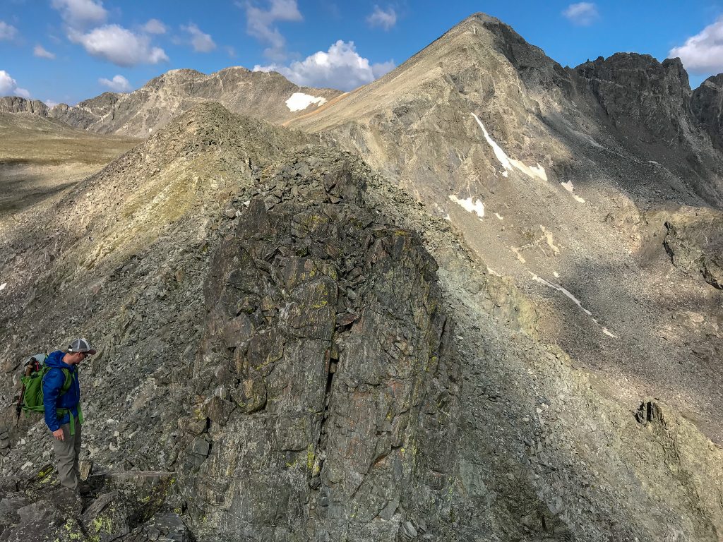
The Best Class 3 Fourteener for Beginners: Wetterhorn Peak
Miles: 7 round trip
Elevation gain: 3,300 feet
Class: Class 3
Highlights: Mostly solid rock and the Class 3 terrain section is pretty easy to get through.
If you’re looking to break into Class 3 terrain (read: you’ll be scrambling and using your hands) then consider climbing Wetterhorn Peak’s Southeast Ridge.
The rock is mostly solid and the class 3 portion is quick. These two factors let you dip your feet into scrambling without committing to something that’s burly.
Once you’re in class 3 terrain, navigation becomes more of a much-needed skill set as long as you do your homework and read up on the route beforehand.
What’s great about Wetterhorn is the rock is overall solid and generally mellow scrambling. So you can focus on the moves and how to spot the route – essential scrambling skills. However, there are a few steep and exposed sections to get your heart pumping.
This route will give you a true feel for what class 3 terrain can be like. If you’re not quite up to the challenge but want to learn to scramble I’d recommend starting with the Colorado 13er route of Father Dyer’s East Ridge.
Please note: There are several, much easier Colorado 14er routes than Wetterhorn Peak. This is an ideal route for someone who has a few of the easier Colorado 14ers under their belt and is looking to take a more challenging peak that has a little bit of climbing.
This climb is ideal for someone looking to get into more technical climbing and is not intended for the inexperienced mountain hiker.
Other Fun Picks for the Easiest Colorado 14ers
Here’s a look at a few easy Colorado 14ers that make a lot of lists, but aren’t at the top of my best-of lists. They get a mention here because they are on the simpler side of things, but they lack the beauty or unique aspects of the 14ers mentioned above on this list.
San Luis Peak via Stewart Creek Trail
Miles: 13.4 miles out and back
Elevation gain: 3559 feet
Class: 1
Highlights: An 8-hour out-and-back hike through the Gunnison National Forest that takes you past an old log cabin, through a local creek, and to the ridge crest.
This is one of the easiest Colorado 14ers that requires a four-wheel-drive vehicle to access. After all, the closest town is Creede and it is about a 2-hour drive to the trailhead along paved/unpaved roads.
I’m not super impressed with San Luis Peak, but a lot of people enjoy it for the straight-forward nature of the trail to the summit. A lot of people enjoy the adventure of driving deep into the wilderness to the trailhead.
However, upon arrival, you’ll be rewarded with a simple climb along a well-maintained trail that will have you following Stewart Creek before entering the forest.
Local Tip: This is a great 14er for fall, before the snow comes in, as you’ll pass through an aspen grove.
At about two miles in, you’ll see some remains from an old log cabin and may even pass some beaver dams as you continue towards Upper Stewart Creek.
At the 3-mile mark, make your way through some willows until you hit open terrain around the treeline at 4+ miles.
Go toward the upper basin and then drop down to a creek. Cross it and make your way through even more willows as you head to the bottom of the slope beneath the Organ Mountain-San Luis saddle.
Make your way up the saddle, with a switchback, and hike across the saddle until you hit the northeast ridge of the San Luis’. Continue to the ridge crest and summit to enjoy the epic views from the top.
Local Tip: Please note that the trail may be tricky to follow in spring or if any trees have fallen.
Mt Princeton
Miles: 7 miles out-and-back
Elevation gain: 3,340 feet
Class: 2
Highlights: A short out-and-back hike through the San Isabel National Forest that features a large boulder field.
Local Tip: This hike is not safe for dogs since there is a large bouldering section during which they could easily get hurt.
Princeton gets a lot of flack in the 14er community for being a steep, tedious mountain. Maybe I was just having an awesome day, but I enjoyed the grind on this one. The views are pretty great too – since the Sawatch mountains boast the highest concentration of peaks over 14,000 feet.
Located near Buena Vista, the hike to the top of Mt. Princeton is a fairly straightforward climb through the San Isabel National Forest. It’ll be a steep climb along a road
However, to get to the trailhead you’ll need to travel along County Road 322. This road is rough and incredibly narrow.
Therefore, I would not do this drive without a solid, four-wheel drive vehicle. Road conditions can also deteriorate throughout the year, with the road being totally closed in the winter.
But, when you finally do reach the upper trailhead near the radio towers, start hiking along the road away from the radio towers.
Trek on for 1.5 miles before turning right onto the Mt. Princeton Trailhead. Now, the start of the trail is technically class 1. But, it’s very steep. So, be prepared for an intense workout.
However, the trail levels out a bit before you go below the Tigger-Princeton Ridge. This is where the hike becomes a class 2.
Therefore, you’ll need to move across some boulders before going up a series of switchbacks to the top of the ridge.
Make your way along the ridge and enjoy a flat section before conquering some final elevation gains on your way to the summit.
Local Tip: This hike is VERY popular. Therefore, spend the night in Buena Vista and get up early for your push to the summit. And once you’ve finished your climb, relax at the Cottonwood Hot Springs (Mt Princeton Hot Springs are over-rated in my opinion).
The Easiest 14er to Avoid: Mt Antero
Miles: 15.2 miles out and back,
Elevation gain: 4,842 feet
Class: 2
Highlights: Not much
Okay, so I’ll level with you here. Mt Antero appears on a LOT of “easiest 14er” lists. And because search engines will punish me for not mentioning this mountain, I put it on here.
But to be frank: Mt Antero is a horrible slog up an exposed Jeep road. It’s not fun at all. In fact, many 14er finishers (those who’ve done them all) complain that this one is actually one of the worst 14ers.
But for whatever reason, people who aren’t well-versed in actually climbing these peaks have started to put it on their lists. So if you want to really know if someone who is talking about easy 14ers mentions Antero, then you’ll know they really don’t know a whole lot about hiking mountains.
If you like slogging up crummy 4×4 roads, then be my guest here. But in all honesty, there are better easy Colorado 14ers out there.
Of course, if you like off-roading, you can get pretty far to the top with a high-clearance, 4WD vehicle. There’s interspersed parking along the way. It’ll cut down on the slog, but it’s still a crummy way to claim a summit.
Local Tip: Please be aware that snow can cover parts of the road as late as July.
Wanna skip the crowds? Consider checking out Colorado’s 13ers instead. Here’s a look at a few fantastic Colorado 13ers for all abilities.
When to Hike a Colorado 14er
If you’re brand new to high-altitude hiking and you don’t have much experience in the mountains during the snowy months, July through September are great times to tackle your first fourteener.
In Colorado, there is still plenty of snow in the mountains during June, so be sure to understand relevant avalanche hazards, travel properly over snow, and have proper gear (microspikes, snowshoes, or even crampons and an ax) before setting out.
Not only the season is important for a beginner 14er, but so is the time of day. Be sure to get an early start – I’m talking before the sun comes up – in order to avoid the summer monsoons.
Thunderstorms kill people every year in the Colorado mountains, take care to look up the weather before heading out and start as early as possible to lessen the chance of inclement weather.
Related: When to Visit Colorado for Hiking
Where to Stay Before Hiking the Easiest 14ers in Colorado
If you’re arriving from out of town, or you’re traveling from a city like Denver, you’ll likely want to stay near the trailhead the night before your hike.
Staying near the trailhead allows you to sneak in some extra sleep before your early start. Some trailheads offer camping, some have free campsites nearby, and others require advanced planning.
Be sure to look into the details about camping for the mountain you plan to hike.
For more about camping in Colorado, check out these posts:
- Fantastically free camping near Denver
- Colorado’s Most Amazing Campgrounds
- How to find free camping anywhere
Tips for Your First 14er
There are a few key things you need to understand before you embark on an easier Colorado 14er.
Before you hit the trail, be to tell someone at home your plans, make sure you’re proper;y acclimatizes, and check the weather to get up-to-date information about storms, wind, temps, etc.
Also download photos, GPS coordinates, and maps – printing off a paper map and any additional resources you may need.
Once on the trail, go slow and take plenty of breaks as needed. Remember, getting to the summit is only the halfway point.
What to Pack for the Easiest Colorado 14ers
Not sure what to pack for some of the easiest Colorado 14ers? Then check out this local’s super quick 14er packing list.
Use this and you’ll know that you have everything you need to stay safe and enjoy the hike of a lifetime!
- Water
- Snacks
- Extra layers (hat and gloves are a must – even in summer!)
- First aid kit
- Blister kit
- Headlamp
- Sun protection
- Emergency space blanket or bivvy
- Lighter/fire starting kit
- Map/compass/GPS.
Easiest Colorado 14ers FAQs
What is the Easiest 14er to Summit in Colorado?
The easiest 14er in Colorado is Handies Peak. Not only is the trail super easy-to-follow trail, but elevation gains are fairly low, as is the mileage.
However, the term “easy” is relative. Therefore, it is worth noting that no 14er on this list is easy and that you should always be well-prepared for the intense hike that you are about to embark on.
Where is the Easiest 14er to Hike Near Denver?
The easiest 14er to hike near Denver is Grays Peak followed by Mt. Evans from Summit Lake. Grays Peak is a longer hike but features a well-defined trail and doesn’t involve bouldering.
In contrast, Mt. Evans is a more technical climb since it’s steeper and has a larger boulder field to hike through.
What is the Shortest 14er?
If you want to do a full hike up a 14er then the climb up Mt. Evans from Summit Lake is the shortest.
However, you could make your trek even shorter by driving to the top of both Pikes Peak and Mt Blue Sky (formerly Mt Evans). Then, from the upper parking lot on Mt. Evans, it’s about a 15-minute walk to the summit.
Additional Resources for Colorado 14ers
Hiking all of Colorado’s 14ers is a big bucket list item for many people. There are a wide variety of resources available to help you plan for your big adventure.
14ers.com is the go-to resource for planning your 14er hike. The website offers route descriptions, photographs, information about difficulty, recent conditions, camping, and more.
They even have an app – just be sure to download the photos before heading out (learned this one the hard way!).
For the weather, the most reliable, pinpoint weather service is weather.gov.
You can input the exact peak name (be sure to reference with another map when the results pop up) and get the most accurate weather down to the hour.
Click the charts below the general description (on the side for desktops) for hourly weather conditions.
Catch me on YouTube!
Want more secret backpacking trips? Ultralight hacks that every hiker can adapt? Experience the top outdoor destinations in the world without the crowds? If you want to get insider knowledge of all things outdoors, then you’ll wanna subscribe to my YouTube channel, where I am giving away my DECADES of knowledge as an outdoor professional. I’ll see ya there!
For more info on preparing to hike or climb a Colorado 14er, check out these handy resources:
These easier Colorado 14ers by category offer up a varied amount of terrain and scenery. What they all have in common is both a physical and mental challenge with a stunning mountain backdrop.