Last Updated on September 23, 2025 by foxintheforest
Grays and Torreys are twin peaks that make an absolute classic Colorado 14er combo. Everyone needs to hike these beauties at least once. As one of the easiest 14ers in Colorado, this dynamic duo makes for a great first 14er.
The beauty of Grays Peak is that it’s all Class 1 – meaning it’s a clear trail to the top. Reaching Torreys Peak from Grays Peak is an additional 1.5 miles round trip and well worth the effort – you’re most of the way there after all.
Torreys Peak offers several different variations, such as the Kelso Ridge Route, Dead Dog Couloir, and several approaches from Nearby Grizzly Peak (one of Colorado’s best 13ers).
Most people opt for the classic double-summit route up both Grays and Torreys Peaks.
Since there are so many different options for climbing and hiking, I’ve been up Grays Peak and Torreys Peaks countless times, doing most of the named routes.
In fact, despite the extraordinarily crowded nature of the Grays and Torreys hike, I’ve actually never shared the summit with someone – typically having the place to myself. What a treat!
You won’t find a better in-depth guide to hiking these twin peaks anywhere else on the internet. It’s my mission to get you outside like a local, not a tourist.
About this Guide to Grays and Torreys Peak
In this guide, you’ll get in-depth information about Grays Peak and Torreys Peak. You’ll learn all about how to hike the stunningly beautiful Grays and Torreys combo and get info about:
- The best time to hike Grays and Torreys Peak
- Tips about how to hike a Colorado 14er
- Where to find the Grays and Torreys trailhead and how to get there
- How to hike Grays Peak
- How to hike just Torreys Peak
- The Grays and Torreys combo
- Scrambling Kelso Ridge on Torrey’s Peak
- Practical information about each route including, elevation gain, round-trip distance, difficulty, estimated time, how to beat the crowds, and route-finding information.
- Camping
- Nearby attractions
- Packing list
- Additional planning resources
When is the Best Time to Hike Grays Peak and Torreys Peak?
The most ideal time to hike Grays Peak and Torreys Peak is between late June and September. However, throughout the months of July and August, this trail is extraordinarily crowded, as this is one of the best things to do in Colorado.
Thanks to easy access from Denver (a 40-minute drive) and for being one of the best hikes in Colorado, people know about this place.
Unless you’re savvy (and we’ll dive into that in a second), don’t expect to have this place to yourself. In fact, it’s not uncommon to see cars lined up along the road, parked illegally to hike Grays and Torreys.
October and November can be good times if they are snow-free. Snow typically doesn’t melt out and the road doesn’t really open until around mid (sometimes late) June.
It’s certainly possible to hike Grays and Torreys Peaks year-round if you have ample avalanche safety knowledge (winter routes travel through avalanche terrain).
You’ll add about 6 miles round trip of road hiking (or skinning) and about 1,000 feet of elevation gain for a winter attempt. You shouldn’t attempt these summits in winter unless you’ve got plenty of snow experience under your belt.
Weekdays are Better than Weekends
Grays and Torreys are utterly smashed on a weekend. If you want even a sliver of hope not being in a relentless conga line, you’ll want to be at the trailhead no later than 4 am.
During the week the crowds are still present, but are far more mellow, especially in early fall. Show up no later than 6 am during the week.
What Time Should I Start Grays Peak?
When it comes to how to hike your first Colorado 14er, there is one BIG rule, start early. Like before the sun early.
An early start is for safety above all else.
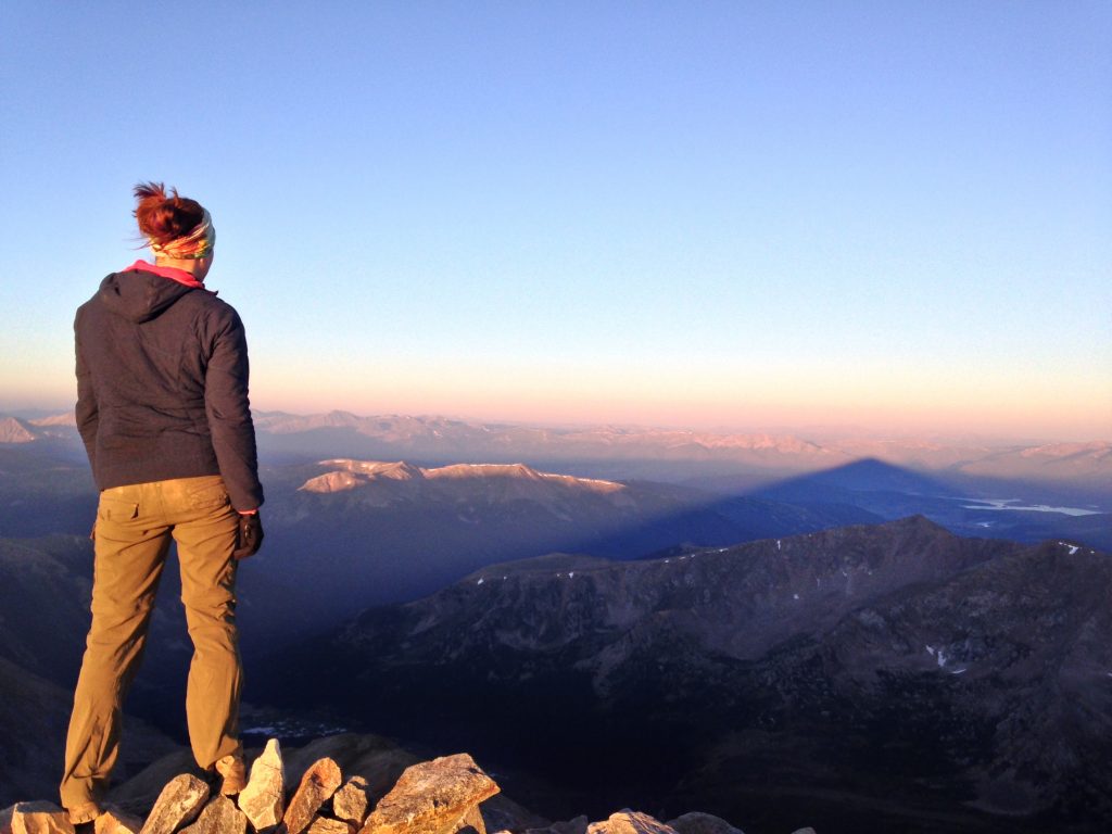
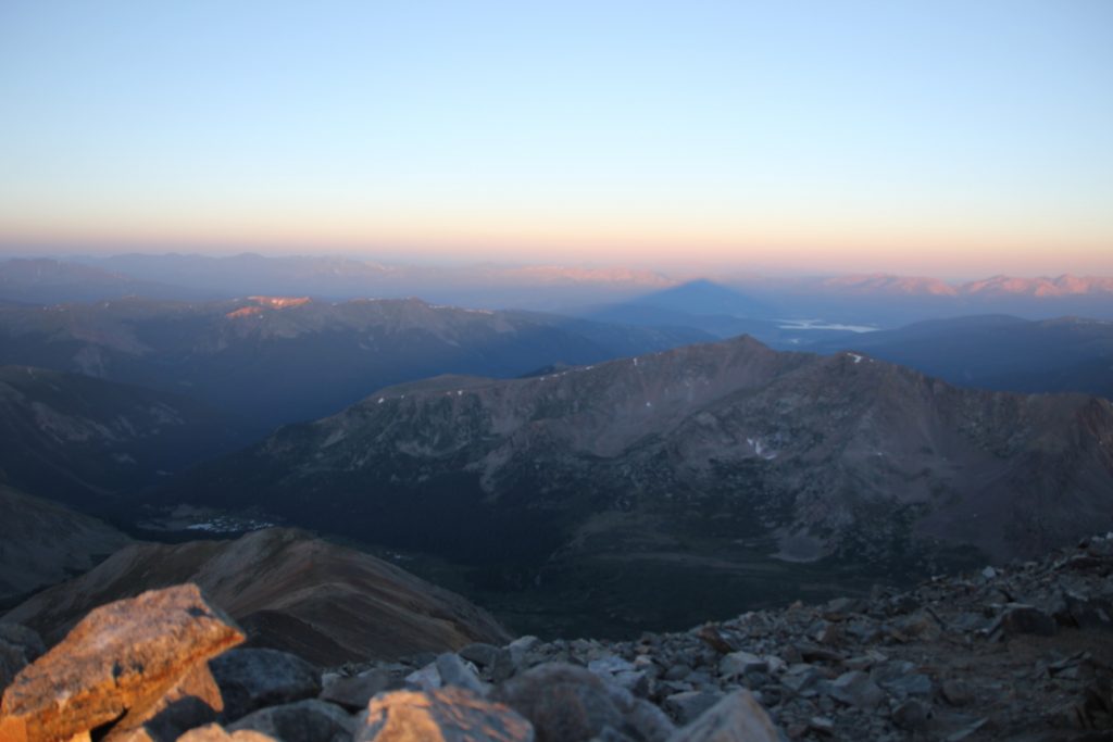
Start by 6 am if you want to avoid storms, 3 am if you want to avoid crowds, especially on weekends. Trust me, watching the sunrise from the summit of Gray’s Peak is a phenomenal way to greet the day.
In summer, afternoon thunderstorms sweep in quickly and unannounced, leaving you prone to deadly lightning strikes. Unlike other easy 14ers, there is no tree coverage along this trail.
Local Tip: Always check the weather using weather.gov (put “Grays Peak, Colorado into the search bar) to get pinpoint weather conditions and avoid hiking if storms or rain are in the forecast before 11 am.
How Difficult is it to Hike Grays and Torreys?
In the world of Colorado 14ers and mountain climbing, Grays and Torreys are about as easy as they come.
However, be warned. For the average hiker, this is NOT an easy journey. NO mountain is easy and accidents are possible, even on easy terrain.
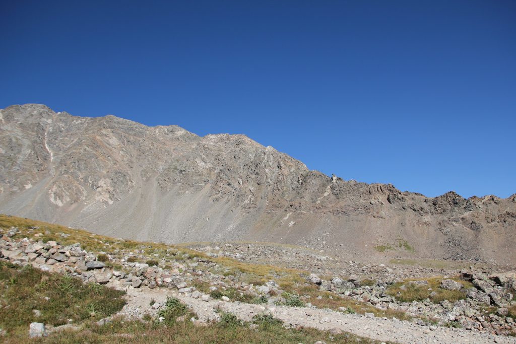
The elevation and relentless uphill grind are what most people struggle with. The path to Grays is straightforward and has a very low risk of exposure, but you’ll still want to watch your footing.
The famous Kelso Ridge is a popular first choice for a Class 3 (requiring the use of hands and a helmet) scramble and runs more like a climb than a hike. Again, it’s generally a very easy route compared to other mountain objectives, but shouldn’t be tackled unless you don’t mind precarious drops, loose rock, and exposure.
Overall, any route up to the summit of these peaks is considered difficult. There are no easy summits. However, if you’ve hiked a few mountains, or you’re an avid climber/scrambler/mountaineer, these peaks are a cinch.
How Hard is Torrey’s Peak?
Torreys Peak is considered a difficult hike. If you don’t have any experience with hiking up steep inclines at altitude, this will certainly be an extremely challenging day. However, as far as 14ers in Colorado go, it’s considered an easy peak. Just remember that no mountain is easy in Colorado.
Where is Grays and Torreys Peaks?
You’ll find the trailhead directly off of I-70, on a non-descript exit – exit Bakerville Exit 221 – that leads to a lower dirt parking lot. This is the winter lot.
Continue up the bumpy, rocky 4WD road for an additional 3 miles before it terminates at an established trailhead complete with a few places to camp and a toilet.
Keep in mind that there are no parking signs EVERYWHERE. This is because the road is narrow with steep drops and no guard rails. Cops regularly patrol and ticket this road.
Local Tip: On summer weekends the parking will fill up by 5 am. Arrive early if you want to snag a spot.
Getting to Grays and Torreys Peak from Denver
Take I-70 westbound from downtown Denver almost to the Eisenhower Tunnel. You’ll exit at Bakerville Exity 221. Head Left across the freeway past a dirt parking lot (this is the winter parking lot). Take the dirt road beyond the parking lot and follow the road to the trailhead.
Do I Need a High Clearance Vehicle?
You don’t need a lifted vehicle to make it to the trailhead but you do need some clearance. A standard SUV with AWD should make it just fine.
The road is very bumpy and a little rocky, making for a slightly obnoxious ride, but doable.
A passenger car does not have the clearance to make it to the trailhead and will need to park in the dirt lot near the highway.
How Long Does it Take to Climb Grays and Torreys Peak?
For the average hiker who is just starting to dive into 14ers, the Grays and Torreys Peak hike takes around 7 to 7.5 hours to complete. As a general rule of thumb, the average pace is about 1 hour per 1,000 feet of gain (remember, 1,000 feet up also goes 1,000 feet down).
With that being said, some people do the hike in a shorter amount of time, and others take longer.
Map of Grays and Torreys Peak Route
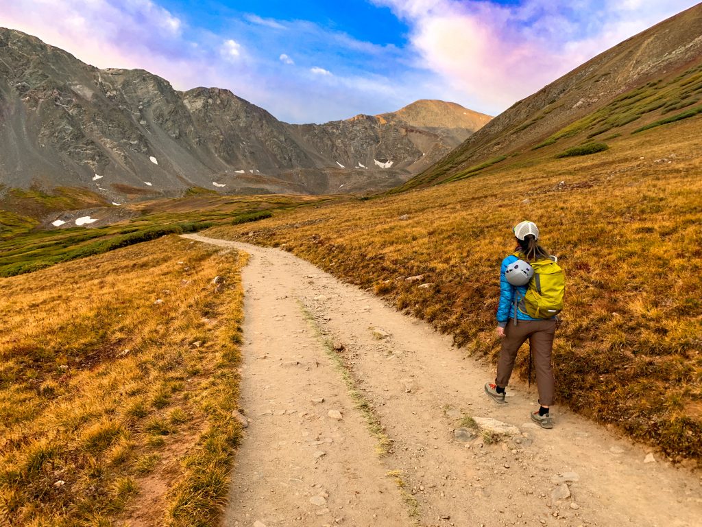
You can opt to hike just Grays Peak, just Torreys Peak (via the Class 1 trail or the challenging Kelso Ridge), or do the combo. This map shows the combo route with the split trail that goes from Grays to Torreys. After you summit Torreys, come back to the saddle where the split trail is to avoid re-summiting Grays Peak.

Practical Information about Grays Peak
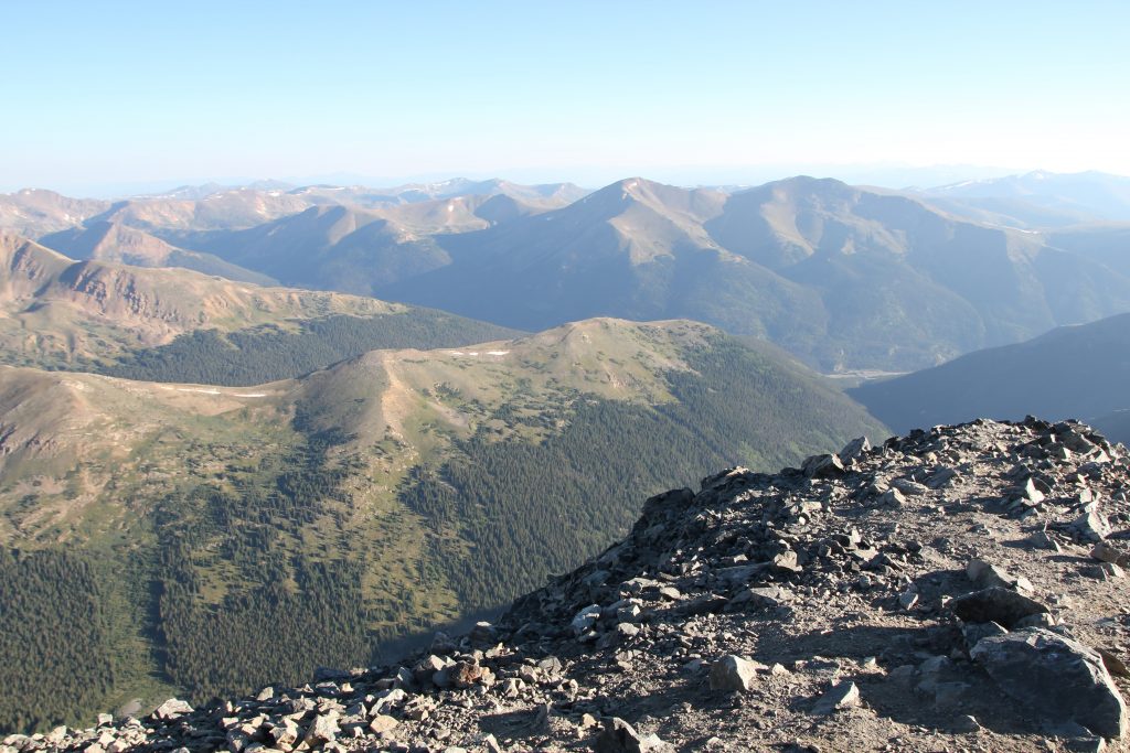
Reaching the top of Grays Peak is a class 1 hike with a trail that leads towards the summit. In general, this route is fairly easy and requires little to no navigation skills.
Local Tip: This is the same trail for the Grays and Torreys combo.
Round Trip Distance: 7.5 miles
Elevation Gain: 3,010 feet
Max Elevation: 14,270 feet
Starting Elevation: 11,280 feet
Difficulty: Easy for a 14er, difficult for a hike
Rating: Class 1 – well-defined trail with steep sections, some loose rock, and minimal exposure.
Estimated Time: 6 to 7 hours
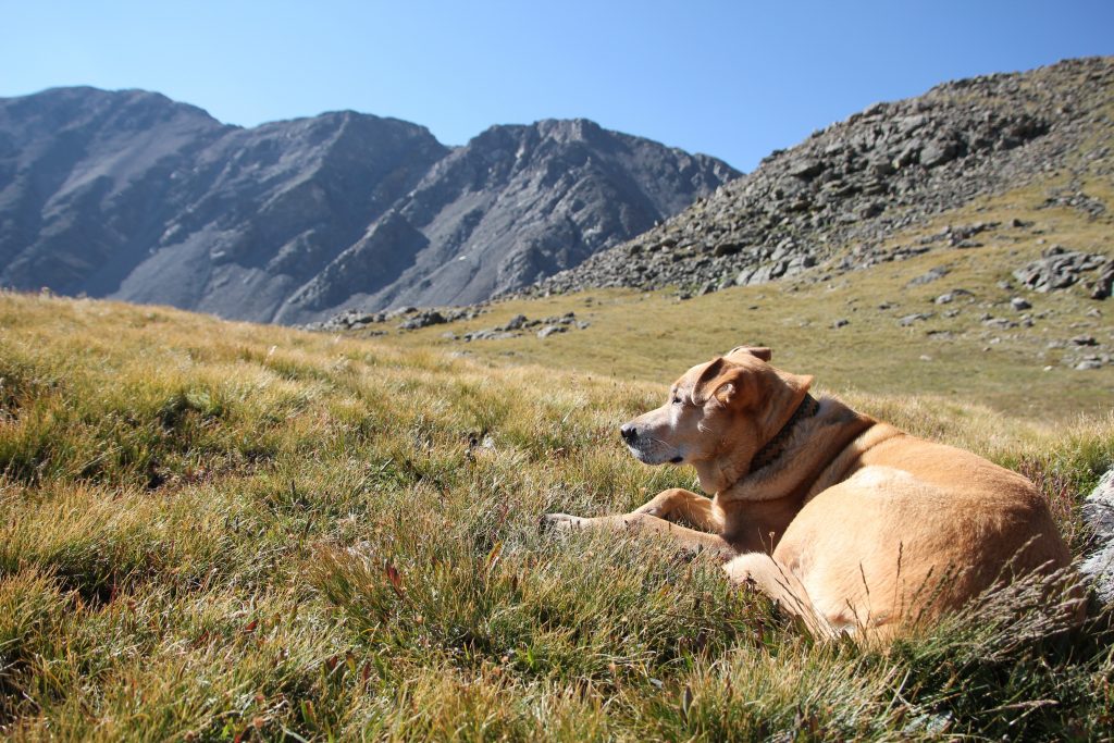
Dog-Friendly? Yes, please leash and clean up after your pet
The trail starts by crossing a bridge over Stevens Gulch. Follow the wide, obvious trail through the valley and upwards until Gray’s comes into view.
At 1.5 miles you’ll hit a sign, keep going, staying on the major trail (you’ll see offshoots to your right for more difficult routes). Grays Peak is to the left, while Torreys is to the right.

Continue up the trail to the ridge until you reach another junction, hooking left and following signs for Grays Peak (left takes you up Torreys Peak).
After several miles and some gain, the trail hooks an obvious right and starts up switchbacks. Continue the grind until you reach the summit.
Return the way you came.
Local Tip: I typically don’t recommend dogs hike 14ers. Mostly because the rock is really rough on their paws and the trails are so busy with loose rock it’s easy for your dog to accidentally kick a rock onto someone, but Grays and Torreys are acceptable for dogs. Pack paw protection.
Hiking Grays and Torreys Combo
Most people opt to hike both Grays and Torreys in one go. Honestly, this is my vote if you’re not into technical climbs or scrambles. You’re practically there once you reach the top of Grays Peak.
If the weather is looking good, then by all means snag both summits!
Start by summitting Grays, then drop down the north ridge of Grays. This is the roughest part of the trail. It’s mostly well-defined, but take care of loose boulders and test things before you step on it.
The rock is loose and the gravel doesn’t help either. It’s a steep 575-foot drop to the Grays and Torreys saddle.
Hike across the saddle, ignoring the trail that cuts downwards with the huge cairn (rock pile) and sign). Your goal is to ride the saddle back up to Torreys.

From here it’s less than a half-mile to the top. Just follow the trail and be aware of the steep drops with loose rock to your right. For safety, hike on the left side of the ridge, but stay on the obvious trail. Losing your footing could send you tumbling down a couloir.
Once you reach the summit celebrate! You made it! But your journey is only half over.
Continue back down the way you came heading along the trail until you reach the mega-cairn and junction at the saddle. Avoid the temptation to head off-route and go more direct, the rock is loose and you can kick rocks down on people below you.
Next, take the descent trail that drops east until it reaches the Grays Peak trail junction you encountered on your way to the top of Grays. Join the Grays trail and continue down to your car.
Round Trip Distance: 8 miles
Elevation Gain: 3,600 feet
Max Elevation: 14,267 feet
Starting Elevation: 11,280 feet
Difficulty: Easy for a 14er, difficult for a hike
Rating: Class 2 – well-defined trail with steeper sections of loose rock, boulder hopping, and some exposure. Fall might cause injury.
Estimated Time: 7 to 8 hours
Dog-Friendly? Yes, please leash and clean up after your pet
How to Hike Kelso Ridge
Kelso Ridge on Torreys Peak is an uber-famous Class 3 route that takes the most direct way to the summit of Torreys. It’s a great beginner scramble, but it should only be attempted by those who have had plenty of summits under their belt.
Class 3 (III) hikes aren’t really hikes. You’ll be using your hands to climb up low-angle rock without ropes. If you fall, you can seriously injure yourself (or worse), so be sure to wear a helmet if you’re going to hike Kelso Ridge.
My favorite part about scrambling Kelso Ridge is that it’s an excellent Class 3 option for beginners. There is a trail that leads directly to the top. It will peter out when you hit rock obstacles, but in general, you’re staying on the ridge proper, bypassing large chunks of rock along the way.
If you’re an avid scrambler, this route is just so-so (lots of loose gullies). You can go up and over virtually every single rock fin and keep the route to class 3 with maybe a class 4 move, or you can opt to bypass these obstacles if this is your first adventure.

Kelso Ridge Trail Info
Kelso Ridge on Torreys Peak is the most direct way to the summit. The distances below are via the Grays and Torreys saddle descent. Descending the ridge proper takes about a mile off of the journey but takes a similar amount of time since you’ll be scrambling over rock.
Round Trip Distance: 6.75 miles
Elevation Gain: 3,100 feet
Max Elevation: 14,267 feet
Starting Elevation: 11,280 feet
Difficulty: Difficult
Rating: Class 3 – rock navigation and use of your hands required. Dangerous exposure and rockfall potential. For experienced hikers only.
Estimated Time: 5 to 7 hours
Dog-Friendly? NO.
Local Tip: Bring a trail description (the 14ers.com app is helpful, download the photos before you go) and a GPS.
Kelso Ridge has a VERY obvious trail up it, but both times I’ve done it I’ve seen parties scattered and lost in dangerous areas they had no business being in. Not sure HOW you get lost, but I’ve seen it many times, so bring some beta (climber slang for info).
Practical Information about Torreys Peak
Most people opt to hike Torreys Peak either as a combo with Grays Peak or via the famous Class 3 Kelso Ridge. It’s entirely possible to just hike Grays, so if that’s your jam, here’s how to just hike the single peak.
Follow the instructions for Grays Peak, but when you reach the signed junction, hook right. This will take you to the saddle between Grays and Torreys.
Stay right again, continuing up a slightly rockier and steeper (class 2) trail. You’ll pass by the famous Dead Dog Couloir and the Tuning Fork couloir. Be cautious of the steep drops off to the right as you hike.
The rock on the final ridge is relatively loose, but you won’t need to use your hands. Continue along the ridge until you reach the summit of Torreys Peak. Return the way you came.
Round Trip Distance: 7.5 miles
Elevation Gain: 2, 913 feet
Max Elevation: 14,267 feet
Starting Elevation: 11,280 feet
Difficulty: Easy for a 14er, difficult for a hike
Rating: Class 2 – well-defined trail with steeper sections of loose rock, boulder hopping, and some exposure. Fall might cause injury.
Estimated Time: 6 to 7 hours
Dog-Friendly? Yes, please leash and clean up after your pet
Alternative Routes
There are several other awesome ways to reach the top of Grays and Torreys. The other mentionable ways to the top are either very long across unmarked or poorly marked trails, or require technical gear and skill.
Here are a few of my faves:
- Dead Dog Couloir. A great beginner snowclimb (axe, helmet, mountaineering boots, and crampons required).
- The Tuning Fork Couloir. Another excellent snowclimb. Narrower than Dead Dog with fewer skiers. Technical mountaineering gear required
- Approaching from Grizzly Peak at Loveland Pass. A long slog, but brilliant views.
Camping at Grays and Torreys
I often get asked if you can camp at the Grays and Torreys Peaks Trailhead. Camping is available, but not in vast numbers.
With limited camping, I wouldn’t recommend it unless you simply sleep in your vehicle. Remember, you’re camping above treeline so it will be colder, windier, and your poop doesn’t break down so use the toilet and pack out your trash.
Catch me on YouTube!
Want more secret backpacking trips? Ultralight hacks that every hiker can adapt? Experience the top outdoor destinations in the world without the crowds? If you want to get insider knowledge of all things outdoors, then you’ll wanna subscribe to my YouTube channel, where I am giving away my DECADES of knowledge as an outdoor professional. I’ll see ya there!
Nearby Attractions
There are plenty of other awesome things to do near Grays and Torreys. Here are a few of my faves.
- Jones Pass: Camping, hiking, off-road driving
- Herman Gulch: Scenic alpine lake, wildflower hiking, and the famous Citadel Mountain.
- Loveland Pass: One of the easiest scenic drives near Denver.
- Smokin’ Yards BBQ in Idaho Springs – perfect for your post-send meal.
What to Pack for Grays and Torreys
When it comes to what to pack for a Colorado 14er, you’ll want to be well prepared. The weather can change in an instant. Always be prepared. Here’s a comprehensive packing list for Grays and Torreys Peak.
- Sunshirt
- Noncotton socks
- Hiking footwear with good traction that you are comfortable wearing all day.
- Non-cotton shorts for hiking
- Or non-cotton, pants for hiking. Convertible pants are great too!
- Non-cotton shirt for hiking
- Hiking day pack. I love the REI Flash 22 for an affordable day pack.
- Water and snacks for the car – it’s always nice to have a treat at the end!
- Sunscreen, sunhat, sunglasses
- First Aid Kit
- Electrolyte powder – optional but nice to have!
- A water bladder capable of carrying at least 2 liters of water.
- Camera
- Camera clip to strap to your back
- Beanie
- Glove liners
- Fleece layer
- Puffy layer
- Hiking poles (optional)
- A toilet kit: shovel, WAG Bag (if you plan to travel above treeline), hand sanitizer, TP/baby wipes, a small plastic baggy to pack out TP and sanitary items
- Pee funnel – optional
- Pee rag – optional.
- Headlamp
- GPS navigation
- emergency communication device
- Wind/rain layer
- Pocket knife
Which Colorado 14er is the Easiest to Climb?
When it comes to 14ers, no mountain is easy. However there are a few standout 14ers that are considered easier. Mt Sherman (5.2 miles round-trip, 2,100 feet of gain) and Handies Peak (5.5 miles, 2,500 feet of gain) are often considered the two easiest Colorado 14ers.
Grays Peak, Mt Quandary, and Mount Bierstadt are also considered easy 14ers.
Additional Planning Resources
Wanna experience the best hikes in Colorado? Check out these amazing resources:
- Amazing Colorado Lake Hikes You Can’t Miss
- Backpacking Trips in Colorado that Will Knock Your Socks Off
- Free Camping Near Denver
PIN THIS POST

