Last Updated on September 23, 2025 by foxintheforest
Kenosha Pass is one of those accessible, iconic Colrado locales that everyone needs to visit at least once. From amazing opportunities for Kenosha Pass hiking along the Colorado Trail to epic fall views, this place is worth a stop.
Arguably one of the most popular places to enjoy fall colors in Colorado, Kenosha Pass gets a lot of attention. But you can enjoy this stunning location throughout the year.
As a Colorado local of over 13 years, I’m on a mission to show you the best of Kenosha Pass like a local, not a tourist. So if you wanna ditch the crowds and really get out there, you’re in the right place.
About this Guide to Kenosha Pass
In this local’s guide to Kenosha Pass hiking and more, you’ll uncover:
- Practical info about Kenosha Pass such as location, distance, and more
- An epic guide to Kenosha Pass hiking
- Other activities such as camping at Kenosha Pass
- Additional local Colorado travel resources
Where is Kenosha Pass?
Kenosha Pass is a lower-elevation mountain pass off ov Highway 285 between Grant and Jefferson. At just under 10,000 feet it’s one of the lower scenic drives in Colorado, but that doesn’t mean it’s not absolutely beautiful.
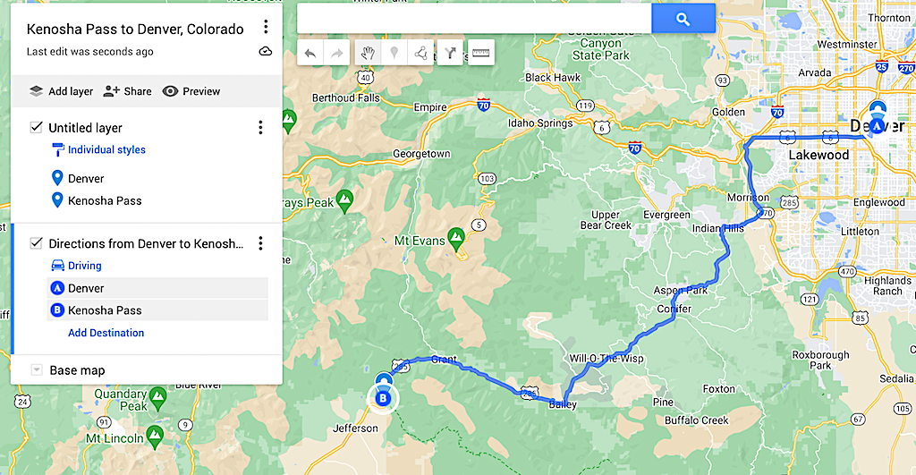
To get to Kenosha Pass from Denver, you’ll want to take Highway 285 out of town. It’s about a 1 hour and 45 min drive to get to the pass. You can also click here for the full map.
Is Kenosha Pass on the Continental Divide?
In short no, Kenosha Pass – originally along the famous Ute Trail – is not along the Divide. The pass is part of the ancient Ute Trail, a route that the Ute tribes would use to travel seasonally between Utah and Colorado. The pass is 9,997-feet above see level.
Nearby Georgia Pass (accessible by high-clearance vehicle) is along the Continental Divide (11,598′). However, Kenosha Pass is a landmark for the famous Continental Divide Trail. Meandering from Canada to Mexico, this high-altitude thru-hike often uses Kenosha Pass as a way on and off the trail.
You can find the Continental Divide Trail at Georgia Pass where it joins the Colorado Trail.
How Long is Kenosha Pass?
This largely depends on your appraoch. If you’re enjoying some of the Kenosha Pass hiking opporutnities, the trail is anywhere between 1 to 30.8 miles long. However, if you’re simply driving the pass it’s about 10 miles long.
Can You Drive Kenosha Pass?
Yes! In fact, most people drive Kenosha Pass. From the top of the pass there is a parking lot and campground. Here you can hike or bike around Kenosha Pass. The main hiking trail through Kenosha Pass is the Colorado Trail. This 498-mile through hike goes from Denver to Durango.
The Colorado Trail is broken into 28 segments. Each segment is a place where vehicles can access the trail. Kenosha Pass is between Segment 5 and Segement 6 of the Colorado Trail.
Best Time to Visit Kenosha Pass
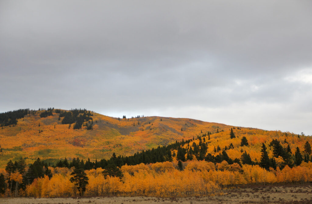
You can visit Kenosha Pass year-round, however most people opt to visit from mid-September through early October. The area is famous for amazing Colorado fall colors. As one of the top fall drives in Colorado, leaf peepers flock to Kenosha Pass to enjoy the views.
Local Tip: Although many people claim this is the best time to visit – during the weekends the area is absolutely packed with people. I’m talking police need to show up to direct traffic and the pass can be backed up for hours in each direction.
For a fighting chance at solitude, come here early in the morning (before 8 am) on a weekday during the fall color rush.
Summer is another great time to visit Kenosha Pass. The campground is open and there are plenty of opportunities to enjoy amazing hiking and backpacking routes.
Kenosha Pass in the Fall: Crowds
A fair warning here. Kenosha Pass is a exceptionally crowded place during the fall months – especially when the leaves change. There are typically so many people that traffic can quickly back up.
Plan your visit to avoid the crowds by:
- Arriving before 6 am. This will ensure you can park and beat a vast majority of traffic and crowds
- Avoid weekends. This is the most crowded time.
- Go during the week. If you want to venture around in the daytime, the week is the best time visit.
Kenosha Pass Hiking
The Colorado Trail offers access to two disticnt hiking areas at Kenosha Pass. Segment 5 is accessed via the east side of the pass, while Segment 6 is on the west. Both of these hikes are point-to-point trails, meaning you’ll need to turn around and come back unless you’re planning on backpacking the entirety of the Colorado Trail.
Segment 5 is a more moderate level hike, without steep elevation gains while Segment 6 is difficult, passing up and over 2 mountain passes.
As one of the top fall hikes in Colorado, most people hike the Kenosha Pass trails for about 4 to 5 miles in either direction. Segment 5 requires a short hike down a road to access, but will lead through stands of aspens with peeping views along the hillside.
Segment 6 has a bit more coverage and also meanders through thick aspens. However, Segment 6 offers views towards a large stand of aspens and is the more popular option.
Local Tip: Most people don’t hike too far from the car while enjoying the fall colors. If you want some solutide, get an early start and hike further.

Quick Facts about Hiking Kenosha Pass
Here’s a quick rundown of the Kenosha Pass hiking options.
Distance: 1 – 30.8 miles Out and Back or Point to Point. Segment 5: East side, 13.7 miles one way 1,886 feet of gain. Segment 6: west side, 30.8 miles one way and 4,954 feet of elevation gain.
Elevation Gain: around 300 to 4,954 feet
Difficulty: Easy to difficult
Duration: 30 mins to 7 hours, hiking for at least an hour is recommended to beat the crowds.
Dog Friendly? Yes, on leash.
Permit required? No.
Drive time from Denver: 1 hr 15 mins.
Highlights: Spanning views of the Mosquito Range, Aspen groves,
Kenosha Pass and the Colorado Trail
At this famous junction, Kenosha Pass meets up with the Colorado Trial. If you’re planning on mountain biking or hiking Kenosha Pass you’ve got two options. Each one has a slightly different flavor, making the pass a repeatable outing.
Segment 5: The East Side of Kenosha Pass
Distance: 13.7 miles one-way. For the best views travel at least 1.5 miles down the trail (3 miles round-trip)
Elevation Gain: 1,886 feet total, roughly 500-feet or so with the 3 mile option.
Difficulty: Moderate – easier than the Segment 6 side
Start your hike off by parking in the lot and hiking down the small dirt road on the east side of the pass. Head over a cattle guard. You’ll find a restroom and parking area here too if you don’t want the road walk. Just before the parking area you’ll see a trail wandering out to the south (right) side of the road.
This is the end of Segement 5 of the Colorado Trail. Continuing down this trail heads towards Segment 4 of the trail. Continue down the trail for about a 1/2 mile to your first stunning view. From here you can see the aspens on display as well as a spanning view towards South Park.
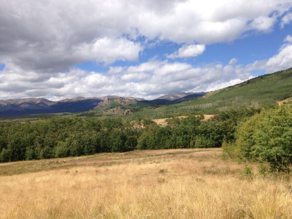
The peaks in the distance make up the Mosquito Range. Continuing up the hill gives you an even higher vantage point at aorund 1.5 miles. From here you’ll get expansive and stunning views. In the fall, the hillsides are on fire with the changing aspens.
Local Tip: Having done over 128 miles of the Colorado Trail, this viewpoint and Segment 6 are the most beautiful segments of the Front Range section of the Colorado Trail.
Segment 6: The West Side of Kenosha Pass
Distance: 30.8 miles one-way. For the best views travel at least 3 miles down the trail (6 miles round-trip)
Elevation Gain: 4,954 feet total, roughly 700-feet or so with the 6 mile option.
Difficulty: Moderate to challenging. More challenging than the east side.
Arguably the best segment of the Colorado Trail until you really reach the high country, hiking hte west side of Kenosha Pass is a real treat. However, it’s not easy and the entirity of the hike is best done as a backpack.
But if you’re looking to score some sweet fall color action, be sure to hike the west side of Kenosha Pass for approximately 3 miles. You’ll wander in and out of conifer and aspen forests along the way, emersing yourself in the glittering, golden aspens.
Once you reach around 3 miles, you’ll crest a hill and get peeping views of the South Park Valley and Mosquito Range. From here you can see the large stand of aspens out east that makes Kenosha Pass so popular.
The trail ventures down towards Guernsey Creek at this point before flattening out. From here, it’s a steep march up Georgia Pass. If you’re a serious hiker you can hoof it up to Georgia Pass in a day. This hike goes above the trees and gives you incredible views of the Mosquito and Tenmile Range.
However, it’s about a 20-mile journey and should only be attempted by seasoned long-haul mountain day hikers. If that doesn’t sound like your think, driving Georgia Pass is an option too. Home to some of the top free camping near Denver, it’s a weekend outing that’s sure to delight!
Kenosha Pass Campground
Kenosha Pass has one reservable campground at the top of the pass. You’ll certainly here road noise of communiting vehicles, but the campground is a great way to get a jump start on hiking.
Sites are non-electric and first-come-first-served from September 6 through September 25th. During the summer months, you can (and should) make an advanced reservation on a 6-month rolling basis. The campground closes over winter.
Amenities include fire rings, picnic tables, trash, and vault toilets.
Do You Need a Reservation for Kenosha Pass?
Nope! Kenosha Pass is currently completely open to visit at any time. The only reservations that are required is if you plan at camping on Kenosha Pass. In that case, you’ll want to make a reservation in advanced until September 6th when the campground becomes first-come-first-served.
Biking Kenosha Pass
Many people opt to mountain bike Kenosha Pass. In fact, Segment 6 of the Colorado Trail is one of the more famous montain biking sections. But be warned, it’s a long, tough journey! Segment 5 has more mellow terrain and is only bikeable until it reaches the Lost Creek Wilderness. Once at Lost Creek, you have to switch to road biking since bikes are not allowed on the trail.
Catch me on YouTube!
Want more secret backpacking trips? Ultralight hacks that every hiker can adapt? Experience the top outdoor destinations in the world without the crowds? If you want to get insider knowledge of all things outdoors, then you’ll wanna subscribe to my YouTube channel, where I am giving away my DECADES of knowledge as an outdoor professional. I’ll see ya there!
Additional Local Colorado Travel Resources
Looking for the best of Colorado the local way? Check out these resources:
