Last Updated on November 6, 2025 by foxintheforest
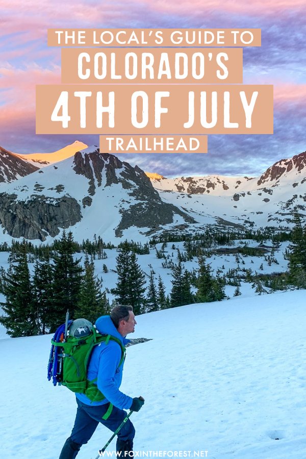
The 4th of July Trailhead in Colorado is a treasure trove of outdoor adventurers. Located just outside of Eldora, it’s proximity to nearby Boulder and Denver make it an excellent place to explore.
As a Colorado local for over 12 years, I try to make a stop at the 4th of July Trailhead every season. I’m also a full-time freelance writer for the great outdoors, making me a real pro who can give you a ton of secret, insider tips on the ins and outs of this stellar trail.
It doesn’t take long to hike down the trail and be rewarded with outstanding Colorado scenery. Not to mention there are plenty of mountains to climb and wildlife to spot.
About This Guide to the 4th of July Trailhead
I’ve put my expert local knowledge together to give you the complete guide to 4th of July Trailhead. Although there’s a lot to cover (just because this area has so much to offer), we’re going to dive right in by covering:
- How to access the 4th of July Trailhead
- Opening times for the 4th of July Road
- When is the best time to hike at the 4th of July Trailhead
- Rules and regulations
- Best 4th of July Trailhead Hikes
- Best climbs at the trailhead
- 4th of July Trailhead Campground
- Other things to do at the 4th of July Trailhead
- Additional Colorado travel resources
How to Get to the 4th of July Trailhead
The 4th of July Trailhead is right on the edge of the beautiful Indian Peaks Wilderness, located off of 4th of July Road. 4th of July Road is a bumpy and steep(er) 2-mile dirt road located right outside of Eldora.
I would recommend at least driving an SUV up the road, especially in recent years, since the ruts and erosion is getting pretty bad. A driver with nothing to lose might get away with less clearance, but most people take a 4WD SUV up to the trailhead. If you don’t have a car, you’ll add 4 miles round trip to your journey.
Take the 191 or the Peak-to-Peak Highway into Nederland and turn off at Eldora Avenue (on the west side of town). There’s only one direction to turn, and those coming from Denver/Boulder will make a left.
Take Eldora Road through the town of Eldora until it ends. You’ll hit a split in the road. Take the right fork, 4th of July Road, until it terminates at a campground and parking lot.
Is the 4th of July Road Open?
4th of July Road closes every winter and is not maintained. Typically the road is closed from mid-November until mid-June. This varies depending on the amount of snow, so always check with the Forest Service before heading out.
When is the Best Time to Hike at 4th of July Trailhead?
The best season for hiking in Colorado is between late June and September. This is also the best time to visit 4th of July Trailhead. Although you can access the Indian Peaks any time of year, the best time for snow-free trails is during the summer and it’s a great time to see Colorado wildflowers too.
Rules and Regulations
Indian Peaks Wilderness is a highly-trafficked wilderness area in the Front Range. It’s important to respect the rules and regulations of the area. Keep these rules in mind when visiting Indian Peaks and 4th of July Trailhead.
- Follow Leave No Trace at all times.
- Park only in designated areas. There is a lot of private lands here and you will be towed.
- Camp only in designated areas. Camping along 4th of July Road is mostly prohibited due to the private land surrounding the area.
- It’s free to park, but if you leave your car overnight, you’ll have to pay a fee.
- Dogs are allowed, but must be kept on a leash and you MUST carry your dog poop with you at all times.
- If you would like to camp in the backcountry or backpack at the 4th of July Trailhead, you’ll need a permit between May 15th and September 15th. Permits fill up quickly so reserve yours well in advance.
Best Hikes at the 4th of July Trailhead
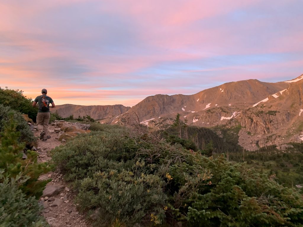
Some of the best hikes in Colorado are located at the 4th of July Trailhead. During the summer months, you’ll quickly be treated to unbelievable mountain scenery. July is a spectacular time to visit since the wildflowers are in bloom. Here’s a look at the best 4th of July Trailhead hikes.
Pro Tip: This place gets crowded as all get out in the summer. In order to ensure you have a parking spot, and some solitude, plan on arriving early (think before 8 am), especially on weekends.
4th of July Mine via Arapaho Pass
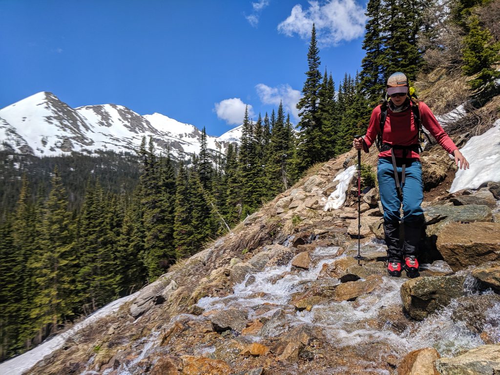
Take the Arapaho Pass Trail (the trailhead uphill from the toilets) up a gentle grade for 2 miles. You’ll see old mining equipment right near the junction for the Arapaho Glacier Trail. You’ll pass plenty of water and even a small waterfall you’ll get to cross (pictured).
Arapahoe Pass Trail continues onwards, but you’ll be treated to killer mountain views. If you’re feeling up for it, continue up the trail to climb Arapaho Pass for even more mountainy goodness.
Mileage: 4.1 miles round trip
Elevation: 1,131
Difficulty: Easy to moderate
Arapaho Pass Hike
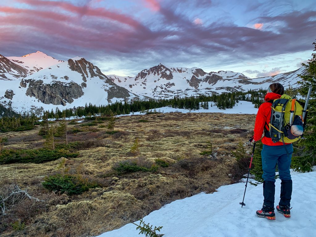
Continue upwards towards the obvious Arapaho Pass. Since you’re almost above treeline, you should be able to see the path clearly. as it winds its way up towards the saddle between Mount Neva and an un-named point. Gaining the pass is relatively easy if you’re experienced at hill walking. Even if you find yourself huffing and puffing in the thin air, keep going and soak in all the views.
Pro Tip: If you’re looking for some of the best backpacking in Colorado, continue on the Arapaho Pass Trail for another 9 miles (12.1 miles total) to reach Monarch Lake. This buggy lake is an alright overnight. Once you reach the junction with Cascade Creek, take that trail until it ends (another 6.1 miles) to reach Mirror Lake and Lone Eagle Peak, Colorado’s most beautiful mountain.
Mileage: 6.3 miles round trip
Elevation: 1,943
Difficulty: Moderate
Lake Dorthy Hike
Once you’ve gained Arapaho Pass, continue onwards for another half mile to reach Dorthy Lake. At the junction, bear left onto the Caribou Pass Trail. Dorthy Lake will be on your left. This beautiful gem sits right below the mighty Mount Neva, an excellent class 4 mountain.
Mileage: 7.1 miles round trip
Elevation: 1,943
Difficulty: Moderate
Caribou Pass
Gain two passes in one day by continuing past Dorthy Lake and around Mount Neva until you reach Caribou pass on the north side of Neva. You’ll get spanning views of the north side of Indian Peaks, a truly breathtaking wilderness area in Colorado.
Mileage: 8.1 miles round trip
Elevation: 2,237
Difficulty: Moderate
Diamond Lake
Those who love high alpine scenery and backpackers alike will love Diamond Lake. Snag a backcountry permit for one of Colorado’s best beginner backpacking routes. Schlep your heavy pack 2.3 miles to Diamond Lake. Get there by heading left at the fork with the Diamond Lake Trail. Drop your stuff at your site and continue hiking with less gear up to Upper Diamond Lake, a true high-alpine cirque.
Mileage: 8 miles round trip
Elevation: 2,070
Difficulty: Moderate
Climbs at the 4th of July Trailhead
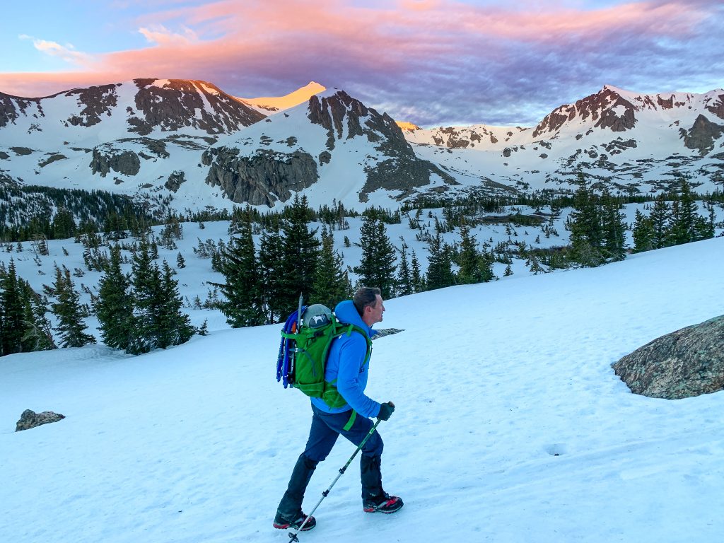
One of my favorite activities at the 4th of July Trailhead is to climb snow and scramble peaks. Some of the best 13ers in Colorado can be found here. If you’re new to climbing mountains, check out my guide to getting ready for your first peak before you head out.
South Arapaho Peak Standard Route
South Arapaho peak has several top-notch routes on it. In fact, I’ve climbed this mountain three times, never summiting the same way twice. South Arapaho Peak is a great beginner class 2 climb with a trail that leads to the top. Some people call this mountain a class 3 scramble, I’m here to let you know it is not. You may need to use your hand once, but no special gear is required.
Take the Arapaho Glacier Trail to reach the summit, head left once you hit the saddle. right will take you to Old Baldy.
Mileage: 8.1 miles round trip
Elevation gain: 3,231 feet
Class: 2. Rock hopping and a distinct trail lead to the top.
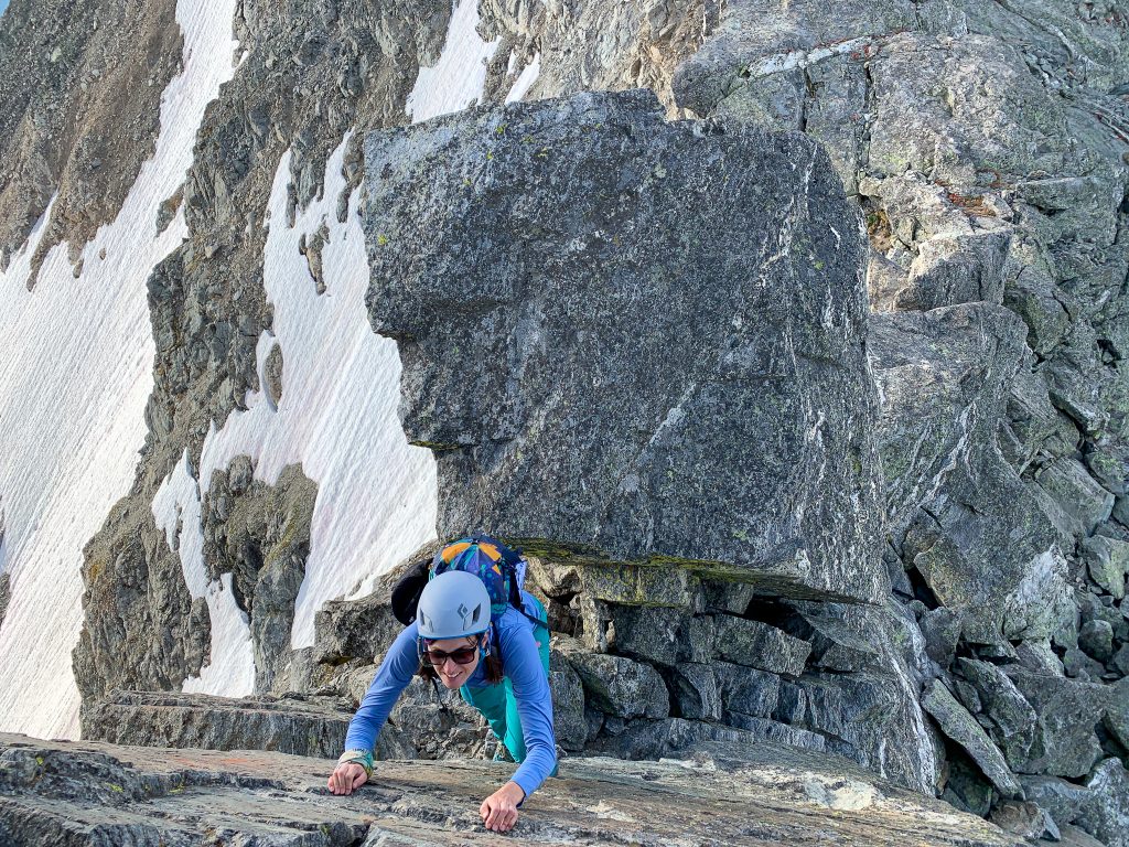
The Arapaho Traverse to North Arapaho
Scramble freaks (*raises hand*) will love this super-classic line. From the summit of South Arapaho strap on your helmet and let the spice begin. One of my favorite ridge runs near Denver, the traverse from South Arapaho to North Arapaho is fun and engaging on mostly solid rock.
You can follow painted arrows for the easiest line or choose your own adventure by summiting the many points along the route (most of them go at class 4 and low 5). The crux of the climb is a rather loose and freaky (yet short) gully towards the summit of North Arapaho.
Mileage: 8.3 miles round trip
Elevation gain: 3,500 feet
Class: 3/4. Helmet required. There is one or two class 4 moves on the famous slab (pictured). If you rock climb this is not a huge deal at all. If you don’t it’s a little heady, but it honestly looks harder than it is.
Mount Neva
Mount Neva is another great scrambling adventure that’s easily accessed directly from the top of Arapaho Pass. Take the Caribou Pass Trail until you reach the ridge, then jump on it!
The exposure on this one is certainly real, so be sure to bring your A-game mentally. A downclimb into a notch and then heads up towards a crux, a series of class 4 points.
Rock hop off the summit down the ugly scree pile and bushwhack your way back to the Arapaho Pass Trail, making your way towards the 4th of July Trailhead.
Mileage: 9 miles round trip
Elevation gain: 3,400 feet
Class: 4. Helmet and scrambling experience required.
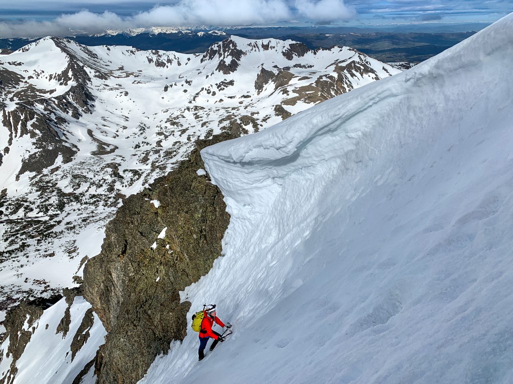
South Arapaho’s Famous Skywalker Couloir
This is by far the best snow climb in Colorado if you don’t have ropes. The Skywalker Couloir is truly a classic Colorado line that simply must be climbed.
The going is super-steep, quickly reaching 40-ish degrees and topping out via the Princess Leiah finish gets to a whopping 65 degrees. This climb is a no-fall zone for sure and should only be attempted if you have crampons, two tools (or a tool and an ax), and some prior snow experience. It’s also a pretty bitchin’ ski line.
Mileage: 5.97 miles round trip
Elevation gain: 3,263 feet
Class: Steep snow. Helmet, crampons, ice tool and ax required
Note: The season is short for this one, it’s usually in and has the best conditions the first two weeks of June. Beware of cornices.
Mount Jasper
Despite being the only 12,000-foot peak on this list, it’s still a worthy objective and a difficult day. Mount Jasper is mostly a bushwhacking and boulder hopping adventure, but you can find the wreckage of an old plane crash by the lake at the base.
Take the Diamond Lake Trail for a hot second before keeping west to reach the unnamed lake at the base of Mount Jasper. Make your way up the northeast ridge for a mix of rock hopping and scrambling. Descend the way you came for the easiest way down.
Mileage: 9.1 miles round trip
Elevation gain: 3,400 feet
Class: 3. Helmet and rock navigation required.
Camping at the 4th of July Trailhead
There are 10 coveted camp spots available at the 4th of July Campground, located right at the trailhead. There are no services here aside from a pit toilet and the sites are first-come-first-served only.
Due to its location next to some of the best hiking near Denver, the 4th of July Campground is one of the best places to camp in Colorado. However, everyone knows this, so plan on being here early if you want to camp on a weekend.
Camping is free, but you’ll have to pay a fee to park your vehicle overnight.
Things to Do Nearby
The Indian Peaks Wilderness and 4th of July Trailhead is a beautiful area and there are tons of activities nearby. A few favorite things to do in the area are:
- Drive the Peak to Peak Highway, one of Colorado’s most scenic drives.
- Visit nearby Rocky Mountain National Park
- Check out the Hessie Trailhead, and nearby Brainard Lake Recreation area for more of Colorado’s best hiking trails.
- Hang out at nearby Eldora and Nederland
Places to Eat
Nothing works up an appetite quite like hiking. Here are a few kick-ass spots to chow down post-hike!
- Crosscut Pizzeria and Taphouse
- Kathmandu Restaurant
- New Moon Bakery and Cafe
Have the hiking adventure of the season by exploring the 4th of July Trailhead this summer. Soak in those beautiful mountain views, smell the wildflowers, and get some mountain sun. Happy hiking!
Catch me on YouTube!
Want more secret backpacking trips? Ultralight hacks that every hiker can adapt? Experience the top outdoor destinations in the world without the crowds? If you want to get insider knowledge of all things outdoors, then you’ll wanna subscribe to my YouTube channel, where I am giving away my DECADES of knowledge as an outdoor professional. I’ll see ya there!
Additional Hiking Resources in Colorado
Traveling to Colorado? Plan the adventure of a lifetime with these incredibly local travel resources.
- How to Visit Colorado Like a Local
- Must-See Spots in Colorado
- The Ultimate 4-Day Colorado Road Trip
- 11 Colorado Hot Springs You Need to Soak In