Last Updated on October 31, 2025 by foxintheforest
There are 58 peaks over 14,000 feet high in Colorado – the largest number of any state outside of Alaska. However, despite the large numbers, there are surprisingly only a handful of 14ers near Denver.
In fact, the closest 14ers to Denver are still over an hour’s drive away. But don’t worry, there are still plenty of spectacular 14,000-foot peaks you can hike within 2.5 hours of Denver.
From steep dirt trails to full-on mountaineering adventures there are 14ers near Denver to satisfy every type of summit freak.
As a full-time freelance writer for the outdoors, climber and mountaineer I’ve summited well over 50 peaks across the world with most of them here in my Colorado home. Honestly, I stopped counting.
I’m not into hiking peaks for lists, but instead just like to get out there and have a good time. Have I hiked every 14er? No, that’s not my jam, but I have climbed every peak on this list. Some of them multiple times and from various routes.
I’ve been on everything from easy walk-up summits with a trail leading the way to picking my way across 1,000 vertical feet of rock while trad climbing in the alpine.
In short, I’m a 14er expert. Colorado has been my home for over 12 years and I’m an authority on being safe and responsible while having fun on Colorado’s famous 14ers.
This list of the closest 14ers to Denver brings you the best summits within a 2.5 hour drive from downtown. Wake up well before the sun and be back in town by happy hour. Now that’s a day out in the mountains!
About this Guide to 14ers Near Denver
Inside this guide you’ll get the pro scoop on the closest 14ers to Denver and more. Here’s what to expect:
- A complete list of 14ers near Denver that are within a 2.5 hour drive
- Route descriptions for each peak including difficulty, mileage, elevation gain, location, estimated time, highlights, drive time from downtown Denver, and more.
- Pro tips and tricks for hiking a Colorado 14er
- Additional planning resources

14ers Near Denver
This is a comprehensive list of all the closest 14ers to Denver (with a 2.5 hour drive). While no 14er should be considered easy, these are listed from easiest to most difficult.
Mt Blue Sky (formerly Mt Evans)
Mount Blue Sky is the closest 14er to Denver. With stunning panoramic mountain views, Mount Blue Sky is definitely one of the best hikes near Denver. Plus, you might get lucky enough to see some of the bighorn sheep and mountain goats, who frequent this trail.
The trail starts at the Summit Lake parking lot, then heads up the ridge of Mt. Spalding. Follow the ridge to the opposite side, then across to Mount Blue Sky itself. Follow the cairns and cross a boulder field, then pick up the established path to the summit.
Pro Tip: If you want to skip the hiking but still stand on top of a 14er, the Mount Evans Scenic Byway takes you almost all the way to the summit. It is the highest paved road in North America and is also one of the most scenic drives in Colorado.
You’ll also need to keep an eye on seasonal road closures.
- Distance: 5 mile
- Elevation Gain: 1,771 feet
- Summit Elevation: 14,264 feet
- Class: 2
- Estimated Time: 3-5 hours
- Permits/Fees: Self-issued wilderness permits are required. These are free and available at the wilderness boundary. There is also a $5 parking fee at Summit Lake.
- Trailhead Location: The Summit Lake Trailhead is located 9 miles up Mount Evans Road (CO-5). To get there, exit 1-70 at Idaho Springs (exit 240), then head south on CO-103 to Echo Lake.
- Highlights: The summit views are especially spectacular at sunrise
- Drive time from Denver: 1 hour 15 mins
Grays & Torreys Peaks
Located just over an hour from downtown Denver, the twin summits of Grays and Torreys are two of the closest 14ers to Denver. The combo of Grays and Torreys is one of the most popular 14er routes, not only because it is one of the easiest 14ers in Colorado, but also because you can bag two 14ers in one. Plus, they’re only about an hour from Denver.
The trail is well-marked and easy to follow. You’ll cross a bridge after the trailhead, then head up to the signed junction, where you take a left to continue to Grays (heading right goes to Torreys). Head up switchbacks to the summit. Then you can return to the saddle and tack on Torreys. Then descend to the saddle again and turn back towards the trailhead at the signed junction.
Local Tip: If you want to avoid the crowds on Grays & Torreys, check out nearby Mount Sniktau, which is one of the best 13ers near Denver. Also be aware that roads can close seasonally.
- Distance: 8.3 miles for both peaks round trip
- Elevation Gain: 3,600 feet
- Summit Elevation: 14,278 feet (Grays) & 14,275 (Torreys)
- Class: 1 (Grays) & 2 (Torreys)
- Estimated Time: 7-8 hours
- Permits/Fees: None
- Trailhead Location: Stevens Gulch Trailhead is up a badly maintained dirt road off of Exit 221 on I-70.
- Highlights: Incredible views of the Continental Divide
- Drive time from Denver: 1 hour 15 mins
Local Tip: If you’re looking for a more difficult route to the top of this dynamic duo, consider scrambling the Kelso Ridge route on Torreys Peak.

Mount Elbert
Stand on the tallest point in Colorado on top of the massive Mount Elbert. Okay, so the hike to the top might feel more like a constant uphill grind than an exhilarating mountain adventure. But trust me, if you time it right you can be at the summit for sunrise and that’s something special.
This butt-busting grind covers over 4,000 feet of elevation gain to reach the top. Hike through the forest along slightly inclined terrain until you reach a signed junction. Turn right and follow the Mt Elbert Trail.
You’ll stay along this trail for the rest of your journey slowly winding up towards the summit. Be warned, you’ll have 3 prominent false summits before you finally make it.
- Distance: 9 miles out & back
- Elevation Gain: 4,410 feet
- Summit Elevation: 14,439 feet
- Class: 1
- Estimated Time: 6-8 hours
- Permits/Fees: None
- Trailhead Location: Along Half-Moon Road. Take a left at the trailhead pull-out
- Highlights: Stand on the tallest point in Colorado! For the highest peak, this is one of the easier Colorado 14ers. It’s accessibility makes it an adventurous outing for the budding peak bagger.
- Drive time from Denver: 2 hour 15 mins
Quandary Peak
Arguably one of the most popular 14ers near Denver, the East Ridge of Quandary Peak is an excellent introduction to climbing 14ers. While this trail has plenty of elevation gain in just over 3 miles to the summit, it is not technical. So as long as you have the fitness and are fine with the altitude, it should be a straightforward and doable hike.
The trail is fairly easy to follow, just make sure you don’t miss the right turn at the boulder about 0.3 miles in. As you continue on, the trail does intersect with a few old mining roads, but they are signed to keep you on track. Eventually, you’ll hit the ridge and follow switchbacks up to the summit.
Pro Tip: For one of the best lake hikes in Colorado, take the West Ridge of Quandary (technical scramble over loose rock) which passes the Blue Lakes. However, be aware that this route contains Class 3 terrain and is much more technical than the standard East Ridge, so don’t attempt this if you don’t have the skills, experience, and a helmet to do it safely.
A reservation is required to park at the trailhead from June 17 through September 17. Learn more here.
- Distance: 6.5 miles out & back
- Elevation Gain: 3,169 feet
- Summit Elevation: 14,265 feet
- Class: 1
- Estimated Time: 3-6 hours
- Permits/Fees: None
- Trailhead Location: Quandary Peak Trailhead is north of Hoosier Pass on McCullough Gulch Road (851) off of Blue Lakes Road (850).
- Highlights: Excellent views of alpine lakes and the mountains of the Continental Divide
- Drive time from Denver: 1 hour 45 mins
Local Tip: As of July 30th, 2021 you must have an advanced permit reservation to hike Quandary Peak.

Mount Sherman
I’ll admit it, Mount Sherman isn’t the most exciting thing on the planet. In fact, it’s mostly just a slog up endless talous (fist-sized rocks) on a large hump of a mountain. What Sherman lacks in personality, it gains in ease.
At under 5 miles round-trip its the shortest summit route (without a road to the top) out of all of the 14ers near Denver. You can hike this one and be back before lunch if you time it right.
The route is very straight forward. Hike up the road past the gate. Eventually you’ll bump into the Dauntless Mine. Continue to a road junction and stay on the main road. Another mine (Hilltop Mine) awaits. You’ll turn let here and continue up more mining structures. Stay on the road past a big pile of rock. Eventually you’ll see a cairned trail (rock stacks that mark the trail). Follow these to the saddle and continue up along the ridge until you reach the summit.
- Distance: 4.8 miles out & back
- Elevation Gain: 2,100 feet
- Summit Elevation: 14,043
- Class: 2
- Estimated Time: 2-4 hours
- Permits/Fees: None
- Trailhead Location: Fourmile Creek Trailhead wet of Fairplay
- Highlights: mining ruins, relatively easy as far as 14ers go, low mileage.
- Drive time from Denver: 2 hour 10 mins
Mount Bierstadt
Mount Bierstadt is the closest 14er to Denver and one of the best hikes in Colorado. The trail is easy to navigate, the hike is fun, and the views are awesome. It’s also relatively easy for a 14er – the elevation gain isn’t terrible, but there is some Class 2 terrain near the top.
The trail begins in Arapaho National Forest and doesn’t gain much elevation until after you cross Scott Gomer Creek. Then you’ll head through the willow trees and start switch backing up the steep west slope. The trail continues up to a ridge, and as you get close to the summit, you’ll have to navigate over rocks and boulders to reach the top.
Pro Tip: Thanks to being tied for the closest 14er to Denver, Mount Bierstadt is one of the most popular 14ers, so get as early a start as you possibly can to beat the crowds (think 3 am), especially on summer weekends.
There are also seasonal road closures and you will need a permit to visit the area.
- Distance: 7.1 miles out & back
- Elevation Gain: 2,729 feet
- Summit Elevation: 14,065 feet
- Class: 2
- Estimated Time: 4-6 hours
- Permits/Fees: Mandatory self-issued permit is free and available at the trailhead.
- Trailhead Location: The Bierstadt Trailhead is located at the top of Guanella Pass. Head west on 1-70 to Georgetown, then drive through the town and up Guanella Pass Scenic Byway.
- Highlights: Great views of Grays, Torreys, and Mount Blue Sky. This hike is extra special when the vibrant wildflowers bloom in the valley in July & August.
- Drive time from Denver: 1 hour 20 mins

Decalibron (Democrat, Cameron, Lincoln, & Bross)
Do the Decalibron Loop to hit four the summit of four 14ers in a relatively short day. This hike is also a great way to train at altitude, since most of your time on the trail will be above 13,000 feet.
From the trailhead, you’ll start by summiting Mount Democrat, then head down to a saddle to make your way up Cameron, then down to another saddle up Lincoln, then down one more time and up Bross. The descent down Bross is pretty terrible talus but eventually you’ll get back to the trailhead.
Pro Tip: As of December 2023, the summits of Democrat and Cameron are public land, but the summits of Lincon and Bross remain on private property and are not legal to access, but people do it anyway.
- Distance: 7.5 mile loop
- Elevation Gain: 3,000 feet
- Summit Elevation: 14,154 feet (Democrat), 14,238 feet (Cameron), 14,293 feet (Lincoln) & 14,178 feet (Bross)
- Class: 2
- Estimated Time: 3-5 hours
- Permits/Fees: $5 parking fee
- Trailhead Location: You’ll find the Kite Lake Trailhead on Kite Lake Road in the town of Alma. The road quality varies, you’ll need some clearance to reach the upper TH.
- Highlights: Doing four 14ers in a day!
- Drive time from Denver: 2 hours
Pikes Peak
So there are two main ways up Pike’s Peak. One way is to drive to the top. As one of the most scenic drives near Denver, this is a must-do at least once. Is it “cheating?” kinda, but I won’t tell anyone so don’t worry!
The other way is to take the 24-mile round-trip class 1 route to the top of this massive beast. The elevation gain is super-real, so don’t let the dirt trail fool you – you’ll earn it! The Barr Trail is the easiest way for walkers to reach the top.
Start up the trail for 1.5 miles and you’ll reach a corner (this heads to the Manitou Incline). Hang left and bypass another Incline entrance. Check out the arch as you continue the upward grind until you reach Barr Camp (you can stay here if you want to hike the entire route). This is the halfway point!
Continue upwards passing several junctions. After 7 miles in you’ll head left. By now you’re in the thick of switchback hell. The journey continues until you reach the top.
- Distance: 13 miles one way (Instead of hiking all the way back to the trailhead, you can take a shuttle down from the summit to make it a doable day hike.)
- Elevation Gain: 7,434
- Summit Elevation: 14,115 feet
- Class: 1
- Estimated Time: 6-10 hours
- Permits/Fees: None
- Trailhead Location: Barr Trailhead is located just west of Manitou Springs on Hydro Street.
- Highlights: Barr camp, excellent views of eastern Colorado, a snack bar and shelter at the summit (yippee!).
- Drive time from Denver: 1 hour 25 mins
Local Tip: This is a pretty difficult route in my opinion. It’s tough to stay motivated over such a long distance. But since you don’t really need to descend (you can even have a friend meet you at the top) and it’s a Class 1 hike, it’s towards the top of the list.

Mount Princeton
Mount Princeton not only houses some of Colorado’s best hot springs (post-summit soak anyone?) but it’s also one of the more captivating peaks. Located in the mighty Sawatch, hiking to the top of Mount Princeton is one of the more exciting things to do in Buena Vista.
Start off on Mt Princeton Road for some tedious road walking. Eventually you’ll find the Princeton Trail on the right side of the road. You’ll cross a handful of gullies (beware of snow in early season attempts) and continue west. The trail fades a little bit, but is relatively easy to follow.
Once you reach a small rock wall, bank left until you reach the top of the connecting ridge with Princeton and nearby Tigger mountain. Once you crest the ridge turn right and head towards the summit.
- Distance: 6.8 miles out & back
- Elevation Gain: 3,320 feet
- Summit Elevation: 14,204 feet
- Class: 2
- Estimated Time: 6-8 hours
- Permits/Fees: None
- Trailhead Location: Mt Princeton Road, west of Johnson Village on FR 322.
- Highlights: Spanning views of the Upper Arkansas River Valley, Sawatch Range, and nearby hot springs.
- Drive time from Denver: 2 hours 30 mins
Mount Massive
As the second-highest mountain in Colorado, Massive certainly lives up to its namesake. Yet another big, long day greets you if you want to stand on the top of this mighty mountain.
Leave the parking lot and be prepared for a couple of creek crossings until you reach the Mt Massive Trail junction at 2.25 miles. Head left and wind around the switchbacks until you reach the summit. You’ll pass a junction or two as you slog it out, just stay on the ridge crest until you reach the top.
- Distance: 13.7 miles out & back
- Elevation Gain: 4,553 feet
- Summit Elevation: 14,429
- Class: 2
- Estimated Time: 8-12 hours
- Permits/Fees: Mandatory self-issued permit is free and available at the trailhead.
- Trailhead Location: Mt Massive trailhead along Halfmoon Road.
- Highlights: A mighty mountain with spanning views of the Sawatch Range and the Upper Arkansas River Valley
- Drive time from Denver: 2 housr 25 mins
Mount Belford/Oxford
Mount Belford and Mount Oxford are almost always combined since the summits are so close. This hike makes for a long day, but is a nice escape into the Sawatch Range.
Be prepared for some steepness on this trail right from the start. You’ll head straight up through a forest until you emerge above treeline and see Mount Belford.
Take a ridiculous number of switchbacks to the summit of Belford, then descend to a ridge which connects to Mount Oxford. Head up to that summit, then make your way back up and over Belford again before heading down.
- Distance: 11 miles out & back
- Elevation Gain: 5,700
- Summit Elevation: 14,203 (Belford) & 14,160 (Oxford)
- Class: 2
- Estimated Time: 6-10 hours
- Permits/Fees: None
- Trailhead Location: Missouri Gulch Trailhead is located between Leadville and Buena Vista. Take US-24 to Chaffee County Road 390, and you’ll find the trailhead pullout on your left after about 7.5 miles.
- Highlights: Views of the Sawatch range and wildflowers when they’re in season
- Drive time from Denver: 2 hours 30 mins
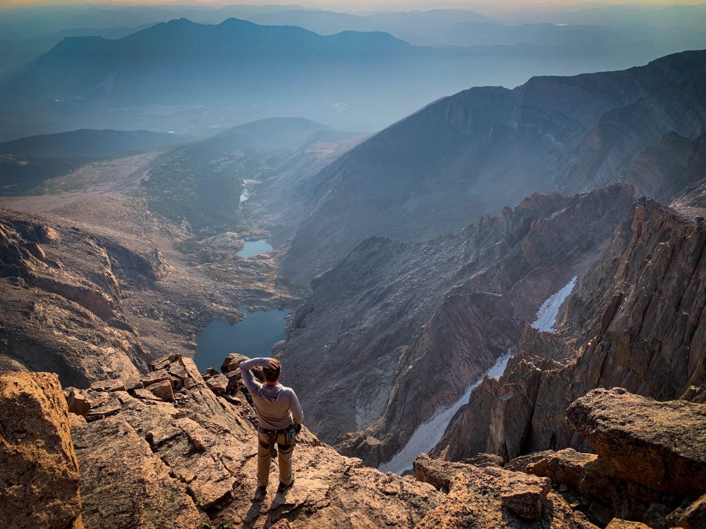
Longs Peak
Even I’ll admit it, despite the rather uneventful, broad summit, Longs Peak is still one of the best 14ers in Colorado. Arguably the most iconic of the 14ers near Denver (and the only 14er in Rocky Mountain National Park), there are countless routes up to the top. However, the easiest route still requires scrambling, a helmet, and plenty of experience before attempting it.
The Keyhole route is the standard line. This Class 3 scramble is long, exposed, and very real. It’s unlike any of the other hikes on this list, simply because you’re scrambling (using your hands over terrain with steep drops) not hiking.
In my opinion the Keyhole route is extremely overrated, but I dislike hiking with 100s of people, especially scrambling. If you’re looking to ditch the crowds (and shave a few miles off of your entire journey) check out the famous Cables Route. This one-pitch 5.4 trad climb is an awesome way to get stunning views of the insanely famous Diamond (the highest and second-biggest granite climbing face in the US) and enjoy Longs without the crowds.
For those that love a little bit of everything, Kiener’s Route is another uber-classic mountaineering route in Colorado. With everything from steep snow (crampons/ax required) to the exposed Broadway Ledges, and some class 4 rock it’s got everything to keep even the most experienced mountaineer on their toes.
Keyhole Route
- Distance: 14.8 miles out & back
- Elevation Gain: 5,039 feet
- Summit Elevation: 14,259 feet
- Class: 3 (wear a helmet)
- Estimated Time: 10-15 hours
- Permits/Fees: None, unless you’re camping
- Trailhead Location: Longs Peak Trailhead at the end of Longs Peak Road. Signs mark the turnoff along St Vrain Ave.
- Highlights: A classic mountaineer’s mountain inside of the beautiful Rocky Mountain National Park.
- Drive time from Denver: 1 hour 40 mins
Local Tip: The parking lot for Longs Peak fills up by 2 am nearly every day in the summer with extra crowds on weekends. Get there early or you may not be able to park.
Quick Tips for Hiking Colorado 14ers
Be in the know before you go. Although many of the 14ers near Denver aren’t technical, they are still a different kind of hike. Often long and grueling, don’t underestimate how long it takes to reach the top.
Be sure to know how to prepare for a 14er and use a 14er packing list to make sure you don’t forget anything!
Local Tip: For my first 14er I forgot to pack a hat and gloves. It was late July and the temps at the summit were in the 20s with windchill! It was certainly cold, so always be prepared!
Take your time and keep a steady pace. Listen, the uphill grind is REAL! Budget 1 hour per 1,000 feet of gain both up and down. Take breaks and listen to your body. It’s ALWAYS okay to turn around if you’re just not feeling it.
Local Tip: I’ve summited well over 50 peaks and a success rate of around 40% is considered good, so don’t let turning around on a mountain bum you out. Always make the safer choice.
Start EARLY
Like well before the sun rises early. Dangerous thunderstorms ravage Colorado 14ers and every year hikers get stranded, stuck, or worse. Always plan to be below the treeline (where the trees grow) by 11 am to avoid afternoon storms.
Weather.gov gives the most accurate weather info and you can search the specific peak. Use the chart to gauge storm activity.
Be prepared
Always be sure to pack the essentials, extra layers, rain gear, a first aid kit, plenty of snacks, and sun protection.
Consider leaving Fido at home
There are very few 14ers I would recommend bringing a dog on. Their paws really aren’t meant for the rough rocks and dogs can get dehydrated, have altitude adjustment issues, you name it. Not to mention they can easily kick rocks down on other hikers and climbers.
Know your route
Study your proposed route before you go. Load a GPX file to your phone. Read trip reports, stay up-to-date with recent conditions, and keep any helpful screen grabs of info with you while you hike. Don’t forget the paper backup (phone batteries die, paper does not).
Hiking 14ers is dangerous, even if you’ve done it countless times like me. Always be aware of your surroundings and know that getting lost on the mountain can happen even to the most experienced climbers. Stay vigilant and when in doubt, don’t be afraid to turn around and call it.
Remember: The mountains will always be there, but you may not.
Catch me on YouTube!
Want more secret backpacking trips? Ultralight hacks that every hiker can adapt? Experience the top outdoor destinations in the world without the crowds? If you want to get insider knowledge of all things outdoors, then you’ll wanna subscribe to my YouTube channel, where I am giving away my DECADES of knowledge as an outdoor professional. I’ll see ya there!
Additional Planning Resources
Ready to explore the best mountains in Colorado? Here are a few additional adventures you’ll want to check out.
