Last Updated on April 22, 2024 by foxintheforest
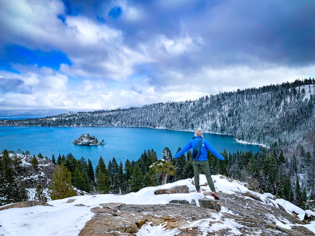
If you’re looking for stellar landscapes and epic mountain beauty, look no further than this list of the best hikes in South Lake Tahoe. From cascading falls to ragged peaks, Tahoe has it all.
One of my favorite pastimes is exploring these amazing South Lake Tahoe hikes. My family lives in the Tahoe Basin and I’ve been coming here for over 20 years to hit the trails.
Inside this guide to hiking trails in South Lake Tahoe, you’ll find insider knowledge and local tips for how to enjoy these iconic locales.
About this Guide to the Best South Lake Tahoe Hikes
Inside this locale guide to top South Lake Tahoe hikes you’ll find:
- Easy hikes in South Lake
- Moderate hiking trail recommendations
- The most challenging hikes in South Lake Tahoe
- Juicy info included mileage, estimated time, and more

Does Lake Tahoe Have Good Hiking?
Absolutely! In fact, there are an array of amazing Lake Tahoe hikes that will keep you coming back again and again.
What’s great about Lake Tahoe is you can find a variety of hikes for different skill levels all within a relatively small area.
So, enjoy one of the best South Lake Tahoe activities and hike the day away. Just be sure to check trail conditions, especially during November in Lake Tahoe.
Map of South Lake Tahoe Hiking Trails
Below you’ll find a map highlighting where to find the best South Lake Tahoe hikes. Yea, we threw in one on the north shore – mostly because you can see the south end from the top.

Get the interactive version here.
Easy South Lake Tahoe Hikes
These quick and easy South Lake Tahoe trails offer up killer scenery without a ton of effort. Do keep in mind you’re still high in elevation, so you may feel breathless, but these hikes don’t have a lot of mileage so the commitment is short. Plus, it’s a great way to get out of Tahoe City.
1. Cascade Falls Hike
Cascade Falls has to be one of the prettiest hiking trails in South Lake Tahoe. A short jaunt from the Emerald Bay parking area brings you face-to-face with a small, but stunning waterfall. What’s so great about this hike is that it’s easy to combine with Eagle Lake or the Vikingsholm Trail.
Local Tip: This parking lot fills up quicky in the summer. Be here by 6 am if you want a (free) place to park. There is a lot across the 2-lane highway that is paid parking. This will also fill up quite early and there is no parking on the road. Alternatively, visit Lake Tahoe in November to avoid the crowds.
Distance: 1.4 miles out and back
Elevation Gain: 255 feet
Difficulty: Easy
Estimated Time: 40 minutes
Dog Friendly: Yes but on a leash
Red Tape: $10 parking fee

2. Angora Lakes Trail
You can technically drive to the shores of these lakes, but the 1.2-mile hike to the lake is worth it. You’ll pass two other small lakes and ponds along the way. Soak in the rocky shoreline and pine forests on this South Lake Tahoe hike.
Distance: 1.2 miles out and back
Elevation Gain: 266 feet
Difficulty: Easy
Estimated Time: 45 minutes
Dog Friendly: Yes but on a leash
3. Pope Baldwin Bike Path
Alright, so this is a slightly longer path, but it’s paved and pretty flat making it an accessible option for people with strollers or wheelchairs.
You can go for as long as you choose along this South Lake Tahoe trail. Many people opt to take their bikes down it as well.
Distance: 7.3 miles
Elevation Gain: 196 feet
Difficulty: Easy
Estimated Time: 4 hours 30 minutes
Dog Friendly: Yes but on a leash
Moderate South Lake Tahoe Trails
These moderate South Tahoe trails will get your heart pumping but aren’t too strenuous. The ideal option for a quick burn or a longer day out.
4. Vikingsholm Trail
This quick, but steep hillside takes you down from the views of Emerald Bay right to the shoreline. Here you’ll find the historic Vikingsholm house – a mansion built long ago. You can tour the home from June through September. Or you can opt to continue down the trail towards Lower Eagle Falls, where there’s a place to dip your feet into the cool water.
Distance: 1.7 miles out and back
Elevation Gain: 377 feet
Difficulty: Moderate
Estimated Time: 1.5 hours
Dog Friendly: Yes if on a leash, although no dogs are allowed in the house.
Red Tape: $10 fee
5. Fallen Leaf Lake Hike
Fallen Leaf Lake lives up to its namesake. As you drive towards it it looks like a leaf that fell out of Lake Tahoe proper. As one of the best hikes in South Lake Tahoe, this one gets pretty busy. Start early to beat the crowds and enjoy some solitude.
Distance: 3.6 miles out and back
Elevation Gain: 138 feet
Difficulty: Moderate
Estimated Time: 1 hour 15 minutes
Dog Friendly: Yes

6. Van Sickle Rim Trail Hike
Van Sickle is one of the better options if you want a top-down view of the Lake. The trail connects with the Tahoe Rim Trail – a 100-plus-mile through-hike that circumnavigates the lake.
You can keep going to scope out distant views of Carson City in the distance or turn around whenever you’ve had enough.
Distance: 5.4 miles out and back
Elevation Gain: 1351 feet
Difficulty: Moderate
Estimated Time: 3 hours 15 minutes
Dog Friendly: Yes if on a leash
7. Eagle Falls to Eagle Lake Hike
So low-key confession here – this is my favorite moderate hike in South Lake Tahoe. I take everyone who comes to visit to this spot. It’s just so classic.
You’ll get stunning views of Emerald Bay, one of the best views in Lake Tahoe, and you get the bonus Eagle Lake plus a waterfall. What’s not to love?
Local Tip: This has to be the busiest hike on the list, in fact, it’s one of the best things to do in Lake Tahoe. So an early start is best.
My recommendation is to start around 6 am in the summer – earlier on weekends.
Distance: 1.9 miles out and back
Elevation Gain: 459 feet
Difficulty: Moderate
Estimated Time: 1 hour
Dog Friendly: Yes if on a leash

Hard South Lake Tahoe Hikes
So when it comes to things to do in South Lake Tahoe, some of these hikes really top the list. Sure, they are butt-busters and they will get your blood pumping, but that’s all part of the fun right?
8. Rubicon Trail Hike
Yet another super-famous hike in the Emerald Bay area, the Rubicon Trail is an absolute classic.
There are a few routes to take and the full Rubicon Trail is quite long, with plenty of options to make it harder.
Most people opt to start in DL Bliss State Park and hike down to the water’s edge and into Emerald Bay.
Ending at Vikingsholm adds another 2-ish miles round trip.
Distance: 7.3 miles out and back
Elevation Gain: 1,007 feet
Difficulty: Hard
Estimated Time: 4 hours
Dog Friendly: Yes
Red Tape: $10 entry fee

9. Granite Lake and South Maggie’s Peak
If you’re not quite ready for Mt Tallac, Granite Lake to South Maggie’s Peak is an excellent alternative. Still hard, but not as committing, you’ll get killer views of Emerald Bay and a few lakes too. If you haven’t had your fill, consider adding Vikingsholm or Cascade Falls to your day.
Distance: 4.1 miles out and back
Elevation Gain: 1778 feet
Difficulty: Hard
Estimated Time: 2 hours and 50 minutes
Dog Friendly: Yes if on a leash
Red Tape: $10 entry fee
10. Mt. Tallac Hike
As one of the top challenging hikes in South Lake, Mt Tallac takes the cake. It’s the highest point in the Lake Tahoe Basin (followed by Mt Rose on the northern Nevada side).
This hike is a real challenge, with over 3,000 feet of elevation gain. But for those willing to keep going, the views are magnificent.
Distance: 10.5 miles out and back
Elevation Gain: 3,274 feet
Difficulty: Hard
Estimated Time: 6.5 hours
Dog Friendly: Yes if on a leash

11. Glen Alpine Trail to Aloha Lake Hiking Trail
Aloha Lake has to be one of my favorite spots in the Desolation Wilderness.
The lake itself is stunning, just be aware that it’s rocky and shade is hard to come by at times. What makes this trail so difficult is the distance, not the elevation.
Local Tip: I think Aloha Lake is best done as a backpacking trip. It’s worth it to spend the night out here. You’ll just need to get your permits in advance.
Distance: 11.1 miles out and back
Elevation Gain: 1,961 feet
Difficulty: Hard
Estimated Time: 5 hours and 15 minutes
Dog Friendly: Yes if on a leash
Bonus: 12. Mount Rose Trail
Okay, so this hike is technically on the north side of the lake, but I added it in here because it’s a serious challenge.
It’s well worth the drive to scope out the view from the second-highest mountain in the area.
What I love about Mt Rose is that you get it all – waterfalls, high desert, and views of the entire Lake Tahoe and the Reno basin.
Distance: 10.7 miles loop
Elevation Gain: 2395 feet
Difficulty: Hard
Estimated Time: 5 hours and 30 minutes
Dog Friendly: Yes
What is the Most Difficult Hike in Lake Tahoe?
The most difficult hike in Tahoe is the Tahoe Rim Trail. This trail circumnavigates the lake from a higher elevation and is roughly 170 miles long with nearly 28,000 feet of elevation gain.
It takes on average 10-12 days for the seasoned hiker to complete. There are places to re-supply along the way, but finding water along the trail is a challenge.
What is the Prettiest Part of Lake Tahoe?
One can argue the entire lake is gorgeous, however, there are a few spots that get quite a bit of notoriety. Emerald Bay is often called the prettiest part of the lake.
The views from Cave Rock are also quite stunning. However, you really can’t go wrong anywhere along Lake Tahoe. Just look at South Lake Tahoe vs. North Lake Tahoe to determine where you want to base yourself.
Here’s a Look at What to Bring
Don’t forget the essentials with this mountain hiking packing list!
What to wear:
- Sunshirt
- Noncotton socks
- Hiking footwear with good traction that you are comfortable wearing all day.
- Non-cotton shorts for hiking
- Or non-cotton, pants for hiking. Convertible pants are great too!
- Non-cotton shirt for hiking
What to pack:
- Hiking day pack. I love the REI Flash 22 for an affordable day pack.
- Water and snacks for the car – it’s always nice to have a treat at the end!
- Sunscreen, sunhat, sunglasses
- First Aid Kit
- Electrolyte powder – optional but nice to have!
- A water bladder capable of carrying at least 2 liters of water.
- Camera
- Camera clip to strap to your back
- Beanie
- Glove liners
- Fleece layer
- Puffy layer
- Hiking poles (optional)
- A toilet kit: shovel, WAG Bag (if you plan to travel above treeline), hand sanitizer, TP/baby wipes, a small plastic baggy to pack out TP and sanitary items
- Pee funnel – optional
- Pee rag – optional.
- Headlamp
- GPS navigation
- emergency communication device
- Wind/rain layer
- Pocket knife
Additional Local Lake Tahoe Travel Resources
Looking to explore Lake Tahoe like a local, not a tourist? Then you’re in the right place. Check out these handy resources:
