Last Updated on January 23, 2026 by foxintheforest
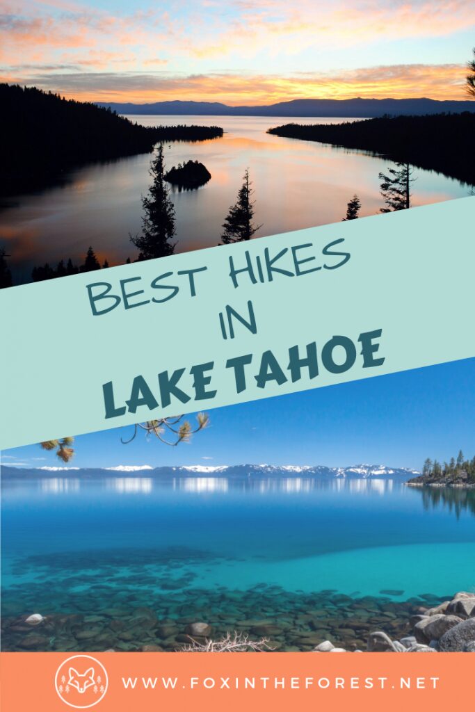
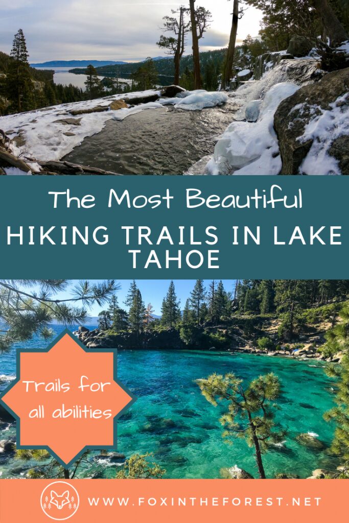
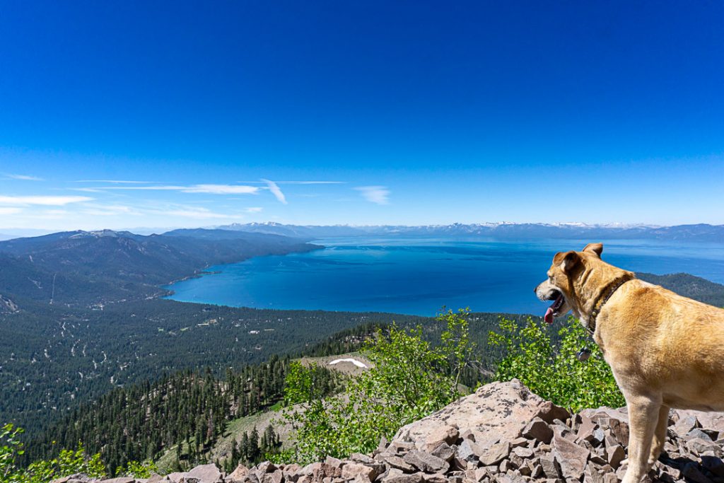
The best Lake Tahoe hikes range from easy 1-mile waterfall walks like Cascade Falls to challenging 10-mile summit climbs like Mount Tallac, offering stunning alpine lakes, granite peaks, and crystal-blue Tahoe views across all difficulty levels. With over 150 trails circling the lake, the top hikes include Eagle Lake (beginner-friendly, 1.8 miles), Rubicon Trail (moderate, 6 miles of shoreline views), and Mount Rose (advanced, 10.6 miles to Nevada’s highest Tahoe peak at 10,778 feet).
My family moved to Lake Tahoe when I was 14 years old. That was over 20 years ago, and I’ve been exploring these trails ever since. I grew up hiking Eagle Lake with my brother on summer weekends, learned to scramble near Mt Rose Knob as a restless teenager a peaceful view. Now I bring my own adventures back to these mountains multiple times a year, visiting my parents who still live here.
What makes me different from other hiking guides? I didn’t visit Tahoe for a long weekend and compile a list from AllTrails. I spent my formative years on these trails. And still check in. I know which hikes get absolutely slammed on summer weekends (DL Bliss State Park, I’m looking at you) and which stay blissfully quiet even in peak season. I know when the wildflowers peak at Tahoe Meadows and exactly where to park for Hidden Beach without dealing with the tourist chaos that clogs Highway 28.
As a professional outdoor writer who literally gets paid to hike and has been published in REI, Outside Magazine, and Backpacker Magazine, I’m sharing the 22 best Lake Tahoe hiking trails with the kind of insider knowledge you only get from two decades of local experience. This isn’t a best-of list. This is a love letter to the trails that shaped me.
Quick Reference: Find Your Perfect Lake Tahoe Hike
Looking for something specific? Here’s how to choose your adventure:
Best views with minimal effort: Cave Rock (1.6 miles), Emerald Point (4.4 miles). Busy
Best for families with kids: Spooner Lake (2.5 miles loop), Eagle Lake (1.8 miles), Cascade Falls (1.4 miles). Often busy, especially on summer weekends.
Best swimming spots: Hidden Beach (0.5 miles)
Best alpine lake hikes: Ralston Lake, Middle Velma Lake, Lake Aloha
Best waterfalls: Cascade Falls, Eagle Falls (en route to Eagle Lake)
Best summit views: Mount Tallac, Mount Rose, Freel Peak, Maggie’s Peaks
Best for solitude: Tamarack Peak, Lola Montez, 4th of July Lake
Best wildflowers (July): Tahoe Meadows Interpretive Loop, Winnemucca Lake Loop
Best fall colors (Sept-Oct): Spooner Lake, any aspen-lined trail (more rare in Tahoe, but head south of the lake)
Best year-round accessibility: Cave Rock, Emerald Point (can and does close), Spooner Lake
Table of Contents
- Easy Lake Tahoe Hikes
- Moderate Tahoe Trails
- Challenging Hikes
- North Shore vs South Shore
- When to Hike Lake Tahoe
- Avoiding the Crowds
- What to Pack
- FAQ
Easy Lake Tahoe Hikes (Under 3 Miles)
These trails deliver stunning Tahoe scenery without requiring serious fitness or time commitment. Perfect for families, casual hikers, or anyone wanting to experience the lake’s beauty without the suffering.
7. Emerald Point Trail
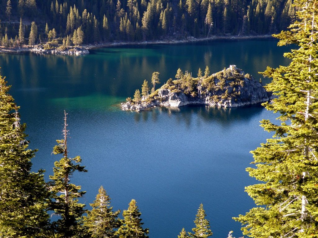
Emerald Bay is a South Lake Tahoe icon and the source of approximately 90% of the tourist photos you see from the area. Most visitors stop at the scenic pullout along Emerald Bay Road, snap their photos, and leave. The Emerald Point Trail takes you down to the shoreline for an entirely different perspective on one of California’s most photographed spots.
The trail descends steeply from the overlook (which you’ll feel on the way back up) to an old stone building at the water’s edge, then hugs the north shore of the bay. Going all the way to the bottom is a moderate hike, but you can simply enjoy the the views for as long as you like to keep it easy.
You get up close and personal with those famous emerald waters, see Fannette Island from beach level, and might even spot the Tahoe Gal, a steam-powered paddle boat that cruises the bay.
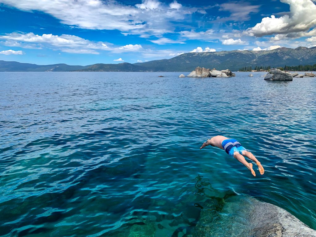
The water color comes from the depth and clarity. On sunny days the blue-green is almost unreal. The sand contains flecks of pyrite (fool’s gold) that catch the light. Swimming is allowed and encouraged, though the water stays cold even in peak summer.
Trail Stats:
- Distance: 4.4 miles round-trip.
- Difficulty: Easy to moderate (steep section at beginning).
- Elevation gain: 557 feet.
- Time: 2.5 hours.
- Trailhead: Emerald Bay Overlook pullout on Highway 89.
- Permits: None.
- Best time: June through October; accessible year-round but can be icy.
- Dog-friendly: Yes, on leash.
Insider tip: The Emerald Bay Overlook parking lot is an absolute zoo from 8 AM to 6 PM on summer days. The key to beating crowds is beating the tour buses, so the early bird gets the solitude here!
Arrive by 7:30 AM or after 5 PM to find parking. The trail itself thins out crowds significantly since most tourists never leave the overlook. Pack your swimsuit because the swimming opportunities along the trail are too good to pass up on hot days. September and October offer the same beautiful conditions with a fraction of the crowds.
2. Eagle Lake Trail
This is one of my all-time favorite hikes at any time of year, and that’s saying something after two decades of exploring Tahoe. I hiked Eagle Lake with my parents probably 20 times growing up, and I still come back every time I visit.
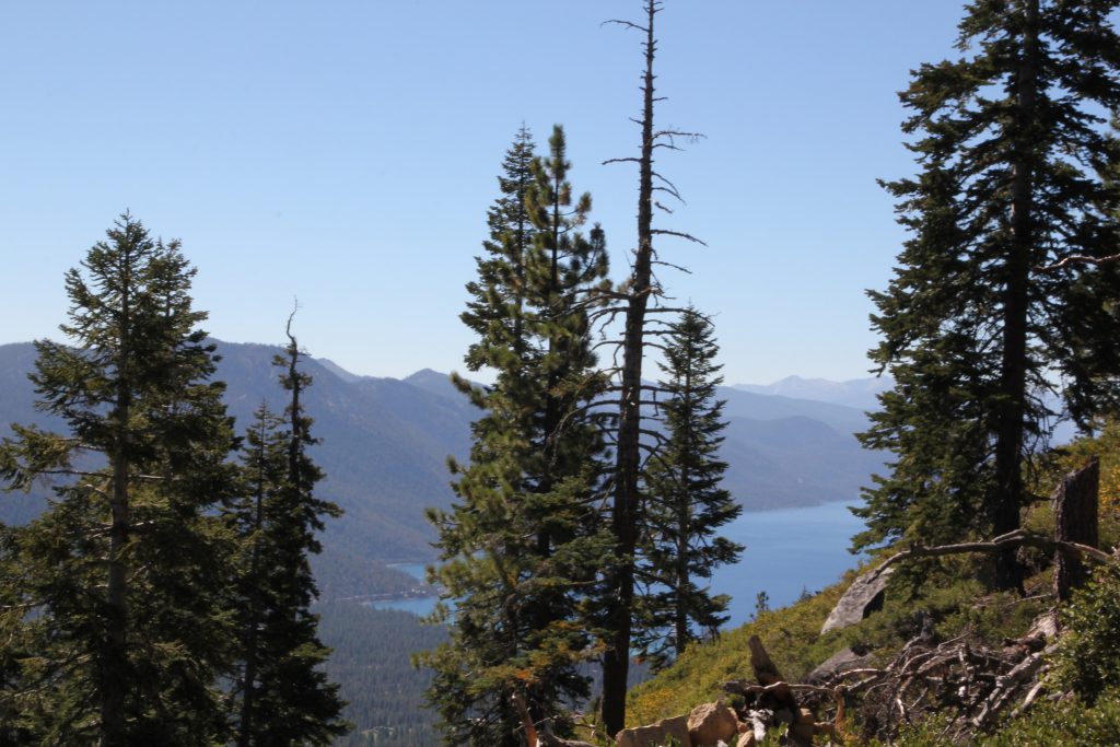
The trail starts with a lung-busting uphill climb right out of the gate, which weeds out the casual tourists pretty quickly. But the effort pays off almost immediately with sweeping views of Lake Tahoe’s impossible blue stretching to the California shore. The trail levels out and winds through fragrant pine forest before depositing you at Eagle Lake, a small alpine gem nestled among dramatic granite peaks that look like they were carved specifically for Instagram.
What makes this hike special isn’t just the lake itself but the fact that you can keep going. More adventurous hikers can continue uphill for even better panoramic views or connect to the Bayview Trail to push deeper into the Desolation Wilderness. I’ve done both extensions, and they’re worth it if you have the time and energy.
The lake itself is perfect for swimming on hot summer days, though the water stays shockingly cold even in August. I’ve jumped in plenty of times and immediately regretted it, then done it again the next visit because the setting is too beautiful to resist.
Trail Stats:
- Distance: 1.8 miles round-trip.
- Difficulty: Easy to moderate (that first hill is no joke).
- Elevation gain: 433 feet.
- Time: 1 hour.
- Trailhead: Emerald Bay Overlook on Highway 89, directly across from the Emerald Bay viewpoint.
- Permits: Desolation Wilderness day-use permit required (free, self-issue at trailhead).
- Best time: June through October; accessible year-round but icy in winter.
- Dog-friendly: Yes, on leash.
Insider tip from 20 years of hiking here: The parking lot at Emerald Bay fills up by 8 AM (or before) on summer weekends. Arrive by 7:30 AM or accept that you’ll be parking along Highway 89 and walking. September and October are absolutely perfect here with way fewer people and beautiful weather. I personally love visiting on weekday mornings in fall when I can have the lake almost to myself.
3. Spooner Lake Trail
Spooner Lake offers one of the easiest loops in the Tahoe Basin with surprisingly nice payoffs considering the minimal effort required. The trail circumnavigates the lake through pine-forested hillsides with almost no elevation gain, making it perfect for families with small kids or anyone wanting a mellow nature walk.
What surprises people is how beautiful it is despite the ease. The lake reflects the surrounding peaks on calm mornings, ducks paddle along the shoreline, and the pine forest feels genuinely peaceful. Fall brings spectacular golden aspen displays that rival those anywhere else in Tahoe.
The downside? It gets absolutely mobbed. Spooner Lake’s accessibility and proximity to Highway 50 make it a tourist magnet. I’ve learned to time my visits carefully or accept that I’ll be sharing the trail with dozens of other people.
Trail Stats:
- Distance: 2.5 miles, loop.
- Difficulty: Easy.
- Elevation gain: 124 feet.
- Time: 1 to 1.5 hours.
- Trailhead: Spooner Lake Day Use Area on Highway 28, just north of the Highway 50 junction.
- Permits: $10 entrance fee per vehicle.
- Best time: September and October for fall colors; accessible year-round.
- Dog-friendly: Yes, on leash.
Insider tip: Arrive before 8 AM if you want any semblance of solitude, especially on summer weekends. The parking lot fills fast and then you’re stuck. September offers the best combination of nice weather and fewer people. Winter visits can be magical with snow dusting the pines, though you’ll want microspikes if it’s icy.
4. Hidden Beach Trail
This is peak local knowledge right here. Hidden Beach used to live up to it’s name. The path was once informal (and parts of it still are).
There’s no marked trailhead, just a few well-worn paths made by locals who’ve been coming here for decades. Lately though, there has been some trail work to help with erosion. However, the final bit of trail, you scramble down the side of Highway 28 on the Nevada side, following cow paths through manzanita and pine until you pop out at a stunning little beach with crystal-clear water and the smooth, round granite boulders that Lake Tahoe is famous for.
The beach itself is small but perfect, tucked into a cove that offers some protection from wind and waves. The water clarity is absurd. You can see 20-30 feet down on calm days. Swimming here feels like you’ve discovered a secret that the tourists jamming Emerald Bay and Sand Harbor will never know about.
It is more rock than beach though, so be prepared.
I spent countless summer afternoons here as a teenager, and it still holds up. The vibe is typically distinctly local, with people bringing coolers, setting up for the day, and treating it like their own private beach. Because functionally, it is.
Trail Stats:
- Distance: Approximately 0.5 miles round-trip.
- Difficulty: Easy scramble.
- Elevation gain: 50 feet.
- Time: 15 minutes.
- Trailhead: No official trailhead; parking along Highway 28 between Memorial Point and Incline Village (0.9 miles south of Lakeshore Boulevard).
- Permits: None.
- Best time: June through September for swimming; accessible year-round.
- Dog-friendly: Yes.
Insider tip: Parking here has gotten more and more limited over the years. Heed no parking signs or take the bus to drop you off. The easiest way to access the beach is to find the main path halfway down and follow it until you can spot some sand. Weekends here are nightmareishly crowded, so come early.
6. Tahoe Meadows Interpretive Loop
In early summer, Tahoe Meadows explodes with wildflowers in a display that rivals anything I’ve seen in the Sierras. The short interpretive loop wanders through these high-elevation meadows absolutely carpeted in lupine, paintbrush, mule’s ears, and a dozen other species I still can’t name despite growing up here.
What makes this hike special beyond the flowers, is the accessibility. My aging parents hike this trail every day. The mostly dirt and gravel trail (unpaved but manageable for most people) makes it suitable for families with small kids. Morning visits bring songbirds and potential wildlife sightings. I’ve seen black bears here on early morning hikes, so stay alert and make noise.
The meadows sit at around 8,700 feet elevation along the Mount Rose Highway, which means they stay cool even when the lake below swelters. The high elevation also means a shorter hiking season. Snow lingers into June and returns by October, limiting the window for flower viewing.
Trail Stats:
- Distance: 1.3 miles, loop.
- Difficulty: Easy.
- Elevation gain: 62 feet.
- Time: 45 minutes to 1 hour.
- Trailhead: Mount Rose Highway (Highway 431), 12 miles north of Incline Village; parking area on right side of road.
- Permits: None.
- Best time: Late June through early August for wildflowers; accessible June through October.
- Dog-friendly: Yes, on leash.
Insider tip: Peak wildflower season is typically the first two weeks of July, though it varies by snowpack. Call the Tahoe Rim Trail Association or check recent trip reports before making the drive specifically for flowers. The parking area can fill on weekends during peak bloom but rarely reaches the insanity levels of trails near Emerald Bay.
3. Cave Rock
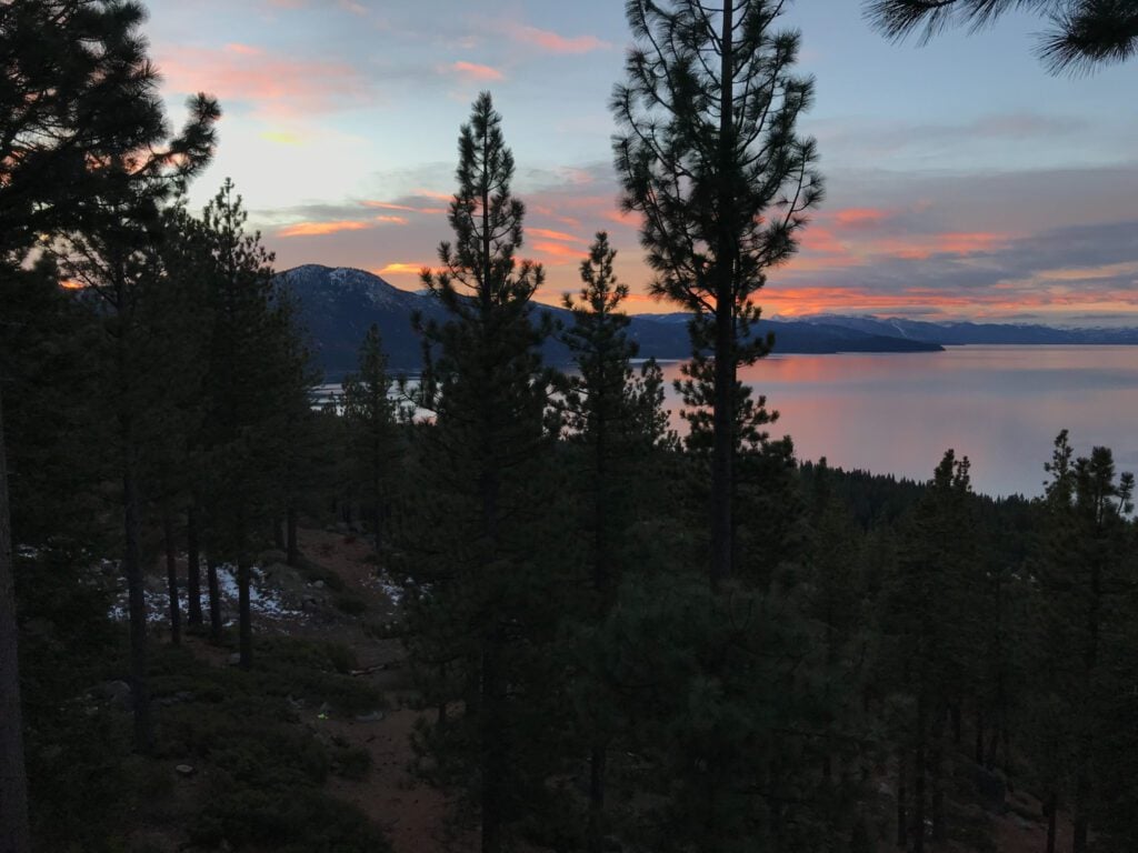
I’ve watched more sunsets from Cave Rock than I can count. When I was a teenager, my brother and I would wander here to watch the sky turn pink over the lake. Twenty years later, it’s still my go-to spot when I visit my family in Tahoe and want a quick dose of that particular Tahoe magic. It’s busy, well-known, but unique and worth it.
Cave Rock isn’t technically a cave but a massive volcanic rock formation jutting into Lake Tahoe’s eastern shore on the Nevada side. The short rock hop to the top rewards you with 180-degree views of the lake’s sapphire waters stretching toward the California shore, offering up some of the best views in Lake Tahoe. From up here, you can watch boats cutting white wakes across the blue, see the sun paint the water in impossible shades of pink and orange at sunset, and feel completely removed from the casinos and traffic of South Lake Tahoe just minutes away.
The actual “cave” formation near the base is fun to explore, created when Highway 50 was blasted through the rock in the 1930s. Most people skip it in favor of the top, which may require using your hands in a few spots but nothing technical or crazy. The exposure might spook some people, but the rock is solid and the holds are obvious.
Trail Stats:
- Distance: 1.6 miles round-trip.
- Difficulty: Easy with one short scrambling section.
- Elevation gain: 137 feet.
- Time: 45 minutes to 1 hour (plus however long you spend watching the view).
- Trailhead: Highway 50 pullout near Cave Rock State Park, just south of Glenbrook.
- Permits: None required (though sometimes state park day-use fee enforced).
- Best time: May through October for dry conditions; accessible year-round but icy in winter.
- Dog-friendly: Yes, though the scrambling section can be tricky for dogs.
Insider tip: This trail gets absolutely slammed during summer weekends, but here’s the secret locals know: go for sunset on a weekday. You’ll have the rock almost to yourself. I personally love visiting in September and October when the summer hordes disappear but the weather stays beautiful. The scramble to the top requires using your hands in a few spots, so think twice about bringing toddlers unless you’re comfortable with some exposure. Winter visits offer incredible solitude but require microspikes for the icy sections.

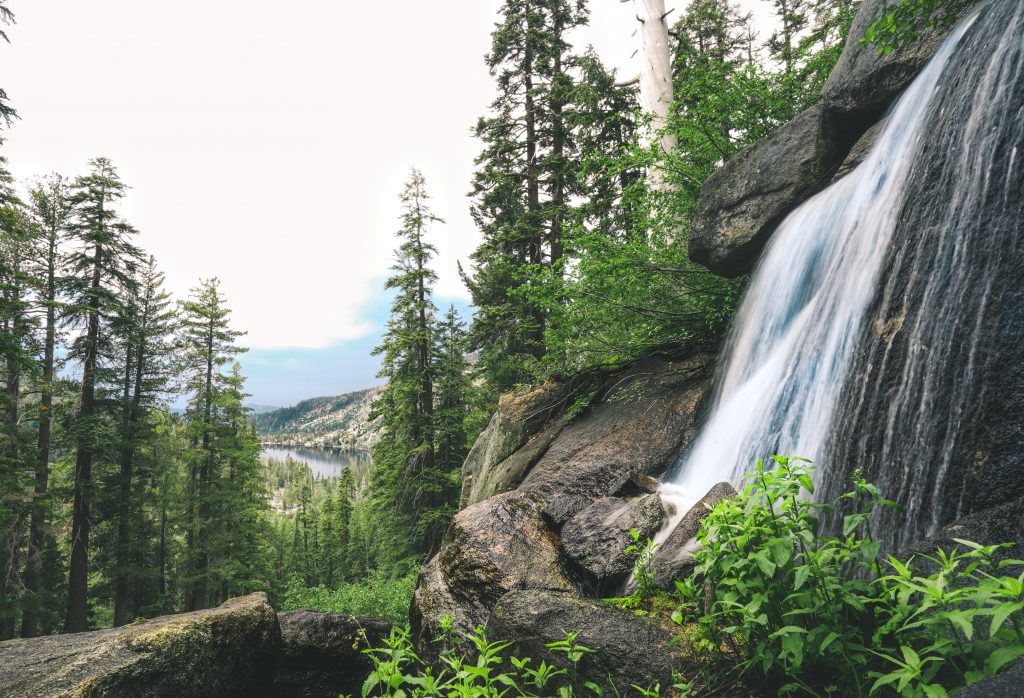
7. Cascade Falls
Waterfalls, two lakes visible from one spot, and minimal effort required. The Cascade Falls Trail is an assault on the senses in the best possible way, making it one of my favorite short hikes in the entire Tahoe Basin.
The mellow trail meanders through pine forest before opening up to reveal Cascade Falls tumbling down granite slabs with Cascade Lake sparkling below and Lake Tahoe’s vast blue expanse stretching beyond. Getting all three features in one view feels almost unfair. I’ve brought visiting friends here dozens of times because it delivers maximum wow factor for minimum suffering.
The waterfall runs strongest in June and early July when snowmelt feeds it. By late summer, it can dwindle to a trickle, though the views remain spectacular.
Trail Stats:
- Distance: 1.4 miles round-trip.
- Difficulty: Easy.
- Elevation gain: 225 feet.
- Time: 45 minutes to 1 hour.
- Trailhead: Bayview Campground on Emerald Bay Road (Highway 89), trail starts at back of campground.
- Permits: None required.
- Best time: June and July for peak waterflow; accessible May through October.
- Dog-friendly: Yes, on leash.
Insider tip: The campground often has a small parking fee even if you’re just hiking (around $10). Most people don’t realize you can park along Emerald Bay Road for free if the campground lot is full, though it’s a slightly longer walk to the trailhead. Weekday mornings see maybe a quarter of the weekend crowds.
Moderate Lake Tahoe Hiking Trails (3-7 Miles)
These hikes require more time and effort but deliver bigger payoffs in terms of views, lakes, and that satisfying feeling of earning your adventure. Perfect for reasonably fit hikers looking to go beyond the easy stuff.
8. Granite Lake and Maggie’s Peaks
The Desolation Wilderness is home to some of the most fantastic hikes in South Lake Tahoe, and Granite Lake to Maggie’s Peaks gives you a bird’s eye view of the dramatic granite-topped mountains this region is famous for. This hike delivers that classic High Sierra combination of alpine lakes, granite slabs, and panoramic views that makes this range so special.
The trail climbs steadily from the Bayview Trailhead (the same start as Eagle Lake but branching off) through pine and fir forest before breaking into more open terrain dotted with massive granite boulders. Granite Lake sits in a rocky basin surrounded by peaks, and if you’re feeling ambitious, the scramble up to Maggie’s Peaks adds incredible 360-degree views of the Desolation Wilderness and Lake Tahoe beyond.
I’ve done this hike probably a dozen times over the years, and it never gets old. The combination of forest, lake, and summit views in one relatively short package makes it a go-to recommendation for visitors who want to experience what makes Tahoe hiking special.
Trail Stats:
- Distance: 7.2 miles round-trip.
- Difficulty: Moderate.
- Elevation gain: 1,761 feet.
- Time: 3.5 to 4 hours.
- Trailhead: Bayview Trailhead near Emerald Bay on Highway 89.
- Permits: Desolation Wilderness day-use permit required (free, self-issue at trailhead).
- Best time: July through October.
- Dog-friendly: Yes, on leash.
Insider tip: The Bayview Trailhead serves both Eagle Lake and this trail, so parking fills early. Same strategy applies: arrive by 7:30 AM on summer weekends or prepare to park along the highway. The Maggie’s Peaks scramble is optional but highly recommended if you’re comfortable with some light Class 2 scrambling. The views from the top are phenomenal.
9. Five Lakes Trail
The Five Lakes Trail perfectly encapsulates what I love about Sierra Nevada hiking: brutal uphill suffering rewarded by multiple alpine lakes scattered through granite bowls like some kind of high-elevation lake buffet.
The trail wastes no time establishing its personality, climbing steeply right from the trailhead. The initial hill is a legitimate butt-kicker that has you questioning your life choices and fitness level. But once you crest that first section, the trail mellows and meanders through a series of five distinct lakes spread across maybe half a mile.
Each lake has its own character. Some are tiny and shallow, perfect for warming up enough to swim. Others are deeper and bluer, reflecting the surrounding peaks. I’ve spent entire afternoons here, having lunch at one lake, moving to another for swimming, finding yet another for a nap in the sun. It’s a choose-your-own-adventure situation once you reach the basin.
Trail Stats:
- Distance: 6.3 miles round-trip.
- Difficulty: Moderate (steep first section).
- Elevation gain: 984 feet.
- Time: 3 to 3.5 hours.
- Trailhead: Alpine Meadows Road, across from Deer Park Drive.
- Permits: None.
- Best time: July through September.
- Dog-friendly: Yes, on leash.
Insider tip: This trail closes in winter for filming and backcountry skiing access. Don’t even try hiking it November through May. Summer weekends can be busy, but far less so than the Emerald Bay area trails. The lakes are phenomenal for swimming in August when the water warms up (relatively speaking). Come prepared for that initial climb because it’s relentless.
10. Echo Lakes Trail
Echo Lakes delivers classic Sierra Mountain beauty: pine forests transitioning to granite slabs, sparkling blue lakes with jagged shorelines, and those characteristic Sierra Nevada granite peaks rising in the background.
The trail hugs both Lower and Upper Echo Lakes, following sections of both the Pacific Crest Trail and the Tahoe Rim Trail. You’re literally walking on two of America’s most famous long-distance trails for a morning. The scenery justifies the hype those trails get, with views that could easily be postcards at every turn.
What makes this hike particularly nice is the relatively mellow elevation profile once you get started. You’re already at a significant elevation (the trailhead sits around 7,400 feet), so the ups and downs feel manageable compared to trails that start at lake level and climb 2,000+ feet.
There are a lot of options to extend (or shorten – see below!) your hike here. We’ve been to this area twice recently and once we even backpacked with our daughter.
Trail Stats:
- Distance: 5.3 miles round-trip.
- Difficulty: Moderate.
- Elevation gain: 511 feet.
- Time: 2.5 to 3 hours.
- Trailhead: Echo Lake, south of South Lake Tahoe via Highway 50.
- Permits: None for day use, required for overnights
- Best time: July through October.
- Dog-friendly: Yes, on leash.
Insider tip: There’s a private water taxi (expensive, around $22 pp one way) that runs across Lower Echo Lake, shaving off some mileage if you want to start deeper in the wilderness. Weekdays are significantly less crowded than weekends. This trail connects to Lake Aloha if you want to extend your adventure into a longer day or an overnight trip.
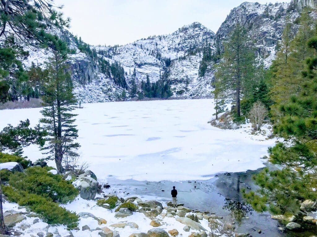
11. Middle Velma Lake
The trek to Middle Velma Lake is longer than the typical Tahoe day hike, but the payoff is worth the extra mileage. This trail takes you deeper into the Desolation Wilderness than most day hikers venture, which means more solitude and more of that remote alpine feeling that makes wilderness backpacking so addictive.
The route passes by two other notable hikes, Eagle Lake and the Emerald Point viewpoint, before pushing on to Middle Velma. You’re covering a lot of real estate here, experiencing multiple ecosystems and elevation zones as you go. The trail climbs through forest, crosses granite slabs, skirts smaller lakes, and finally deposits you at Middle Velma, a beautiful alpine lake that feels genuinely remote despite being accessible as a day hike.
I’ve done this as both a day hike and an overnight backpacking trip. As a day hike, it requires an early start and a solid level of fitness. As an overnight, it’s absolutely perfect, allowing time to explore the area and enjoy the backcountry experience without rush.
Trail Stats:
- Distance: 10 miles round-trip.
- Difficulty: Moderate to difficult (length more than technicality).
- Elevation gain: 2,132 feet.
- Time: 5 to 6 hours.
- Trailhead: Emerald Bay viewpoint parking lot on Highway 89, trail starts on mountainside (not lakeside).
- Permits: Desolation Wilderness day-use permit ($5 for parking in certain spots, self-issue); overnight requires advanced permit.
- Best time: July through September.
- Dog-friendly: Yes, on leash.
Insider tip: Parking lot fills early (by 7:30 AM on summer weekends), but limited free parking is available along Highway 89 if you’re willing to walk a bit. This makes an excellent overnight backpacking trip if you can snag a permit. The solitude at Middle Velma beats anything you’ll find on the shorter, more popular trails.
16. Winnemucca Lake Loop
For incredible high-alpine hiking outside the Tahoe Basin proper, Winnemucca Lake near Kirkwood delivers big Sierra Nevada views. This loop hike passes by three alpine lakes (with a short detour to Woods Lake adding a fourth) and showcases the dramatic granite peaks and wildflower meadows that make the High Sierra so special.
The route is well-marked at all junctions, making navigation straightforward even for those not confident with backcountry route-finding. The lakes are gorgeous, the wildflowers in July are spectacular, and the overall scenery rivals anything in the more famous parts of the Sierras.
I’ve hiked this loop in both summer and early fall, and both seasons offer something different. Summer brings wildflowers and afternoon thunderstorms to watch from a safe distance. Fall delivers golden aspens and more stable weather but colder temperatures.
Trail Stats:
- Distance: 5.8 miles, loop.
- Difficulty: Moderate.
- Elevation gain: 912 feet.
- Time: 3 to 3.5 hours.
- Trailhead: Carson Pass Information Station along Carson Pass Highway, near PCT Meiss Trailhead (about 35 minutes from South Lake Tahoe).
- Permits: None.
- Best time: July through September.
- Dog-friendly: Yes, on leash.
Insider tip: Carson Pass can be windy and exposed to weather. Check forecasts and start early to avoid afternoon thunderstorms in July and August. Pack a picnic lunch at scenic Winnemucca Lake
12. Tamarack Peak
This might be my favorite lesser-known Lake Tahoe hike simply because it’s right out my parents’ back door. Bias acknowledged and accepted. But seriously, Tamarack Peak delivers summit views without requiring the full-day lung-busting torture of the bigger peaks.
The trail follows the Tahoe Rim Trail toward Relay Peak initially, passing a junction with the Tamarack Lake Trail (stay straight), then splitting off about halfway to the summit with the Tahoe Rim heading north and the Tamarack Peak Trail continuing straight. Follow it to the top and you’re rewarded with 360-degree views taking in Lake Tahoe, the Carson Valley, and seemingly endless ridgelines of the Sierra Nevada stretching in every direction.
What I love about this hike is that it feels genuinely remote despite being relatively short. The summit sees a fraction of the traffic that nearby Mount Rose gets, yet the views are nearly as good. I’ve summited Tamarack Peak probably 30 times over the years, and I still find it satisfying every single time.
Trail Stats:
- Distance: 3.1 miles round-trip.
- Difficulty: Moderate.
- Elevation gain: 980 feet, upper trailhead.
- Time: 2 to 3 hours.
- Trailhead: Mount Rose Summit parking area on Mount Rose Highway (Highway 431); large paved lot with restrooms.
- Permits: None.
- Best time: July through October.
- Dog-friendly: Yes, on leash.
Insider tip: The summit is exposed with no shade, so bring sun protection and start early on hot days. September offers perfect weather with far fewer people than July and August.
13. Marlette Lake
Toward the north shore of Lake Tahoe, Marlette Lake offers a fantastic hike along the iconic Tahoe Rim Trail with significantly fewer crowds than the south shore trails. The trail climbs through forest before opening to reveal Marlette Lake, a beautiful alpine gem surrounded by peaks.
The last time I did this hike was when I was pregnant. It made for a great hike thanks to the shade along the trail!
The route follows the Chimney Beach Trail initially, then veers left at the junction to reach the lake. You can loop around the lake in a lollipop fashion or simply out-and-back, depending on time and energy. Either way, the scenery is classic Tahoe with crystal-clear water, pine-studded shores, and granite peaks forming a dramatic backdrop.
What makes this hike particularly nice is the north shore location. While Emerald Bay and the south shore trails see massive crowds, Marlette Lake stays relatively peaceful even on busy summer weekends. The trade-off is a longer drive from most accommodations, but the solitude is worth it.
Trail Stats:
- Distance: 8.6 miles round-trip.
- Difficulty: Moderate.
- Elevation gain: 2,135 feet.
- Time: 4 to 5 hours.
- Trailhead: Highway 28 just south of Sand Harbor, mountainside of the road.
- Permits: None.
- Best time: June through October.
- Dog-friendly: Yes, on leash.
Insider tip: The north shore sees far fewer hikers than south shore trails, so even summer weekends feel manageable here. The climb gains elevation steadily but never feels brutally steep. Bring a water filter as natural sources along the trail can run dry by late summer. This trail connects to the Flume Trail, a famous mountain biking route, so be aware you will likely encounter bikes.
14. Rubicon Trail
The famous Rubicon Trail curls around Emerald Bay, offering multiple hiking options depending on how much time and energy you have. My personal favorite is the horseshoe route around Emerald Bay and back, which gives you miles of incredible shoreline hiking with Lake Tahoe’s impossible blue water lapping at granite boulders the entire way.
The trail stays relatively close to the waterline, offering constant lake views and access. You can stop for swimming breaks, find perfect lunch spots on granite slabs, and feel like you’re on a backcountry adventure despite being close to one of Tahoe’s busiest areas. The contrast between the peaceful trail and the tourist chaos at the Emerald Bay overlook above is stark and satisfying.
I’ve hiked sections of the Rubicon Trail dozens of times. It never gets old. The water is that perfect Tahoe blue, the granite slabs are perfect for lounging, and the whole experience feels like what people imagine when they picture “hiking in Tahoe.”
Trail Stats:
- Distance: 6 miles round-trip (can be extended longer).
- Difficulty: Moderate.
- Elevation gain: Approximately 800 feet.
- Time: 3 to 4 hours.
- Trailhead: Rubicon Trailhead along Emerald Bay Road on the eastern side of the bay.
- Permits: None.
- Best time: June through October.
- Dog-friendly: Yes, on leash.
Insider tip: The Rubicon Trailhead parking area is small and fills fast. This is one of the most popular hikes in Tahoe, but with good reason. Arrive early or be prepared to park elsewhere and walk to the trailhead. The shoreline sections offer incredible swimming opportunities in summer. Bring a swimsuit. This trail can be hiked year-round but requires microspikes in winter when icy.
15. Lola Montez Trail
If you’re looking for a quieter trail with gorgeous lakeside views (not Tahoe) and proximity to the charming town of Truckee, the Lola Montez Trail delivers. This hike starts at the Hole in the Ground Trail, climbs up and over a hill, then descends to Lower Lola Montez Lake tucked into a pine-studded basin.
The trail winds through beautiful Sierra Nevada forest with the smell of pine and the sound of wind in the trees creating that mountain atmosphere I love. At the lake junction, veer left for a quick 0.1-mile walk to the lakeshore where swimming is allowed and encouraged. On hot summer days, this is an absolutely perfect spot to escape the heat and crowds that plague the main Tahoe Basin.
What makes this trail special is the combination of accessibility from Truckee (a fantastic mountain town worth exploring in its own right) and the relative obscurity. Most visitors focus on the trails closer to Lake Tahoe proper, leaving spots like Lola Montez blissfully quiet.
Trail Stats:
- Distance: 6.3 miles round-trip.
- Difficulty: Moderate.
- Elevation gain: 984 feet.
- Time: 3 to 3.5 hours.
- Trailhead: I-80 west of Truckee, exit at Soda Springs, take first right to trailhead.
- Permits: None.
- Best time: July through September.
- Dog-friendly: Yes, on leash.
Insider tip: This makes an excellent addition to a day trip to Truckee. Hike in the morning, then spend the afternoon exploring Truckee’s downtown. The lake is perfect for swimming and relaxing. Pack a lunch and make an afternoon of it.
Challenging Lake Tahoe Hikes (7+ Miles & Significant Elevation)
These are the hikes that make you earn it. Big elevation gain, serious mileage, and views that justify every lung-busting step. Perfect for experienced hikers looking for a proper mountain adventure.
17. Mount Tallac Hiking Trail
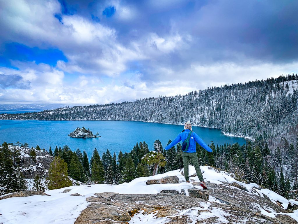
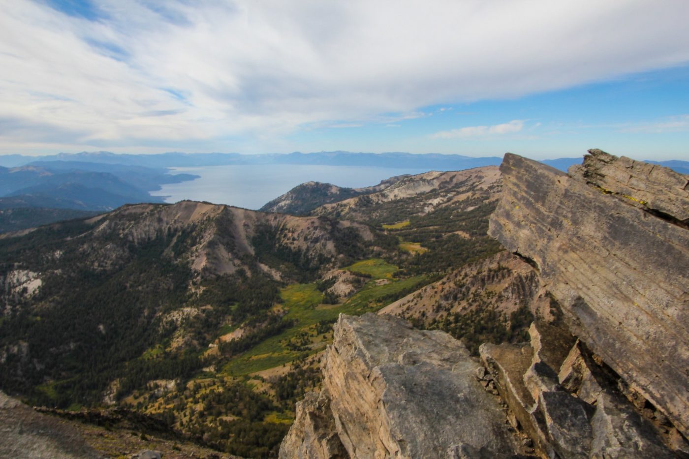
Mount Tallac is THE iconic Tahoe summit hike. The mountain dominates the southern skyline, visible from seemingly every angle around the lake, and the views from the top are absolutely unreal. On a clear day you can see Lake Tahoe spread out below you like a massive blue jewel, Desolation Wilderness stretching to the west, and the Carson Valley to the east.
This is not an easy hike. The trail gains over 3,000 feet in roughly five miles, and the final push to the summit involves scrambling over talus and boulder fields that will test your legs and lungs. I’ve summited Tallac probably a dozen times over the years, and it kicks my butt every single time. But standing on top makes everything worth it.
The trail starts mellow enough through forest, then climbs more steeply as it approaches treeline. Once you’re above the trees, the real work begins. The final mile to the summit is a relentless uphill grind over loose rock and boulders. Your quads will burn, your lungs will protest the thin air at 9,735 feet, and you’ll question why you thought this was a good idea. Then you’ll reach the summit, see the view, and immediately understand.
Trail Stats:
- Distance: 9.7 miles round-trip.
- Difficulty: Challenging.
- Elevation gain: 3,412 feet.
- Time: 5 to 7 hours.
- Trailhead: Mount Tallac Trailhead off Highway 89 near Baldwin Beach, well-signed parking area.
- Permits: Desolation Wilderness day-use permit required (free, self-issue at trailhead). Overnight permits required.
- Best time: July through September; snow can linger into early July on the upper mountain.
- Dog-friendly: Yes, though the boulder scrambling can be tough for dogs.
Insider tip: Start early. I’m talking 5:30 or 6 AM early, especially in July and August simply to beat the heat. The summit is completely exposed with nowhere to hide from the sun or even an (uncommon) thunderstorm. The parking lot fills by 7 AM on summer weekends. Bring more water than you think you need because there’s limited reliable water sources after the first mile or so. The summit can be 20-30 degrees colder than the trailhead with serious wind, so pack layers even if it’s warm when you start.
18. Lake Aloha Trail
Lake Aloha is one of the most stunning alpine lakes in the entire Desolation Wilderness, and that’s saying something in an area absolutely packed with gorgeous lakes. The “lake” is actually a damned reservoir, but nature has reclaimed it so thoroughly that it looks and feels wild. Hundreds of tiny granite islands dot the impossibly blue water, creating a landscape that you can stare at for hours.
Getting there requires commitment. The trail is long, the elevation gain is significant, and you’re hiking deep into the wilderness. But the scenery along the way is spectacular, passing multiple other alpine lakes and climbing through classic High Sierra granite terrain. Once you reach Lake Aloha, the view is absolutely worth every step.
I’ve done this as both a day hike and an overnight backpacking trip. As a day hike, it’s a long push that requires good fitness and an early start. As an overnight, it’s perfection, allowing time to explore the islands, swim in the shockingly clear water, and watch the sunset paint the granite pink and gold.
The only thing I disliked are the backpacking crowds, it gets busy here with overnight traffic. Head around to the left when you reach the the lake to escape the PCT traffic.
Trail Stats:
- Distance: 11.2 miles round-trip.
- Difficulty: Challenging (due to distance and elevation).
- Elevation gain: 2,027 feet.
- Time: 6 to 7 hours.
- Trailhead: Echo Lake Trailhead south of South Lake Tahoe via Highway 50. Parking lot can fill very early on the weekends in summer.
- Permits: Desolation Wilderness day-use permit (free, self-issue); overnight requires advanced reservation.
- Best time: July through September.
- Dog-friendly: Yes, on leash.
Insider tip: The water taxi across Lower Echo Lake can shave off about 2.5 miles each way, making this a much more manageable day hike. It costs around $22 per person (yikes!) and runs regularly in summer. Even with the taxi, this is still a long day. Pack plenty of food and water. The lake is phenomenal for swimming in late summer when the water warms up slightly. This makes an incredible overnight backpacking trip if you can secure a permit. They are competitive, so snag on as soon as they open.

19. Summit Mt Rose: Mt Rose Wilderness, Nevada
Mount Rose stands as the highest peak in the Tahoe Basin at 10,778 feet, offering the kind of expansive summit views that make peak-baggers lose their minds. On a clear day you can see Lake Tahoe, Reno, the Carson Valley, and what feels like half of Nevada stretching to the horizon.
The trail is long and the elevation gain is brutal, but the payoff is worth it. You climb through multiple ecological zones, starting in pine forest, transitioning through meadows absolutely packed with wildflowers in July, then pushing above treeline into that barren alpine environment where only the toughest plants survive. The final push to the summit is steep and exposed, with loose rock that requires careful footing.
I’ve summited Mount Rose maybe 15 times over the years, and it remains one of my favorite big peaks in the Tahoe area. The combination of accessibility (you can do it as a day hike) and dramatic views makes it a go-to recommendation for visitors who want a proper mountain experience.
Trail Stats:
- Distance: 10.6 miles round-trip.
- Difficulty: Challenging.
- Elevation gain: 2,300 feet.
- Time: 5 to 7 hours.
- Trailhead: Mount Rose Summit parking area on Mount Rose Highway (Highway 431); same trailhead as Tamarack Peak but different trail.
- Permits: None.
- Best time: July through September; snow lingers well into June on the upper mountain.
- Dog-friendly: Yes, though the altitude and distance can be tough for dogs.
Insider tip: The parking lot fills by 8 AM on summer weekends. Arrive early or be prepared to park along the highway. The summit is extremely exposed to weather with no shelter. Start by 6 or 7 AM to give yourself time to be off the summit by early afternoon to avoid the heat (the trail doesn’t have much shade) or incoming weather. The altitude affects people differently, so don’t be surprised if you feel the thin air. Pack layers because the summit can be windy and cold even on warm days.
20. Freel Peak Trail
Freel Peak claims the title of highest peak in the Tahoe Basin at 10,881 feet, edging out Mount Rose by just over 100 feet. The views from the summit are absolutely spectacular, offering 360-degree panoramas that include Lake Tahoe, the Carson Valley, Desolation Wilderness, and seemingly endless ridgelines stretching in every direction.
The trail is long and challenging, gaining significant elevation through multiple switchbacks and exposed sections. You’ll climb through forest initially, then break above treeline for the final push to the summit across rocky, exposed terrain. The last section requires some light scrambling over boulders and talus, nothing technical but enough to make you pay attention.
What makes Freel Peak special beyond the views is the sense of accomplishment. This is a proper mountain climb that requires fitness, preparation, and commitment. Standing on the highest point in the Tahoe Basin feels legitimately earned.
Trail Stats:
- Distance: 11.4 miles round-trip.
- Difficulty: Challenging.
- Elevation gain: 3,632 feet.
- Time: 6 to 8 hours.
- Trailhead: Tahoe Rim Trail at Armstrong Pass, accessed via Fountain Place Road south of South Lake Tahoe.
- Permits: None.
- Best time: July through September.
- Dog-friendly: Yes, though the altitude and scrambling can be challenging for dogs.
Insider tip: This trail sees significantly fewer hikers than Mount Rose or Mount Tallac despite offering equally impressive views. The trailhead is a bit harder to find and the trail is longer, which naturally filters out casual hikers. Start early to avoid exposure to weather. The summit is completely exposed with no shelter. Pack more water than you think you’ll need because reliable water sources are limited after the first couple miles.
21. Tahoe Rim Trail: Various Entry Points Around the Lake
The Tahoe Rim Trail is a 165-mile loop circumnavigating the entire Lake Tahoe Basin, offering endless options for section hikes ranging from easy day trips to multi-day backpacking adventures. I’ve hiked probably 50 miles of the TRT in various sections over the years, and it consistently delivers that classic Tahoe combination of lake views, granite peaks, and pine-scented forest.
For day hikers, popular sections include the stretch from Tahoe Meadows to Relay Peak (offering incredible views with manageable mileage) or the section from Brockway Summit toward Watson Lake. Each section has its own character and difficulty level, allowing you to choose your adventure based on time, fitness, and goals.
What makes the TRT special is the variety. You can hike sections through dense forest, across exposed ridgelines with dramatic views, past alpine lakes, and through wildflower meadows, all on the same trail system. It’s like a choose-your-own-adventure hiking experience.
Trail Stats:
- Distance: 165 miles total; section hikes vary from 3 to 20+ miles.
- Difficulty: Varies by section from easy to challenging.
- Elevation gain: Varies by section.
- Time: Varies by section. Most people take about 2 weeks to thru-hike it
- Trailhead: Multiple access points around the lake; Tahoe Meadows, Brockway Summit, and Echo Lake are popular starting points.
- Permits: None for day hiking; overnight requires wilderness permits depending on location.
- Best time: June through October; higher sections may have snow into July.
- Dog-friendly: Yes, on leash, but keep in mind, water is scarce on some sections of trail.
Insider tip: The Tahoe Rim Trail Association website has detailed maps and descriptions of each section, which is invaluable for planning. Popular sections near Tahoe Meadows, Desolation Wilderness, and Mount Rose see significant traffic, while more remote sections toward the south and west shores stay quieter. Consider hiking less popular sections for more solitude with equally good scenery.
22. 4th of July Lake via the Winnemucca Lake Loop
This hike combines the Winnemucca Lake Loop with an extension to 4th of July Lake, creating a longer adventure through spectacular alpine terrain. The route takes you past multiple lakes, through wildflower meadows that explode with color in July, and up to dramatic viewpoints showcasing the raw beauty of the High Sierra.
4th of July Lake sits in a rocky basin beneath towering peaks, offering a more remote and wild feeling than the more accessible Winnemucca Lake. The extension adds mileage and elevation but rewards you with a destination that sees far fewer hikers despite being equally beautiful.
I love this hike for the variety. You get meadows, lakes, granite peaks, wildflowers, and that sense of being deep in the mountains without requiring a multi-day backpacking trip. It’s a full day adventure that delivers maximum Sierra Nevada experience.
Trail Stats:
- Distance: 9.6 miles round-trip.
- Difficulty: Challenging (due to distance and elevation).
- Elevation gain: 1,900 feet.
- Time: 5 to 6 hours.
- Trailhead: Carson Pass Information Station along Carson Pass Highway.
- Permits: None.
- Best time: July through September.
- Dog-friendly: Yes, on leash.
Insider tip: This trail is exposed to weather, so check forecasts and start early if needed. The wildflowers in early to mid-July are absolutely spectacular, making it worth timing your visit for peak bloom. 4th of July Lake is less crowded than Winnemucca, so if you’re looking for solitude, push on to the farther lake.
Best Lake Tahoe Hikes by Location
Lake Tahoe is big. Really big. Driving around the entire lake takes about three hours without stops, and the hiking opportunities are spread across all four shores. Here’s how to choose based on where you’re staying or what you want to experience.
North Shore Highlights
The north shore offers a different vibe than the busier south shore, with slightly fewer crowds and a mix of Nevada and California trails. My parents live on the north shore, so I’ve explored this area more thoroughly than any other part of Tahoe.
Best north shore hikes:
- Tamarack Peak (3.1 miles, moderate)
- Marlette Lake (8.6 miles, moderate)
- Mount Rose (10.6 miles, challenging)
- Tahoe Meadows Interpretive Loop (1.3 miles, easy)
- Hidden Beach (0.5 miles, easy)
The north shore tends to be quieter than the south shore, particularly on the Nevada side. Trails here see fewer hikers even on busy summer weekends, making this area perfect for those seeking more solitude. The Mount Rose Highway provides access to some of the best high-elevation hiking in the basin.
South Shore Highlights
The south shore, particularly the Emerald Bay area, hosts some of Tahoe’s most iconic and popular hikes. This is where you’ll find the classic Tahoe scenery that shows up in everyone’s Instagram feed, and also where you’ll encounter the biggest crowds.
Best south shore hikes:
- Eagle Lake (1.8 miles, easy to moderate)
- Cascade Falls (1.4 miles, easy)
- Mount Tallac (9.7 miles, challenging)
- Emerald Point (4.4 miles, easy to moderate)
- Echo Lake area (5.5 miles, moderate)
The south shore delivers that postcard-perfect Tahoe experience with dramatic lake views, granite peaks, and alpine lakes. The trade-off is dealing with crowds, particularly around Emerald Bay. Early morning starts are essential here during summer.
West Shore Highlights
The west shore offers a nice middle ground between the busy south shore and the quieter north shore, with excellent hiking opportunities and slightly fewer crowds than Emerald Bay.
Best west shore hikes:
- Rubicon Trail (6 miles, moderate)
- Five Lakes Trail (6.3 miles, moderate)
The west shore’s shoreline hiking along the Rubicon Trail is some of the best in the entire basin, offering miles of lakeside wandering with crystal-clear water and granite boulders. Five Lakes delivers classic alpine lake scenery with less crowding than similar hikes on the south shore.
East Shore (Nevada Side)
The Nevada side of Tahoe sees fewer hikers than the California side, partly because the trails are less well-known and partly because the scenery, while beautiful, doesn’t quite match the dramatic granite peaks and alpine lakes of the west and south shores.
Best east shore hikes:
- Cave Rock (1.6 miles, easy)
- Spooner Lake (2.5 miles, easy)
- Mount Rose (10.6 miles, challenging, accessed from north shore)
The east shore is perfect for those wanting easier hikes with fewer crowds. Cave Rock and Spooner Lake both offer beautiful Tahoe experiences without the suffering or the tourist masses.
When to in Hike in Lake Tahoe?
Lake Tahoe’s hiking season varies dramatically by elevation and snowpack, creating a complex puzzle of when trails become accessible and when they’re at their best. After two decades here, I’ve learned that timing can make or break a Tahoe hiking experience.
By Season
Summer (June through August)
Summer is peak season for Tahoe hiking, and for good reason. The weather is generally stable and warm, all trails are accessible, wildflowers bloom in July, and the days are long enough for ambitious hikes. But summer also brings massive crowds, particularly at popular trailheads around Emerald Bay.
Higher elevation trails may not be fully snow-free until late June or even early July depending on the winter’s snowpack. I’ve hiked Mount Rose in mid-June and encountered significant snow on the upper mountain requiring microspikes and route-finding skills. Check recent trip reports before attempting high-elevation hikes in June.
Mosquitos are also an issue, particularly for overnight hikes. June through mid/late July are the worst season for bugs. They are found in swarms in low-lying areas and around alpine lakes. We occasionally backpack with mosquito head nets when we visit this time of year.
Fall (September through October)
Fall is my absolute favorite time to hike Tahoe. The crowds vanish almost overnight after Labor Day, the weather stays beautiful well into October, and the aspens turn golden against the deep blue sky. The only downside is shorter days, but the trade-off is worth it for the solitude and stable weather.
September offers essentially perfect hiking conditions with warm days, cool nights, stable weather, and dramatically fewer people than summer. I try to time at least one Tahoe visit for September every year because it’s that good.
October brings cooler temperatures and the risk of early storms, but it’s still generally hikeable. The aspens peak in early to mid-October, creating spectacular fall color displays along trails like Spooner Lake. Some higher elevation trails may see snow by late October, but lower elevation hikes remain accessible.
Winter (November through April)
Winter transforms Tahoe into a snow-covered wonderland, closing most trails to hikers but opening opportunities for snowshoeing and cross-country skiing. Only the lowest elevation trails like Cave Rock and Spooner Lake remain accessible to hikers, and even those require microspikes for icy sections.
I’ve hiked Cave Rock in December, and it’s absolutely magical with snow dusting the rocks and the lake looking impossibly blue against the white landscape. Just come prepared with proper winter traction devices and layers for cold temperatures.
Spring (May through early June)
Spring in Tahoe is muddy season, that awkward transition period when lower elevation trails become accessible but higher trails remain buried under snow. Waterfalls run at their strongest in May and June, fed by snowmelt, making hikes like Cascade Falls particularly spectacular.
The challenge with spring hiking is predicting conditions. Some years the trails are mostly clear by late May. Other years, significant snow lingers well into early July. Check recent trip reports and be prepared for muddy, sloppy conditions on lower trails and potentially impassable snow on higher routes.
By Month
June: High elevation trails often still have snow. Waterfalls at peak flow. Wildflowers beginning at lower elevations. Crowds building but not yet peak. Mosquitos come out.
July: All trails generally accessible. Peak wildflower month, especially at higher elevations like Tahoe Meadows. Mosquitos are at peak around alpin lakes. Crowds at maximum levels. My strategy is to avoid July unless I’m specifically chasing wildflowers.
August: Similar to July with slightly more stable weather and slightly less spectacular wildflowers. Still crowded. Still beautiful. Still requires early starts to avoid both crowds. Bug pressure is significantly less.
September: Perfect weather. Crowds gone. Stable conditions. Days still long enough for big hikes. This is THE month for Tahoe hiking if you can swing it.
October: Beautiful fall colors. Cool mornings, warm afternoons. Possibility of early-season storms. Shorter days. Still excellent hiking but requires more weather awareness than September.
November through April: Winter conditions. Most trails are inaccessible without snowshoes. Beautiful but limited options for traditional hiking.
Insider Tips for Avoiding the Crowds
After 20 years of hiking Tahoe trails, I’ve developed strategies for avoiding the tourist masses that descend on popular trailheads every summer weekend. Here’s what actually works.
Timing Strategies
The single most effective crowd-avoiding tactic is arriving early. I’m talking genuinely early, like 6 or 6:30 AM, not 9 AM thinking you’re beating the rush. Parking lots at popular trailheads like Eagle Lake, Mount Tallac, and Emerald Point fill completely by 7:30 AM on summer weekends. By 10 AM, you’re looking at roadside parking half a mile away and a total cluster at parking areas.
Early starts also help you avoid crowds and also give you the best light for photography. The morning light on Lake Tahoe is absolutely gorgeous, painting the water in shades of blue you don’t see at midday.
Weekdays are infinitely better than weekends. If you have any flexibility in your schedule, hiking Monday through Thursday will cut the crowds by 75% compared to Saturday and Sunday. I work remotely, so I can hike on Tuesday mornings when the trails are nearly empty.
September and October offer summer weather without summer crowds. This cannot be overstated. The difference between hiking Eagle Lake in July versus September is night and day. Same beautiful scenery, same great weather, maybe 20% of the people.
Location Strategies
The north shore and Nevada side trails see dramatically fewer hikers than the south shore and Emerald Bay area. Tamarack Peak, Marlette Lake, and Mount Rose all offer scenery comparable to the more famous south shore hikes but with far fewer people clogging the trails and parking lots.
Trails outside the Desolation Wilderness also tend to be quieter. Five Lakes, Lola Montez, and the Winnemucca Lake Loop all deliver spectacular Sierra Nevada scenery but avoid the name recognition that draws crowds to Desolation Wilderness trails.
Longer hikes naturally filter out casual hikers. If you’re willing to put in 8 or 10 miles, you’ll find significantly more solitude than on the 2-mile hikes. Middle Velma Lake, Lake Aloha, and Freel Peak all reward the extra effort with fewer people.
Trail-Specific Crowd Hacks
Eagle Lake: Arrive by 7 AM or wait until after 4 PM. The parking lot at Emerald Bay fills insanely fast. September weekday mornings offer the best experience.
Mount Tallac: Start by 6 AM. Seriously. The parking lot is full by 7 AM on weekends. You want to be descending when everyone else is ascending.
Cave Rock: Sunset visits on weekdays are magical and sometimes empty. Summer weekend afternoons are chaos.
Rubicon Trail: The first mile sees heavy traffic, but pushing past the initial stretch thins the crowds significantly.
Cascade Falls: This is always crowded in summer. Visit in May or June for peak waterfall flow with fewer people, or accept the crowds and enjoy it anyway because it’s beautiful.
Hidden Beach: Weekday mornings. Weekend afternoons turn into a crowded mess with extremely limited parking. Still worth visiting but know what you’re getting into.
The bottom line is that avoiding crowds in Tahoe requires either flexibility (early starts, weekday visits, shoulder season timing) or a willingness to hike longer trails farther from the main tourist areas. There’s no magic trick that lets you sleep in, show up at Eagle Lake on a Saturday in July, and find solitude. But with smart planning, you can find incredibly beautiful hikes without fighting the masses.
Tips and Tricks for Enjoying the Best Lake Tahoe Hiking Trails
Hiking in Lake Tahoe is a simple, budget-friendly activity that everyone can enjoy. With so many beautiful trails, there’s a hike suitable for all abilities. However, keep these tips in mind when hiking in Lake Tahoe.
Start early! The crowds here are real, Lake Tahoe is not an unknown destination. Get some solitude on the trail by starting your hike as early as possible.
Check the weather. Thunderstorms can be dangerous if you’re above treeline. Many trails have limited shade and the sun can feel exceptionally hot in summer. Wildfires are also common, so keep an eye on the news.
Pack plenty of water. The mountain air is mega-dry, which means you’ll need to drink more.
Bring sun protection. The sun is brutal in Lake Tahoe, I get sunburnt often here (even though I live at a high elevation) so be sure to come prepared with a hat, sunscreen, and sunglasses.
Practice Leave No Trace. With so many people getting out and hiking, trails are becoming litered with trash and dog poop. Clean up after yourself and leave it better than you found it.
What to Pack Lake Tahoe Hikes?
Before you head off on any hike, be sure to check the local weather conditions where you are hiking (I love weather.gov for the most accurate Tahoe weather information). Secondly, be sure you have the ten essentials packed and ready to go.
Here’s a quick packing list to prep for your hiking adventures in Tahoe:
What to wear:
- Sunshirt
- Noncotton socks
- Hiking footwear with good traction that you are comfortable wearing all day.
- Non-cotton shorts for hiking
- Or non-cotton, pants for hiking. Convertible pants are great too!
- Non-cotton shirt for hiking
What to pack:
- Hiking day pack. I love the REI Flash 22 for an affordable day pack.
- Water and snacks for the car – it’s always nice to have a treat at the end!
- Sunscreen, sunhat, sunglasses
- First Aid Kit
- Electrolyte powder – optional but nice to have!
- A water bladder capable of carrying at least 2 liters of water.
- Camera
- Camera clip to strap to your back
- Beanie
- Glove liners
- Fleece layer
- Puffy layer
- Hiking poles (optional)
- A toilet kit: shovel, WAG Bag (if you plan to travel above treeline), hand sanitizer, TP/baby wipes, a small plastic baggy to pack out TP and sanitary items
- Pee funnel – optional
- Pee rag – optional.
- Headlamp
- GPS navigation
- emergency communication device
- Wind/rain layer
- Pocket knife
New to hiking? Here are some articles to get you started:
Frequently Asked Questions
What are the best hikes in Lake Tahoe?
The best Lake Tahoe hikes depend on your fitness level and goals, but my top recommendations are Eagle Lake for beginners (1.8 miles with stunning alpine lake views), Rubicon Trail for moderate hikers (6 miles of incredible shoreline), and Mount Tallac for experienced hikers (9.7 miles to the most iconic summit in the basin). Each offers that quintessential Tahoe combination of granite peaks, crystal-blue water, and pine-scented mountain air.
What is the most beautiful hike in Lake Tahoe?
This is entirely subjective, but I’d argue the Rubicon Trail around Emerald Bay delivers the most consistently beautiful scenery for the least effort. Miles of shoreline hiking with that impossible Tahoe blue water, granite boulders perfect for lounging, and constant lake views make it hard to beat. For pure dramatic impact, though, the view from the top of Mount Tallac with Lake Tahoe spread out 3,000 feet below is absolutely unreal.
Can you hike around all of Lake Tahoe?
Yes, the Tahoe Rim Trail is a 165-mile loop that circumnavigates the entire Lake Tahoe Basin, offering options for section hikes or thru-hiking the complete loop. Most people hike it in sections as day hikes or short backpacking trips rather than attempting the full loop at once. The trail showcases incredible variety, from dense forest to exposed ridgelines to wildflower meadows, all with regular views of the lake.
What is the best month to hike Lake Tahoe?
September is the absolute best month for Tahoe hiking. The weather stays beautiful with warm days and cool nights, the summer crowds vanish after Labor Day, trails are in great condition, and days are still long enough for big hikes. July offers the best wildflowers but also the biggest crowds. October brings spectacular fall colors but shorter days and cooler temperatures.
Are Lake Tahoe hikes crowded?
Popular south shore hikes around Emerald Bay see massive crowds during summer weekends, with parking lots filling by 8 AM and trails feeling more like hiking highways than wilderness experiences. However, north shore trails, Nevada-side routes, and longer hikes see dramatically fewer people even during peak season. Timing also matters tremendously. Weekday visits, early morning starts, and shoulder season hiking (May-June or September-October) all help avoid crowds.
Do I need permits for Lake Tahoe hikes?
Desolation Wilderness trails require free day-use permits that you self-issue at trailheads. This includes popular hikes like Eagle Lake, Mount Tallac, Granite Lake, and Lake Aloha. Most other Tahoe trails require no permits for day hiking. Overnight backpacking in Desolation Wilderness requires advanced permit reservations that can be competitive to obtain during summer. Some trailheads charge parking fees, typically around $10 per vehicle.
Are dogs allowed on Lake Tahoe trails?
Yes, dogs are allowed on most Lake Tahoe trails, but must be leashed. Some trails are more dog-friendly than others based on terrain. Easy trails like Spooner Lake and Cascade Falls work great for dogs. Technical scrambles like Cave Rock or long high-elevation hikes like Mount Rose can be challenging for dogs due to exposure or altitude. Always bring water for your dog and clean up after them. DO NOT leave dog poop bags on the trail, even if you plan on picking them up, other people still have to walk past your trash.
What should I wear hiking in Lake Tahoe?
Layers are essential for Tahoe hiking due to changing weather and temperatures at different elevations. I recommend moisture-wicking base layers, an insulating mid-layer like fleece, and a waterproof shell for wind and rain. Sturdy hiking shoes or boots with good traction are crucial for rocky trails. Don’t forget sun protection including a hat, sunglasses, and sunscreen with SPF 50 or higher. The high-altitude sun is intense and unforgiving.
Is Lake Tahoe good for beginner hikers?
Yes, Lake Tahoe offers excellent beginner-friendly hikes including Cascade Falls (1.4 miles), Spooner Lake (2.5 miles), Cave Rock (1.6 miles), and Hidden Beach (0.5 miles). These shorter trails deliver beautiful Tahoe scenery without requiring serious fitness or technical skills. The key is choosing appropriate trails and starting early to avoid crowds and afternoon heat.
How do I avoid crowds on Lake Tahoe trails?
Arrive at popular trailheads by 7 AM on summer weekends or accept you’ll be dealing with crowds and parking nightmares. Weekday visits see 75% fewer people than weekends. September and October offer summer weather without summer crowds. Choose north shore and Nevada-side trails over south shore routes, and opt for longer hikes that naturally filter out casual tourists. Early morning starts, shoulder season timing, and strategic trail selection make all the difference.
I’ve spent over 20 years exploring Lake Tahoe’s trails, watching my relationship with these mountains evolve from being a 13 year old before cell phones were a thing to backpacking with my preschooler. These trails shaped who I am as an outdoor person, teaching me that getting outside isn’t about checking boxes or collecting peaks but about finding those moments of connection with wild places.
The best Tahoe hike isn’t necessarily the longest or the hardest or the most Instagram-worthy. It’s the one where you feel present, where the view makes you stop and actually look, where you remember why you love being in the mountains in the first place.
Catch me on YouTube!
Want more secret backpacking trips? Ultralight hacks that every hiker can adapt? Experience the top outdoor destinations in the world without the crowds? If you want to get insider knowledge of all things outdoors, then you’ll wanna subscribe to my YouTube channel, where I am giving away my DECADES of knowledge as an outdoor professional. I’ll see ya there!
Get the Best Local Travel Advice for Lake Tahoe with These Resources:
- Incredible Places to Camp in Lake Tahoe
- Tahoe’s Top Winter Attractions
- North Lake Tahoe vs. South Lake Tahoe