Last Updated on October 1, 2025 by foxintheforest
Hiking in Grand Junction and nearby Fruita will certainly surprise you. Enormous red rock cliffs surface out of the valley floor to create stunning canyons dotted with lush green pines and juniper. The colorful scene is something only nature could produce.
And the best part? most of the hiking trails near Grand Junction are less than an hour from town.
Local’s don’t say “west slope, best slope” without reason – Grand Junction truly is a hidden gem on the Colorado hiking scene. Most people skip Fruita and Junction in favor of more popular spots like Moab or the San Juans, but that would be a mistake.
Hiking trails in Grand Junction offer up plenty of challenges, endless opportunities for unique scenery, and are even studded with ancient history – yeah as far back as the dinosaurs.
As a Colorado local for over 13 years, I know how to enjoy the best hiking trails in Grand Junction like a local, not a tourist. I am in the area multiple times a year, every year, for a quick escape into gorgeous red rock country.
About this Guide to Hiking Grand Junction
Inside this expert guide to hiking in Grand Junction you’ll get info on:
- The best time to go hiking in Grand Junction
- Visiting the Colorado National Monument in nearby Fruita
- Top hikes in Grand Junction for beginners, intermediates, and expert hikers
- Quick tips for hiking in the desert
- Tips about where to stay and where to eat
When is the Best Time to Go Hiking in Grand Junction?
You can certainly go hiking in Grand Junction at any time during the year, but fall through spring are the best seasons. Temperatures soar during the sweltering summer months and in a scrubby desert with no shade, it’s just not a pleasant season to hike.
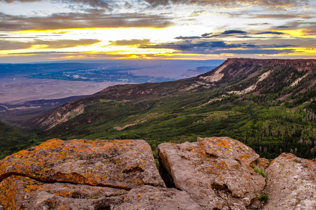
Local Tip: If you’re visiting Grand Junction in the summer, consider hiking at the Grand Mesa National Forest where temperatures are cooler and shade is more abundant.
Spring and fall bring plenty of sunshine and milder temperatures. Spring tends to be a bit windier and late-season snow is still a possibility. While fall is dry and slightly warmer.
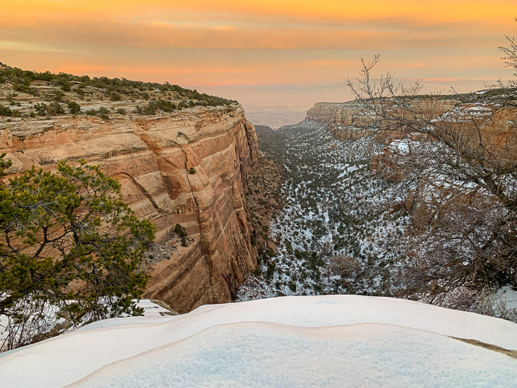
Winter is an excellent season to take a hike in Grand Junction too. The red canyons dusted in snow is a real treat and it’s prime season for locals to get out and explore. You’ll have fewer crowds too!
A Note About the Colorado National Monument
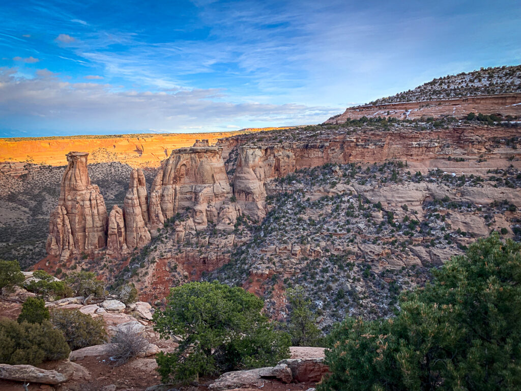
A lot of the best hiking in Grand Junction can be found in the Colorado National Monument. As one of the most scenic places in Colorado, it’s no wonder that so many Grand Junction hikes can be found here.
Located about 10 minutes outside of nearby Fruita, Colorado (about 15 minutes from Grand Junction), this unassuming national landmark is a treasure trove of red rock hiking.
Dogs are not allowed to use the trails inside the Colorado National Monument, so leave Fido at home.
It’s also good to know that the National Parks Service operates the Colorado National Monument. This means that your America the Beautiful Annual Parks Pass gives you free entry into the park. Otherwise, it’s $25 to enter the park, but your ticket is good for 7 days.
There are a few free days in 2022 (but be aware – there will be big crowds. They are:
- January 17 – Martin Luther King Jr. Day
- April 16- First Day of National Park Week
- August 4 – Anniversary of the Great American Outdoors Act
- September 24 – National Public Lands Day
- November 11 – Veterans Day
Local Tip: The Colorado National Monument Scenic Drive is a must-do for sunset. There are several pullouts and viewpoints along the way to really soak in the beauty from above.
The Best Hiking Trails Near Grand Junction for Beginners
These easy hikes near Grand Junction deliver a whole lot of stunning scenery for not much effort. Perfect for beginner hikers, families with young kiddos, or just a gentle jaunt in nature, you won’t wanna miss these trails since they are some of the best things to do in Grand Junction.
1. Canyon Rim Trail to Window Rock
For a gentle wander through some of the most beautiful views looking down on the Colorado National Monument, the trail to Window Rock is it.
This easy jaunt takes you along the canyon rim with 400-500 foot drops below. The trail ends at a rock that frames views like a window. Then simply return the way you came to soak in even more beauty.
Local Tip: If you’ve got kiddos, keep a close eye on them, there are no guardrails.
Round-Trip Distance: 1.8 miles
Elevation gain: 246 feet
Estimated Time: 1 hour
Difficulty: easy
Area: Colorado National Monument
Highlights: Stunning canyon views, a unique rock with a window view through it, kid-friendly
Red tape: fee area, no dogs
2. Riverfront Trail
Okay so this is more of a paved path than an actual hiking trail, but that doesn’t mean it isn’t well worth the trip.
This accessible trail wanders along the banks of the Colorado River and features beautiful river views, red rock canyons, and easy access into town afterward.
Perfect for a bike ride, wheelchair accessible, and family-friendly.
Round-Trip Distance: 10.8 miles but you don’t have to go the whole way
Elevation gain: 62 feet
Estimated Time: 1 to 5 hours
Difficulty: easy
Area: Grand Junction Town
Highlights: Colorado River, some river access, dog-friendly, accessible.
Red tape: None.
3. Devil’s Kitchen in the Colorado National Monument
A little bit tougher than the easiest trails on this list, Devil’s Kitchen is a popular hike in the Colorado National Monument.
The trail can be a little tough to spot in points so keep your head up and look for the more trafficked areas.
The small uphill at the end might be a little challenging for the uninitiated, but the funky red rock formations are a welcomed distraction.
Round-Trip Distance: 1.9 miles
Elevation gain: 403 feet
Estimated Time: 1 hour 45 minutes
Difficulty: easy to moderate
Area: Colorado National Monument
Highlights: Red rock formations, interesting canyon views, slick rock walking
Red tape: no dogs, fee area
4. Escalante Canyon Petroglyphs
This is a bit of an off-the-beaten-path adventure that takes you back in time. The Gunnison River used to be home to the incredible Ute people – a migratory Native American Tribe that often left their mark by pecking the rocks and drawing petroglyphs.
To get there park near the Delta County Gravel Pit Sign just before the railroad tracks. Follow the old dirt road (on foot) downstream towards the cliffs (right). You’ll eventually reach a small stake that’s signed to signify antiquities are nearby.
Lookout towards the rocks to spot various designs and artwork.
Local Tip: DO NOT touch the rocks or add your own art/tags/names. This is a very serious federal offense that is charged as a felony. Leave it better than you found it and take only pictures.
Round-Trip Distance: 0.8 miles
Elevation gain: 67 feet
Estimated Time: 30 minutes
Difficulty: easy
Area: Domingez/Escalante Canyon
Highlights: ancient rock art, dog-friendly
Red tape: hiking only, no camping or motorized vehicles.
5. Serpents Trail
As one of the most popular things to do in Grand Junction, you’ll want to get an early start at the Serpents Trail to avoid crowds.
This old road was once the original road in and out of the Colorado National Monument. Like a snake, the trail winds its way up and down several switchbacks delivering amazing views.
The incline puts this one on the harder end of easy, some call it moderate.
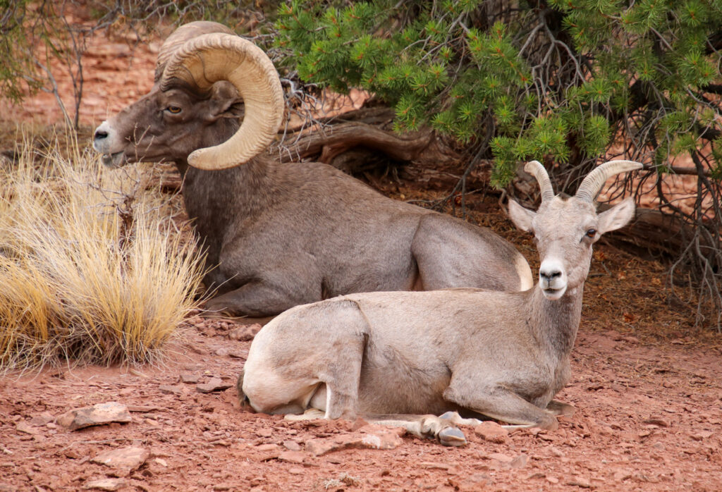
If you’re lucky, you may even spot desert bighorn sheep along the road.
Round-Trip Distance: 3.4 miles
Elevation gain: 780 feet
Estimated Time: 1 hour 45 minutes
Difficulty: easy to moderate
Area: Colorado National Monument
Highlights: Funky red rock formations, canyon views, bighorn sheep territory.
Red tape: fee area, no dogs.
6. Trail Through Time
If you’re really into history – of the dino variety – then the Trail Through Time is a must-see. As one of the most unique things to do in Colorado, scoping out these ancient inhabitants really puts time into perspective.
This active dinosaur fossil quarry has specimens that are over 140 million years old.
During the summer months, excavations are active while there are interpretive signs year-round. Fossils that have been found here include Allosaurus, Diplodocus, and Brachiosaurus.
Round-Trip Distance: 1.5 miles
Elevation gain: 50 feet
Estimated Time: 1 hour
Difficulty: easy
Area: Rabbit Valley by the Utah Border
Highlights: Dinosaur remains, active
Red tape: no dogs, critically endangered area.
Moderate Hikes in Grand Junction
You’ll find some of the best hikes in Colorado can be found right in Grand Junction. These moderate jaunts take a little more effort, but that just makes the reward that much sweeter.
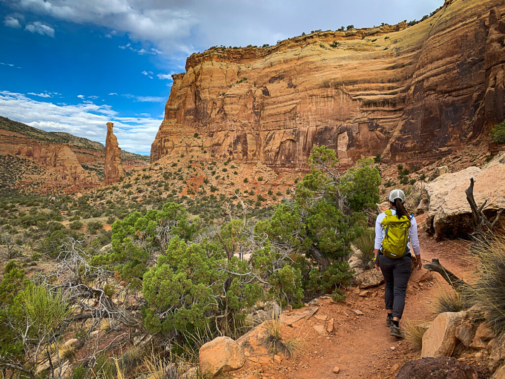
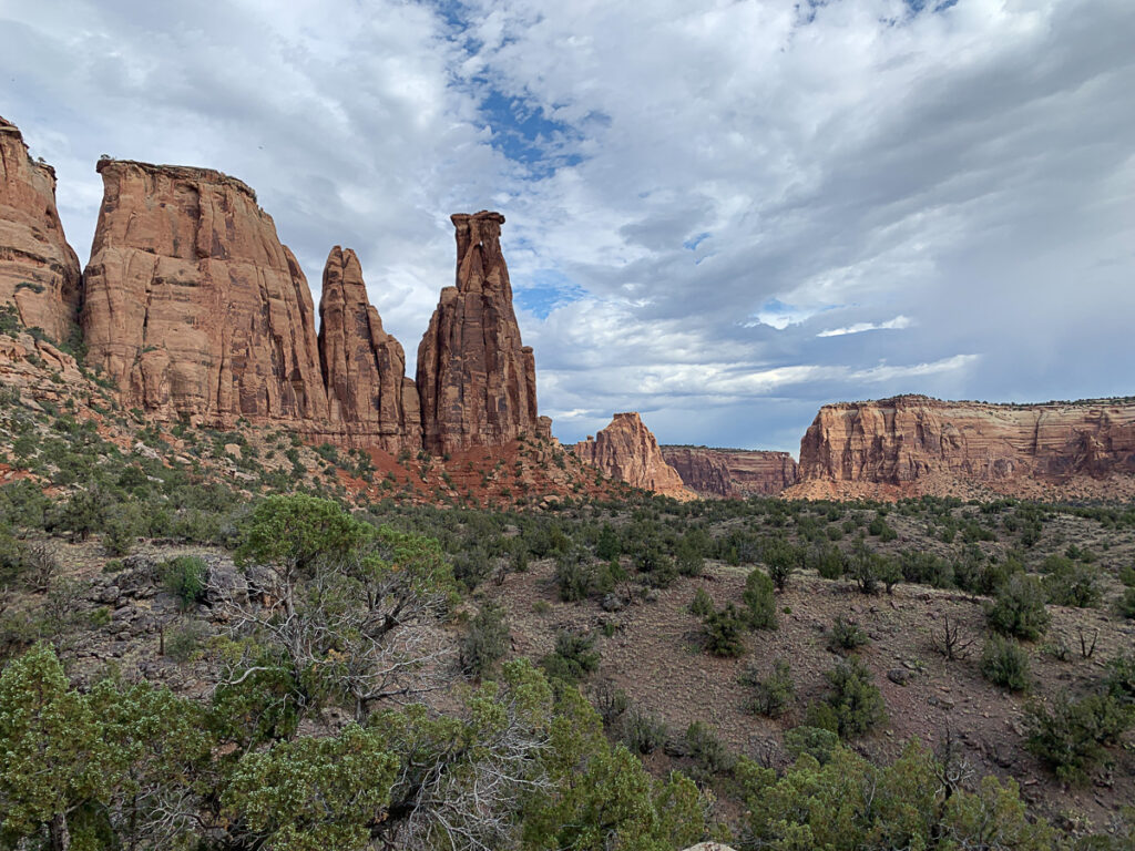
7. Monument Canyon Trail
A lot of people recommend the Monument Canyon Loop, but it’s not the best way to hike this moderate canyon trail. Instead of stopping short of the good stuff, continue onwards up Monument Canyon.
The route is a little longer, but you’ll get up close and personal with several fabulous rock spires and unique red rock formations. The loop trail really just puts your big toe into the canyon and skips a lot of the good stuff.
Upper Monument Canyon does connect all the way the Coke Ovens Overlook along the Colorado Monument Scenic Drive as a one-way, but you can stop shy of the steep incline up the canyon at the end and still get all the glorious canyon action.
Round-Trip Distance: 11.6 miles, but you can make it as short or as long as you’d like. It takes about 4 miles round trip to really get into the canyon.
Elevation gain: 1,873 feet
Estimated Time: 5 to 6 hours
Difficulty: moderate
Area: Colorado National Monument
Highlights: The Kissing Sisters Rock Formation, Coke Ovens Rock Formation, other-worldly red rock spires, stunning canyon views, bighorn sheep country.
Red tape: no dogs. You’ll pay a fee if you start at the top of the canyon (near the Coke Ovens) or it’s free from the bottom (best way).
8. Ute Canyon Trail
Start at the Corkscrew Trail for this lightly-trafficked, quiet jaunt. You’ll follow the trail left until you climb to the top and reach a junction for the Ute Canyon Trail.
At times the trail can be a little overgrown – especially near the water (seasonal), but this historic route is well worth the effort.
With few crowds, you can travel the famous Ute Trail, which was used by the Ute people when they migrated across Colorado, Utah, and the midwestern plains.
Round-Trip Distance: 11 miles
Elevation gain: 1,912 feet
Estimated Time: 5.5 hours
Difficulty: moderate to difficult due to navigation in parts and distance.
Area: Colorado National Monument
Highlights: quiet red rock canyon, adventurous hiking
Red tape: fee area if you start from the top (not recommended) free from the lower end of the trail). No dogs.
9. Lunch Loops Trail
For a scenic butt buster that isn’t too strenuous, be sure to put the Lunch Loops Trail on your list. Shared with mountain bikers, part canyon, part mesa romp takes you through a network of trails just outside of the Colorado National Monument.
You can opt to do the full loop or add and subtract from the many trails in the area. Trail runners love this track for its flow, while mountain bikers enjoy the rocky romp, so be sure to share the trail.
To make the loop take the Curt’s Lane trail to the Holy Cross Trail. Then head northeast (right) on the Tabegauche Trail until it intersects with High Noon. From here, you’ll head north (right) on Eagle’s Wing then to Eagles Tail (fitting huh?). Then you’ll come back to the Tabegauche Junction. Keep north (left), until you’re back at the parking lot.
Local TIp: This area is LOADED with trail options. markings are great, but having a map would be handy.
Round-Trip Distance: 6.4-mile loop
Elevation gain: 777 feet
Estimated Time: 3 hours 15 minutes
Difficulty: moderate
Area: Lunch Loops Area just north of the Colorado National Monument
Highlights: plenty of hiking options, dog-friendly, wildflowers in late spring and summer.
Red tape: none
10. Devil’s Canyon Loop D1 and D7
Not to be confused with Devil’s Kitchen, Devil’s Canyon is a moderately trafficked, dog-friendly romp through the McInnis Canyons National Conservation Area. A personal favorite of mine, this is one of the top trails to go hiking in Grand Junction.
You’ll get the same wow-factor scenes from the Colorado National Monument, but without the crowds. Follow the D1 and D7 trails for a complete loop. D5 is also an option, but it makes the route shorter.
Similar to Lunch Loops there are a lot of options to choose your own adventure, but D1 and D7 give you the full experience.
Local Tip: This is an AWESOME trail for dogs, but pick up your dog poop. Carry it with you by tying it to your pack. Do NOT trash the trail by leaving for the way back, others have to pass your trash!
Round-Trip Distance: 5.2 miles
Elevation gain: 698 feet
Estimated Time: 2 hours 30 minutes
Difficulty: moderate
Area: McInnis Canyon National Conservation Area
Highlights: Stunning red rock canyon, fun rock spires, interesting cabin, dog-friendly
Red tape: none
11. Turkey Flats Loop
Now for something a little different. The Grand Mesa National Forest offers a few incredible trails that are great for leaf-peeping and the best is the Turkey Flats Loop. Another trail that allows dogs, mountain bikes, and horses, be sure to keep your head up while hiking!
Some of the trail is overgrown and navigation can be a bit tough, but that’s the price for some solitude. This trail has more of a mountain feel, starting at 8,000 feet, so plan for higher elevation and watch out for afternoon storms.
Round-Trip Distance: 8.8 miles
Elevation gain: 1,148 feet
Estimated Time: 4 hours and 30 minutes
Difficulty: moderate
Area: Grand Mesa National Forest
Highlights: Aspen groves, wildflowers, and alpine valley views atop a large mesa. Dog-friendly.
Red tape: none.
Challenging Hiking in Grand Junction
If you really want to challenge your hiking prowess, then try your luck as some of the most challenging hikes in Grand Junction. Thanks to the lower altitude, you’ll be putting in serious miles to tackle these tough trails.
12. Rattlesnake Arches Canyon
For a long, doozy of a hike with an unbelievable reward, set off to hike Rattlesnake Arches Canyon. You’ll go up and over three distinct canyon systems on this burly, long trail.
Some slickrock navigation and scrambling is required for the first canyon. Look for cairns to guide the way down the path of least resistance.
Once you crawl out, you’ll almost immediately dive right back down into the second canyon. Depending on the season, you may have to cross a creek or two. Afterward, you’ll join up with the historic Ute Trail – an ancient trail used by the Ute people to migrate across vast distances.
Think about what this steep, unrelenting incline must have been like without modern hiking equipment! Once you reach the plateau things ease up and you’ll have views of both Fruita and Grand Junction.
Curl your way around on top of the Rattlesnake Arches Canyon and be prepared to have your mind blown. There are so many arches both next to you and across the canyon, you won’t be able to count them all!
Local tip: If you’re willing to haul in your own water, this is one of the best backpacking trips in Colorado.
Round-Trip Distance: 14.3 miles
Elevation gain: 2,542 feet
Estimated Time: 7 hours 15 minutes
Difficulty: challenging
Area: Black Ridge Canyons Wilderness
Highlights: scrambling, slick rock hiking, three distinct canyons, stunning arches along the top of Rattlesnake Canyon. Dog-friendly for a burly hiking dog.
Red tape: Some offshoot trails lead to private land, so note signage. None.

13. Old Gordon Trail
Stunning views combined with a bit of butt-busting uphill grinds make this trail a burn-it-to-earn-it kind of hike. The end of the hike gets a few knocks (it dead-ends at a cow fence), but if you’re looking for a challenge with a few views (and fewer people) then the Old Gordon Trail is it.
What makes the Old Gordon Trail one of the best hikes in Grand Junction is that it doesn’t have a ton of mileage, but still presents a worthy challenge. It’s a great difficult hike if you want to feel like you got a workout, but don’t have all day.
Round-Trip Distance: 6.4 miles
Elevation gain: 1,774 feet
Estimated Time: 3 hours 15 minutes
Difficulty: challenging
Area: Colorado National Monument
Highlights: beautiful views, not a lot of crowds
Red tape: Fee area. No dogs.
14. Crag Crest Loop
Ride the ridgelines of Grand Mesa along this loop trail. There is a steep uphill grind to make it to the Crag Crest, from there you can enjoy the stunning views with steep drops along both sides.
Return the way you came or head down into the basin for a loop route. The Crag Crest – the reason for hiking this amazing trail – is only open to foot traffic (thankfully).
If you’re looking to get into the alpine of Grand Junction, then this is the trail to check out. Best done in summer or fall.
Round-Trip Distance: 10.3 miles
Elevation gain: 1,548 feet
Estimated Time: 5 hours 15 minutes
Difficulty: challenging
Area: Grand Mesa National Forest
Highlights: beautiful bird’s eye views of alpine lakes, a fun ridge walk that delivers beautiful scenery on both sides, unique changes in scenery along the way. Dog friendly.
Red tape: none.
Quick Tips for Desert Hiking
The majority of hikes in Grand Junction, Colorado go through some pretty serious deserts. Desert hiking isn’t quite like a casual romp through the woods. Despite the lower elevations, there are plenty of hazards to know about. Here are a few quick tips for desert hiking.
Pack plenty of water – even on cold days. The dry air really takes it out of you so be sure to have at least 2 liters per person and more at the car to quench your thirst post-hike.
Bring plenty of sun protection. The sun can quickly wear you out. Wear a wide-brimmed hat, pack sunscreen, and consider even wearing a lightweight sun shirt.
Don’t bust the crust. The raised, bumpy soil you see is a living organism that is essential to desert life. It lets flora grow and takes years to develop. Never step on this soil (cryptobiotic soil) and stick to pre-existing trails or hard surfaces.
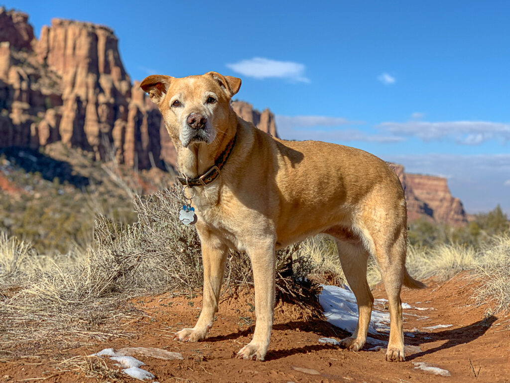
Paw wax for your 4-legged friends. Musher’s Secret is a must in dry desert environments. Dogs will rip their paws on virtually everything, including rough sandstone. So be sure to use paw wax, not booties, as it lets their feet breathe naturally.
Wear pants. The desert has a lot of plants that stick and poke. Wear pants to protect your feet. In the spring rattlesnakes like to sunbathe on the trail, so wearing high-ankle boots and keeping your pup close can help limit unwanted encounters.
Pack tweezers in your first aid kit. Cactus encounters aren’t fun, so be prepared and make sure you’ve got a set of tweezers.
Where to Eat Post Hike
Fruita and Grand Junction have a few eateries that will satisfy virtually any hiker hunger. A few hot spots include:
- Spoons Bistor and Bakery – Grand Junction – American food
- Tacoparty – Grand Junction – street tacos
- Namaste Nepal Restaurant – Grand Junction – Indian fare
- Hot Tomato Pizzeria – Fruita – delicious pizzas
Where to Stay
Fruita and Grand Junction offer up an array of super-affordable AirBnBs. There’s nothing like staying in a cute house and hiking during the day!
Camping is available, but a few campsites have a reputation for being unsafe, so do take care. You can camp in the Colorado National Monument (reservation required). There is also some dispersed camping available in the Rabbit Valley area or around the Jouflas Campground area.
Local Tip: Learn how to find free camping anywhere and never pay for a campsite again.
Nearby Attractions
Grand Junction and Fruita have quite a bit on offer, but if you’re looking for more to do in the area, check out these nearby destinations:
- Drive the San Juan Skyway, one of Colorado’s most scenic drives
- Visit Ouray and Ridgeway
- Soak in the Orvis Hot Springs one of Colorado’s top hot springs
- Check out Glenwood Springs
- Visit Moab
Catch me on YouTube!
Want more secret backpacking trips? Ultralight hacks that every hiker can adapt? Experience the top outdoor destinations in the world without the crowds? If you want to get insider knowledge of all things outdoors, then you’ll wanna subscribe to my YouTube channel, where I am giving away my DECADES of knowledge as an outdoor professional. I’ll see ya there!
Additional Colorado Travel Resources
Planning a trip to Colorado? Let me help you with these local resources:
- The Top Things to Do in Colorado (coming soon)
- Visiting Colorado Like a Local
- Incredible Weekend Trips in Denver to Take Right Now
