Last Updated on February 27, 2024 by foxintheforest
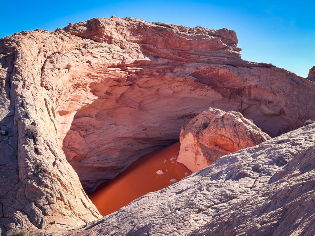
There’s nothing I love more than weird and whacky things in the desert. Except for quiet weird and whacky things – like the Cosmic Ashtray. This funky landmark really checks all of the boxes. Gorgeous hiking, an eye-popping wonder, and zero people.
However, the route to the Cosmic Ashtray (sometimes called The Volcano of Escalante) is closely guarded with no trails and no hints. It’s a tough, sandy, rocky hike to reach this other-worldly locale. But if this sounds like your type of adventure, then keep reading.
As a long-time desert adventurer of nearly a decade, I’m an expert in the Escalante area. I’ve been to Grand Staircase Escalante numerous times and the Cosmic Ashtray is one of my personal favorites. So if you’re interested in exploring this amazing wonder like an expert, not a tourist, then you’re in the right place.
About this Expert Guide to the Cosmic Ashtray
Inside this expert guide to the Cosmic Astray you’ll find:
- Info on where to find the Cosmic Ashtray
- What to expect on the hike
- Tips and tricks for hiking to the Cosmic Ashtray from both the northern and southern routes.
- Other nearby attractions
- Additional Utah trip planning resources
When is the Best Time to Hike the Cosmic Ashtray?
Spring and fall are the best time to enjoy any Escalante hikes. Be sure to check the weather before you head out, as ain can make access to either trailhead completely impassible.
There is no sun protection or any protection from the elements so avoid this hike in the summer or on windy days.
The time of day doesn’t really matter all that much. We hiked in the evening for reference. The Cosmic Ashtray had some shade on the inside and the sun faced you from the viewpoint, but it still made for great photos.
Morning or mid-day might provide better lighting.
Where is the Cosmic Ashtray?
The Cosmic Ashtray is out there. Honestly, it’s kinda in the middle of nowhere and everywhere all at once. Situated at the edge of petrified sand dunes, it’s a small wonder anyone ever found this place.
There really isn’t much of a trail to get to the Cosmic Ashtray. It’s more of a follow-the-path-of-least-resistance to a GPS maker.
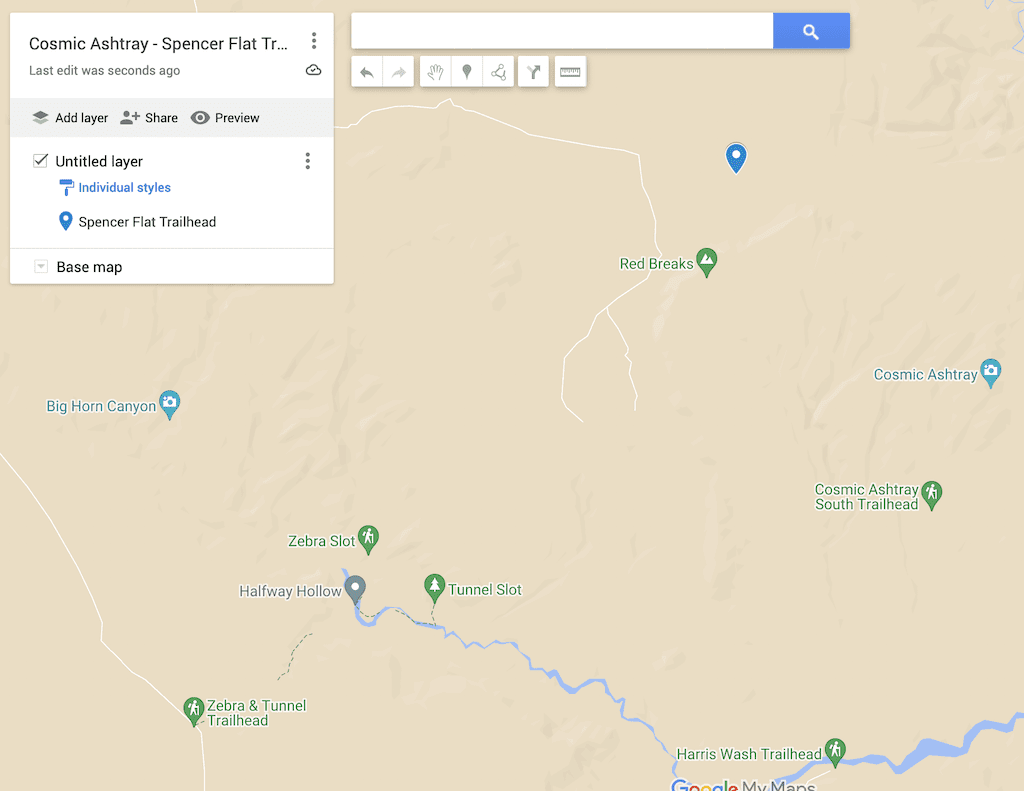
There are two trailheads for the Cosmic Ashtray, with one being far better than the other. You can access each trailhead.
Pro Tip: You will need a GPS, preferably with a loaded map, to reach the Cosmic Ashtray. Cairns are few and far between and there isn’t an official route.
Spencer Flat Trailhead (best)
The best way to reach the Cosmic Ashtray is from BLM Road 103 or Spencer Flat Road. What makes this easier is it’s far less tedious than Hole in the Rock. However, you’ll have a little bit more hiking if you don’t have a 4×4 vehicle.
To get here, take Highway 12 north out of Escalante until you hit BLM Road 103 or Spencer Flat Road on your right (west). Head down the road all the way until the end. Park and start your hike from here.
Pro Tip: There is less washboard than Hole in the Rock and a standard vehicle shouldn’t have any issues aside from a few bumps.
Hole in the Rock Trailhead
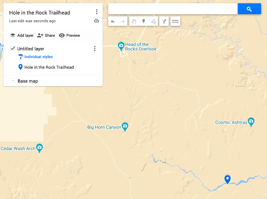
To access the trail from the Hole in the Rock area, you’ll head north on Highway 12 out of Escalante. Turn west onto Hole in the Rock Road. Continue down the washboard-ridden road for 10.6 miles until you see BLM 220/Harris Wash Road split off to the north (left).
From there it’s 6.1 miles to a pullout that acts as a trailhead. If you have 4WD, high clearance, you can continue another 3.5 miles or so, then start your hike from here. Just keep in mind the road can be extremely rugged.
Practical Info for Your Hike
It’s always important to be in the know before you go – like the the hike to Jacob Hamblin Arch – and the hike to the Cosmic Ashtray is no different. It doesn’t matter if you take the north or south route, you’ll need a GPS with loaded coordinates to reach The Volcano or Cosmic Ashtray.
There is no official trail and this is a cross-country route. Come prepared. I’d highly recommend traveling with an emergency communication device.
Pro Tip: I love the Road Trip Ryan App for this location. Another way is to download the GPS from his website and add it to your navigation device.
Details From Spencer Flat Road (Best Route)
Mileage: 8.4 miles officially, we clocked around 9 miles.
Elevation Gain: 882 feet with an additional 800 feet if you opt to do the lolipop
Estimated Time: 4 hours
Difficulty: Difficult. Cross-country navigation skills are required.
Dog-Friendly? Dogs are allowed on leash, must pick up after you pet. Not recommended due to the lack of shade and rugged terrain. Dogs paws can burn on hot sand and rock
Highlights: Stunning, quiet trail that has a lot of distant views along the way. Camping nearby is some of the best in the area. Less sand walking than the southern route.
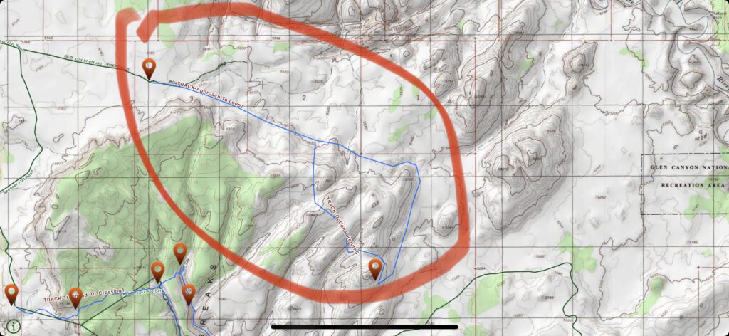
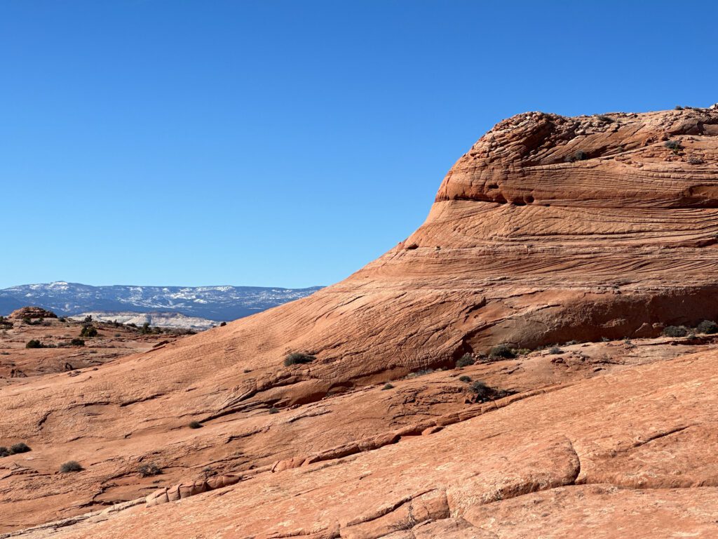
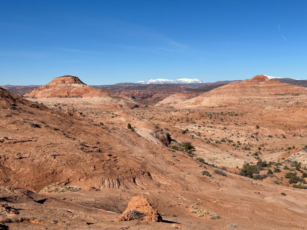
From Spencer Flat you’ll make your way down the obvious sandy trail until it peters out on some rocks. From here, you’ll be marching around slick rock-petrified sand dunes until you reach your destination.
The general idea is to traverse the side of the petrified dunes, not riding too high or too low. Take the path of least resistance and stick to slick rock to save your ankles from the deep sand.
Pro Tip: We took a slightly different way in and out, so be sure to check your GPS frequently.
Eventually, you’ll start to hike uphill, again, taking the path of least resistance until you reach the Cosmic Ashtray, it creeps up on you, and you’ll have no idea where it is until you’re up on it.
Once you reach the Ashtray, you can circle around via a “shortcut.” On paper, this cuts about a 1/2 mile from the journey, but traverses up and over 4 very steep petrified slick rock dunes. It added about 800 feet of gain to our trip and I wouldn’t recommend it unless you want a bit of a suffer-fest.
Details From Hole in the Rock (Tedious)
Mileage: 9.0 miles
Elevation Gain: 880 feet
Estimated Time: 4 hours
Difficulty: Difficult. Cross-country navigation skills are required.
Dog-Friendly? Dogs are allowed on leash, must pick up after you pet. Not recommended due to the lack of shade and rugged terrain. Dogs paws can burn on hot sand and rock.
Highlights: If you have a 4×4 vehicle, you can take about 6 miles off of this hike, but the road is rugged and conditions vary due to drifting sand.
From the south, you’ll make your way 3.25 miles on the V Road – a rugged 4×4 road. Afterward, you’ll peel off the road and start the grueling trudge through the sand. Be on the lookout for cryptobiotic soil! Step around these obstacles.
Eventually, you’ll come across the petrified dunes. From here it’s up and down on slickrock until you peel around the base of the Cosmic Ashtray (it’s too steep to surmount from here, you’ll have to walk around to the other side).
Make your way up and around until you reach the Cosmic Ashtray. Come back the way you came.
Reaching the Cosmic Ashtray
Either way, you’ll need to have a GPS with the route loaded. Again, no official trail for one of the best hikes in Escalante and just a few sparse cairns. However, the rocks all look like cairns here, so it’s very, very easy to get lost.
The GPS coordinates for the Cosmic Ashtray are N 37.68326, W 111.31537.
This is an expert hike and certainly no joke. Don’t let the lower elevation gain fool you. Sand dunes move! We did this hike as a lollipop loop from the north side and clocked just over 9 miles with 1,600 feet of gain. I’m guessing around 700-800 of that was from the supposed “shortcut” that I wouldn’t recommend.
Is the Cosmic Ashtray a Real Volcano?
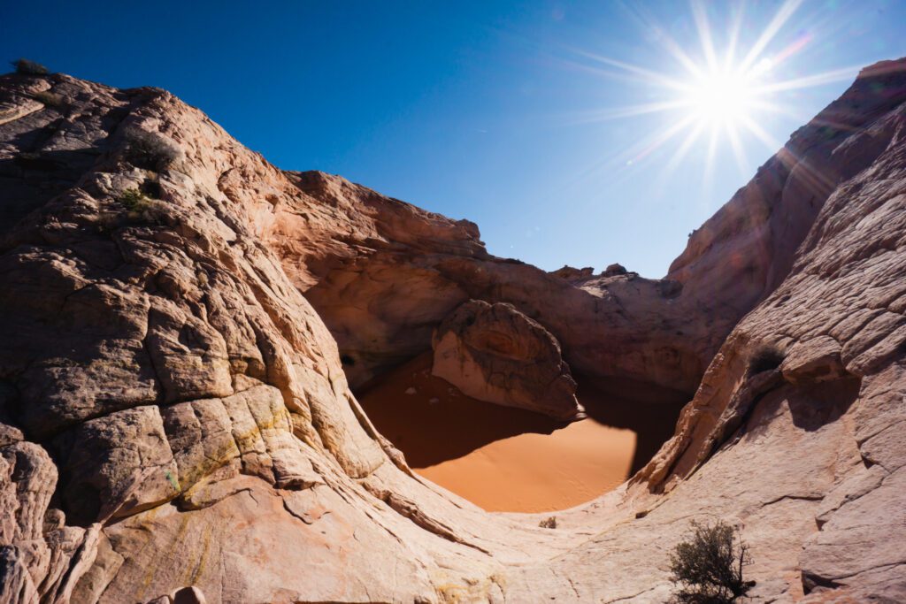
No. Although some people do refer to the Cosmic Ashtray as “The Volcano” it isn’t actually a volcano. This strange landmark was formed by wind and sand eroding from a tiny hole to form the inside of the volcano-looking structure.
How Do I Get Into the Cosmic Ashtray
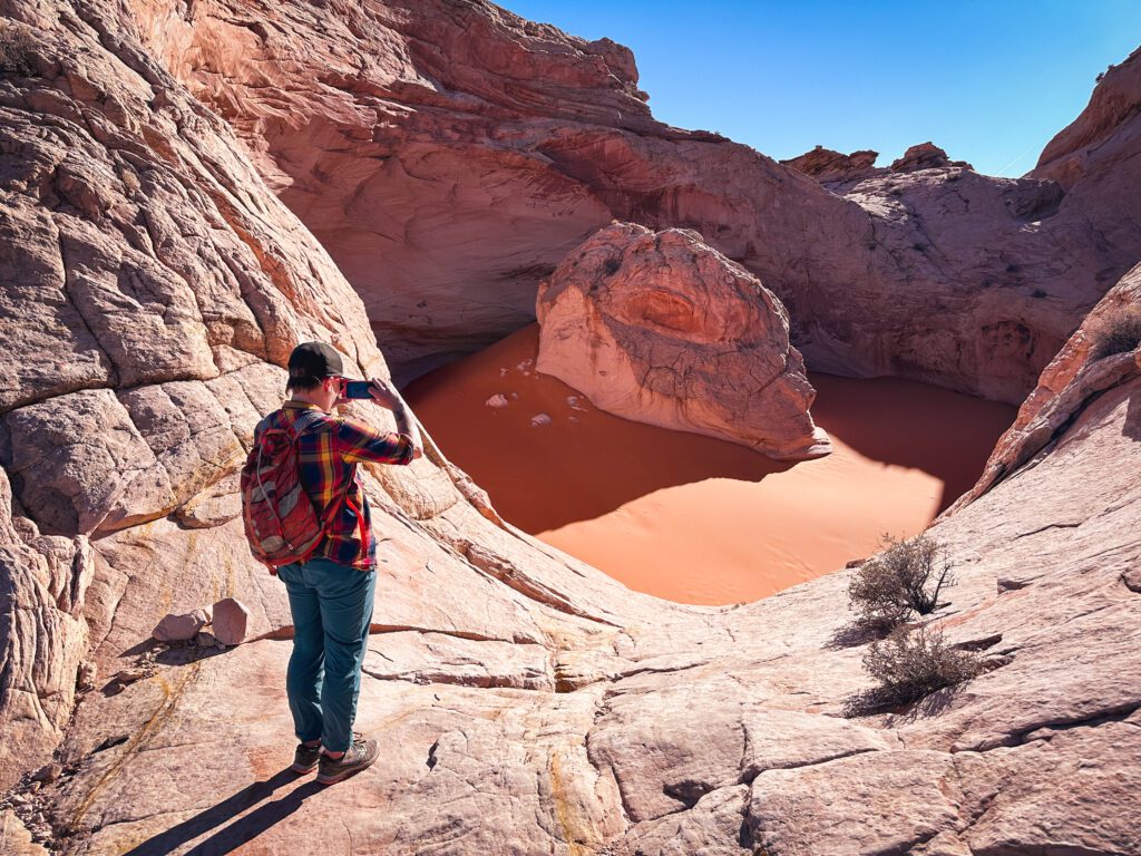
You can certainly get into the Comsic Ashtray by using the thinly carved steps as foot and hand holds. However, most people may want a rope to use as a hand line (there is no anchor here). It’s cool to get into it, but also very sandy.
Don’t climb in if you don’t think you can get out, as a rescue here would take a long time.
Can You Drive Up to the Cosmic Ashtray?
No. You can get close if you have a 4×4 vehicle, but you’ll need to be on foot to access the Cosmic Ashtray. It’s located in a wilderness study area, so no vehicles, including bikes, are allowed near it.
How Was the Cosmic Ashtray Formed?
The Cosmic Ashtray was formed over a period of thousands of years by sand and wind eroding the formation. Wind tends to swirl inside the “cauldron” of the Ashtray. If you look closely you can see the waves and flakes from the sand. It’s a really unique geological formation that took eons and a bit of luck to form!
Camping Near the Cosmic Ashtray
There is plenty of free, dispersed camping without any amenities near the Cosmic Ashtray on both routes.
Keep in mind there are no fires allowed in the Wilderness Study Area to the north and you are only allowed to camp in marked sites. These sites, however, are utterly stunning, although the best one requires 4WD and high clearance thanks to some ruts.
Hole in the Rock also has a lot of free dispersed camping, although it’s not easy to find. There is one obvious camping area a few minutes down Hole in the Rock as well as plenty of previously established campsites on side roads. You need to obtain a free permit to camp at Hole in the Rock which you can get at the Escalante Visitor Center just south of town.
Pro Tip: PACK IT OUT. You’re expected to bring all of your water and supplies with you and pack it allllll out. This includes human poop. Bring a wag bag for any camping along Spencer Flat Road. There are toilets at Dance Hall Rock and the Spooky and Peekaboo Slot Canyon Trailhead along Hole in the Rock Road.
Tips and Tricks for Your Hike
Don’t be a desert noob. Here’s a look at some expert desert hiking tips to make the most of your adventure.
Carry a GPS! I really can’t say this enough. This is an expert-level hike requiring cross-country navigation skills. The micro-terrain here is very disorienting and you’ll never find the Ashtray without a GPS.
There is no shade so pack tons of sun protection. We did this hike in the evening in April and the sun was still relentless. So bring sunscreen, sunhat, sunglasses, and a sun shirt.
Don’t bust the crust! There isn’t a whole lot of cryptobiotic soil (raised, bumpy, black soil) on this route, but it was present. Walk around any crypto so as to not disturb this incredible organism. These tiny microorganisms work together to stop the soil from eroding and allowing plants to grow!
Carry the essentials. Rescue will be very difficult to find out here so come prepared with food, water, a headlamp, sun protection, and even a bivvy. Carrying an emergency beacon device such as a Garmin inReach mini is helpful.
Don’t climb up what you can’t get down. Climbing down is harder than going up, so be prepared if you’re scrambling. Getting into the Cosmic Ashtray is a little daunting. A fall here would be unpleasant, so be sure to either use a rope or enjoy from above!
Nearby Attractions
There are countless fun things to do in Escalante – and Kanab – including world-class canyons and hiking. A few of my top recommendations include:
- Canyoneering in Red Breaks Canyon
- Hiking to Calf Creek Falls
- Scenic drive of Highway 12 to Capitol Reef
- Spooky Gulch and Peek-a-Boo Slot Canyon
- Coyote Gulch as a day hike
- Backpacking Reflection Canyon
More Expert Guides to the Best-Kept Secrets in the American Southwest
Looking to explore the best of the American Southwest? I’ve got you covered with these amazing adventures:
