Last Updated on September 9, 2025 by foxintheforest
From the deep canyons along the Colorado River to the amazingly scenic hikes of Sedona, there are countless amazing hikes in Arizona.
Arizona has a rich natural and Native history, plenty of beautiful hot spots, and unbelievable Arizona hiking trails.
This list of the best hikes in Arizona delivers you mega-amazing scenery and a stunning way to spend the day.
I’ve hiked many of the best hikes in Arizona throughout the years. These trails are all utterly beautiful and mega amazing.
But in order to really understand this amazing state, I’ve enlisted the help of fellow hikers to help me elaborate on a few popular Arizona trails.
Per usual, if you want to beat the crowds on some of the Arizona hiking trails, you’ll want to be at the trailhead before 7 am.
As an expert hiker, it’s my mission to get you on the trail like an expert, not a tourist. This list of professionally curated Arizona hikes features tips and tricks for exploring the best Arizona hiking trails without the crowds.
About this Guide to the Best Hikes in Arizona
Hiking in Arizona takes a little bit of skill and research to master. Inside this guide to the best hikes in Arizona you’ll find:
- Tips for when to hike in Arizona
- Amazingly beautiful hikes in Arizona
- Practical information about each hike including distance, elevation, difficulty, approximate time, and any red tape or advanced permits.
- Quick tips for hiking in the desert like a seasoned pro.
When to Hike in Arizona
Although it’s a desert locale, Arizona is surprisingly diverse. For example, the North Rim of the Grand Canyon sits over 1,200 vertical feet higher than the popular South Rim.
You may be in shorts and a t-shirt on one side, and it’ll be snowing on the other side. If you’re hiking in Arizona, regardless of the time of year, you’ll want to be prepared for all conditions.
Winter is typically a quiet time to hike in Arizona. It’s cooler (a HUGE plus) and the crowds have thinned out. Some areas are closed (ahem – North Rim of the Grand Canyon – ahem), but it’s still one of the best times to hike in Arizona.
Spring and fall are also excellent times to hike in Arizona. Fall is my personal fave since the weather is typically dry and the wind dies down.
Spring can have wilder weather with brutally windy days and wet conditions come and go. You should NEVER hike in sensitive areas during rain or snow. Sandstone is slippery, brittle, and dangerous when wet and you make a greater impact on the environment.
Pro Tip: Spring break is crowded so plan accordingly.
Avoid hiking in Arizona during the summer. Temperatures regularly soar above 100 degrees. And as a desert hiking pro, 100 degrees quickly can feel like 120 thanks to the heat reflecting off of the rocks.
Not to mention, this is the most crowded time to hike in Arizona. I personally don’t get why someone would want to hike when the weather is too hot and the crowds are too fierce.
Cape Final
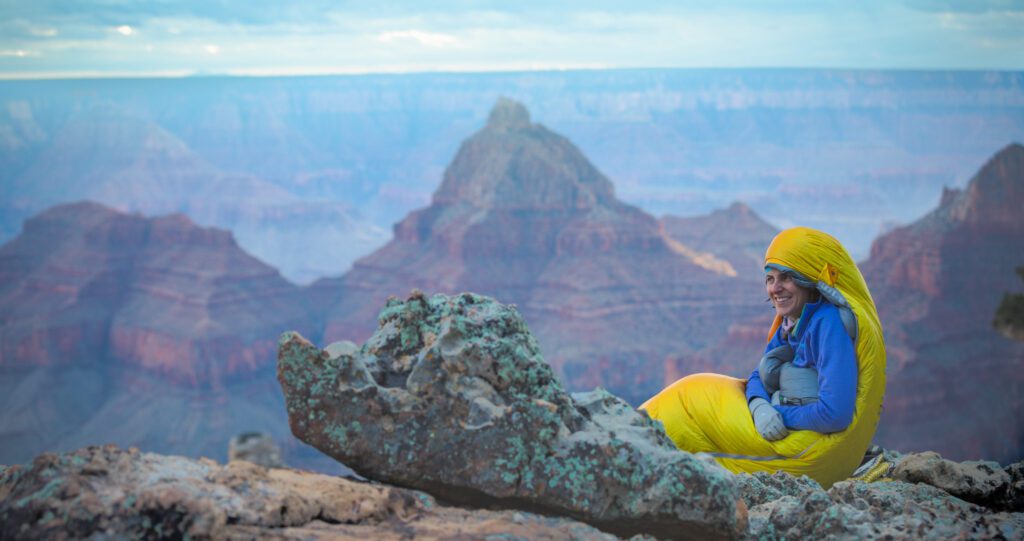
Cape Final is one of the best Grand Canyon North Rim hikes if you’re into ultra secluded spots and wouldn’t mind getting the best uninterrupted views of the Grand Canyon all to yourself. As one of the prettiest national parks in the US, this hike is a real treat!
One little-known secret about the Cape Final Trail is that there is a campsite at the end of the two-mile hike which is set right on the rim of the canyon. This quiet spot is considered the best place to camp in the Grand Canyon as it boasts several different barrier-free vantage points. With a little planning in advance, you can get to experience what camping in the desert is all about!
- Distance: 4 miles
- Elevation Gain: 425 feet
- Difficulty: Easy
- Estimated Time: 2.5 hours
- Dog-friendly? No
- Permits and Red Tape: Permit required for an overnight, which you must reserve in advance. Note this trail is only open from May 15th to October 15th. $30 entry fee to Grand Canyon per vehicle.
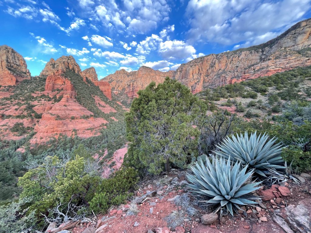
Mount Wilson Bench in Sedona
Mount Wilson is the tallest peak in the Sedona Valley and offers sweeping views of Red Rock Country. The entire hike to the top is a grueling, rocky 12-mile round-trip journey that quite frankly sucks unless you like rocky trails with endless switchbacks.
If you want the views without the endless grind, head up to the Mount Wilson Bench instead. As one of the most scenic hikes in Sedona, you’ll want to plan an early morning jaunt to the bench.
Yes, you’ll still have to work through some rocky, never-ending switchbacks, but you’ll be rewarded with some of the best Sedona views.
Pro Tip: This trailhead is tiny, hit the trail before 7 am to ensure you have a place to park. Parking on the road is not allowed.
- Distance: 5.8 miles
- Elevation Gain: 1,788 feet
- Difficulty: Difficult
- Estimated Time: 3 hours
- Dog-friendly? Yes, leased
- Permits and Red Tape: This is one of the only areas in Sedona that doesn’t require a fee to hike.
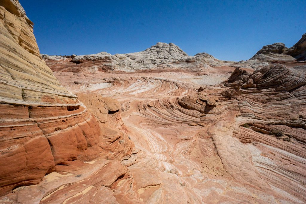
White Pocket
If you can’t get a permit to the Wave, head to White Pocket instead. The weird and whacky rock formations here have a unique history – cows actually “discovered” the place in search of water – you can even see their trodden tracks in the stone.
Many of these formations are EXCEPTIONALLY delicate, so look, but don’t touch! Tread lightly here, pay attention to your impact, don’t climb, pack out your trash, don’t fly drones, and don’t touch any of the delicate formations so the next visitor can enjoy it.
You’ll need a 4WD vehicle to make it to the end of the road to this secret hot spot. The road there is long, sandy, and it’s not uncommon to get stuck. You’ll be nearly 60 miles from pavement and a tow will cost at least $1,500.
Pro Tip: In my opinion, this area should be permitted, it currently isn’t. PLEASE practice Leave No Trace and be a respectful visitor.
- Distance: Varies, 0.5 miles round trip to reach the rock formations
- Elevation Gain: 200 feet
- Difficulty: Easy
- Estimated Time: 2 – 3 hours to explore
- Dog-friendly? Yes, but consider leaving your pup at home – this area is FRAGILE!
- Permits and Red Tape: No entry permit or fee. 4WD, moderate clearance required.
The Wildcat Trail
Hiked by James Ian from Parks Collecting
Officially called Monument Valley Navajo Tribal Park the famous Monument Valley sits on Navajo Land. As the largest Native American Reservation in the country, there is quite a bit of amazing scenery here. However, most of it is closed to outsiders.
Consequently, where you can go and what you can do without a Navajo guide are limited. The only hike that is possible to do independently is the Wildcat Trail, and it is a great hike!
The 3.6-mile trail leaves from The View area and loops around West Mitten, with spectacular views of Merrick Butte and East Mitten along the way.
The first section of the trail is down a sandy dune (which you need to hike back up at the end, this adds some difficulty), but the rest is flat on compacted soil, so it is a fairly easy hike. About 0.7 miles into the hike is the start of the loop around West Mitten.
The shape of the butte changes constantly as you see it from different angles and having a chance to see it up close and from all angles is something that is only possible on this hike. Most people just do the drive or take a tour around Monument Valley, so there is a good chance that you will have the trail to yourself. Late afternoon is a great time, as the buttes glow a brilliant orange color in the last sunshine of the day.
Pro Tip: The Monument Valley Navajo Tribal Park is currently closed to outside visitors until further notice due to COVID 19. You are still able to drive Highway 163, but stopping is forbidden outside of essential services. Masks are required any time you are outside of your vehicle.
- Distance: 3.6 miles
- Elevation Gain: 380 feet
- Difficulty: Easy
- Estimated Time: 2 to 3 hours
- Dog-friendly? Yes (leashed)
- Permits and Fees: No permit is needed, but the trail is closed between 10:00 am and 5:00 pm due to the desert heat, and you need to sign in/ out at the Visitor Center so they know who is on the trail. The entrance fee for Monument Valley Navajo Tribal Park is $10 per person or $20 per vehicle.
The Wave
Hiked by Agnes from The Van Escape
Although technically located in Utah, the Wave is a sought-after trail right along the border between AZ and UT.
What makes it a great hike is a fragile sandstone formation, which shimmers with orange and rusty colors and looks like a wave on the sea.
The Wave is located on the border of Arizona and Utah, in the Paria Canyon-Vermilion Cliffs Wilderness. The rock formation is also known as a Coyote Buttes North. To start hiking the Wave, you must get to the Coyote Buttes North parking lot – Wire Pass Trailhead between Kanab and Page.
It’s only a 6.4-mile hike round trip, but can be strenuous in the summer months, so make sure to bring a lot of water, sturdy boots, and sun protection.
The temperature can often be well over 100 degrees in the summer. You need at least 4-5 hours for a round trip to enjoy this place and take great photos.
Moreover, there are no marked trails – You will only get directions from rangers about the trail if you win the permit. It’s pure wilderness, so a paper map of the area and GPS are a must!
- Distance: 6.4 miles
- Elevation Gain: 400 feet
- Difficulty: easy
- Estimated Time: 4-5 hours, 3 hours of hiking time
- Dog-friendly? Yes (leashed & $7 fee required)
- Permits and Fees: Note that a permit to hike The Wave is required and you can only get one via a very competitive lottery system. Rangers regularly guard the trailhead to check permits. Here’s how to win The Wave Lottery. $9.00 non-refundable fee to apply for the lottery.
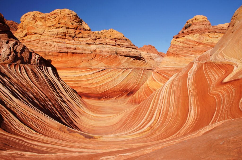
Image courtesy of Agnes from The Van Escape
Havasupai Falls Hike
Hiked by Sam from My Flying Leap
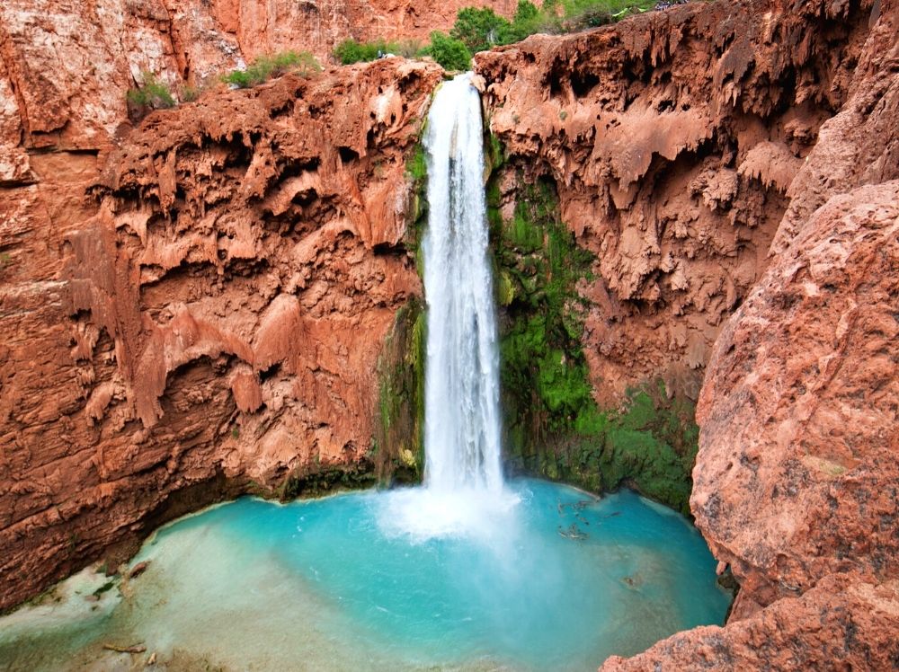
There are few places in the state of Arizona, and even the country, that rival the beauty of the Havasupai Falls. Just picture turquoise blue-green water spilling out of striking red rock. The Havasupai Falls are simply breathtaking – making it a top contender for the best hikes in Arizona.
There are five waterfalls in Havasu Canyon: Havasu Falls, Mooney Falls, Beaver Falls, New Navajo Falls, and Fifty Foot Falls.
It’s located in northwestern Arizona, not far as the crow flies from the Grand Canyon. Havasu Canyon is on Native land, and the Havasupai Tribe is the guardian of the blue-green waters.
Visiting here is a privilege, act accordingly. Read up on the unique Native history in the area and respect the land. It’s not uncommon to see Havasupai trashed, so please do your part and practice Leave No Trace.
It’s a challenging hike with switchbacks getting in and out of the canyon. If you go at sunrise, you’ll be rewarded as the canyon lights up in a beautiful palette of color.
The canyon heats up quickly, so hike in early to enjoy the solitude and cooler temps. The remainder of the hike is easy and mostly flat on a silty dry river bed.
Bring plenty of water as there are no services along the route until you get to the Supai Village where the tribe lives (8 miles from the trailhead).
You’ll want to bring everything you need and take everything you brought out with you – this includes human waste.
The campground has fresh spring water and compostable toilets, but no other facilities. Use human waste disposal bags while you hike.
- Distance: 14.4 miles
- Elevation Gain: 2,155 feet
- Difficulty: Difficult
- Estimated Time: 7.5. hours
- Dog-friendly? No
- Permits and Fees: All visitors must secure a reservation way in advance to travel on these sacred lands. It’s very competitive to get one but well worth the effort to see this soothing and sacred space. You can apply for a permit at Havasupai Reservations.
Piestewa Summit Trail
Hiked by Brittany from Travel by Brit
Piestewa Summit Trail is an extremely challenging 2.2-mile hike with stunning (and rewarding!) views, making it one of the best hikes in Phoenix, Arizona.
Piestewa Peak is the second-highest peak in the Phoenix Mountains, so it’s no surprise that you’ll gain nearly 1,150 feet in elevation during this strenuous hike.
While you’re hiking Piestewa Peak, bring plenty of water, and avoid hiking during June, July, and August to stay safe during the excruciating summer heat in Phoenix.
Apply plenty of sunscreen and wear shoes with good traction since the trail can be rocky and slippery. Note that dogs aren’t allowed on this trail—it would be too challenging for them, anyway!
I recommend hiking the Piestewa Summit Trail at sunrise or sunset to admire the breathtaking views offered by the bright, colorful desert skies. You’ll want to relax once you’ve reached the top anyway—you’ve earned it! Just don’t forget your headlamp.
- Distance: 2.2 miles
- Elevation Gain: 1150 feet
- Difficulty: Difficult
- Estimated Time: 2 hours
- Dog-friendly? No
Echo Canyon Loop
Hiked by Chantelle at Flannels or Flip Flops
Echo Canyon Loop is located in Chiricahua National Monument in South Eastern Arizona.
What makes this hike so great is the unique scenery that changes as you complete the loop. You will walk through huge rock formations called the Grottoes and Wall street. Then, suddenly, you are in the open to see expanding views and pinnacles that will take your breath away.
Continuing through the loop, you will also walk through forested areas that are home to more birds than you can count.
Echo Canyon Loop is actually a few different trails all connected together, so if you don’t want to do the whole loop you could always just do pieces of it.
If you want a shorter hike, then I would definitely recommend doing Echo Canyon to the Grottoes and then turning around.
Start clockwise to make your hike easier or opt for the challenging counter-clockwise loop.
The temperatures here can vary and change quickly. Dress in layers. Bring at least 1 liter of water per person, and a hat to protect you from the sun.
Pro Tip: Also, a warning: this is a mountain lion and rattlesnake habitat, so be aware and cautious of your surroundings. Snakes and cats are most active in the mornings and evenings.
- Distance: 3.3 miles
- Elevation Gain: 593 feet
- Difficulty: Easy to moderate
- Estimated Time: 2.5 hours
- Dog-friendly? No
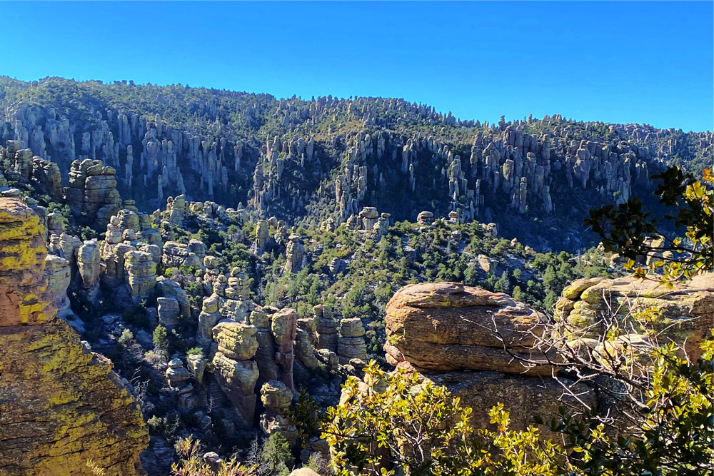
Photo courtesy of Chantelle at Flannels or Flip Flops
Boynton Canyon Trail
Hiked by Jyoti from Story at Every Corner
One of the best hikes in Sedona is the unforgettable Boynton Canyon trail in the Red Rocks Park behind the Mii Amo spa. It is an easy hike with a slight elevation change. It’s best enjoyed on vacation at the Enchantment Resort in Sedona.
It offers great views of the red mountains of Sedona, a vortex experience, and if you’re lucky you can hear the flute performance for world peace.
You can even climb up the rock all the way to the vortex. Near the vortex are two famous rock formations – the Kachina Woman and the Warrior Rock.
At the north end of the resort is the part of the trail that goes north and east through the mountains, woods, streams, and amazing views. In March or late winter, this section is covered in snow, which makes it extra beautiful.
You can hike the entire trail from one of the parking lots, but you can also hike the northern part in the morning and southern part in the evening to enjoy the evening flute music.
Pro Tip: This hike gets EXCEPTIONALLY crowded and parking regularly fills up. Arrive before 7 am if you want to secure your spot.
- Distance: 1.1 mile
- Elevation Gain: 135 feet
- Difficulty: Easy
- Estimated Time: 1 hour
- Dog-friendly? Yes (leashed)
- Permits and Fees: $5 per day and $20 for the year with a Red Rock Pass.
Horseshoe Bend
Hiked by Mark and Kristen from Where Are Those Morgans
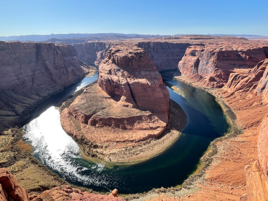
At just 1.5 miles roundtrip and rated as an easy Arizona hike, the sandy “hike” to Horseshoe Bend in Page Arizona may not be the most physically demanding, but it is arguably the best effort vs reward hike in the state.
The trail is largely packed down and exceptionally wide, making it ideal for beginner hikers.
A short, easly climb up a hill, followed by a relaxing gradual downhill walk transports visitors from a well-maintained parking lot to a man-made observation platform 1,000 ft above the mighty Colorado River.
Horseshoe Bend is a stunning U-shaped curve in the Colorado River and this short trail climaxes with awe-inspiring views directly into the canyon. What is lacking in hiking difficulty is more than made up by an extraordinary geological feature carved into the sandstone.
Pro Tip: This hike is ALWAYS crowded regardless of the time of day and for the seasoned hiker, largely looks like a tourist destination. But it’s still worth a visit at least once.
Nature and landscape photographers will fall head over heels for the sheer beauty of Horseshoe Bend, but be aware the viewing area is small and this place can get seriously crowded in peak season.
Pro Tip: You can walk along the edge of the canyon, but keep in mind that most of the rock shelf you’re standing on is exceptionally loose and brittle underneath. Oftentimes, fins of rock jut out and you could be standing on just a few inches of rock with 1,000 feet of air below you. Stay clear of the edge to avoid an unwanted accident.
Top tips for hiking to Horseshoe Bend:
- Hike in spring or fall for the most comfortable conditions and lighter crowds.
- The least crowded times for Horseshoe Bend are sunrise (a bad time for photography as the sun rises behind you and the U is in shade), winter, and around 4 pm.
- The trail is sandy, especially near the end wear open-toed shoes with no socks or hiking shoes.
- There is no shade aside from a few man-made structures along the trail in.
- Wind on canyon edges is real, watch your stuff to avoid accidentally littering here.
- Hiking to Horseshoe Bend at sunset is beautiful but extremely busy.
- Pick up your trash – take out what you take in! It was sad to see so much trash here.
- NO DRONES
- Distance: 1.4 miles
- Elevation Gain: 380 feet
- Difficulty: Easy
- Estimated Time: 1.5 hours
- Dog-friendly? Yes (leashed)
- Permits and fees: No fee required, but you do need to pay a $10 fee to park your vehicle at the parking lot.
North Kaibab Trail
Hiked by Kristen Czudak from Yonderlust Ramblings
One of the best ways to experience the uniqueness of Grand Canyon’s North Rim is hiking the North Kaibab Trail.
This point-to-point trip hike begins in the aspen-laden North Rim of the park, winds through multiple red rock layers, before arriving at the bottom of the Grand Canyon and the Colorado River.
Here you’ll find a completely different world, filled with meandering streams, surprisingly verdant vegetation, and mesmerizing rock formations, all framed by a backdrop of towering canyon walls.
Not only does hiking the North Kaibab Trail transport you through time itself, as evidenced by its canyon layers, but also through multiple and varied ecosystems. It’s a chance to witness the Grand Canyon from both the height of its rim, to the depths of its canyons!
The North Rim is only open between mid-May through mid-October. No permit is required to day hike the North Kaibab Trail, though permits are required to camp at Cottonwood Campground or Bright Angel Campground located along the trail. Parking is available at the trailhead but fills up quickly, so it’s important to start early.
The nearest small town is Jacobs Lake, approximately 45 minutes from the trailhead. The various ecosystems at the North Rim mean varying conditions on the North Kaibab Trail.
An early morning start in early October might be met with 20 degrees at the rim, but 90 degrees at the Colorado River. Finally, the North Kaibab Trail is an ideal option for those looking to connect to the South Rim for a full Rim to Rim hike!
Pro Tip: You’ll need to pack a human waste disposal bag. Pooping in the wilderness is not allowed in the Grand Canyon.
- Distance: 28 miles
- Elevation Gain: 6866 feet
- Difficulty: Difficult
- Estimated Time: Multi-Day
- Dog-friendly? No
- Permits and Fees: No permit is required for day hiking, but you might want to get one if you want to overnight at the campgrounds along the trail. $30 entry fee to Grand Canyon National Park.
Bright Angel Trail
Hiked by Lina from Bucket List Places
One of the top bucket list places for people visiting national parks in the U.S. is the Grand Canyon. A challenging but rewarding hike at the Grand Canyon, the Indian Garden from Bright Angel Trail packs a big reward.
Far less crowded than many of the other hikes in Arizona, the trail is diverse and gives various views not found elsewhere. There is also an opportunity for wildlife viewing as bighorn sheep are regularly seen on the trail.
Keep in mind that this trail is quite steep and strenuous in parts, so it should not be taken lightly. Make sure to bring lots of water and hiking poles as the sand can sometimes be slippery.
At 9 miles and over 3,000 feet of elevation gain, expect a minimum of 6-7 hours depending on your hiking speed and number of stops.
Be sure to wake up early and get there before the groups show up but the views will reward your effort as the canyon is truly breathtaking.
Pro Tip: Human waste disposal bags are required to use when a toilet is not available in Grand Canyon National Park. Pack one with you for emergencies.
- Distance: 15 miles
- Elevation Gain: 4478 feet
- Difficulty: Difficult
- Estimated Time: 7.5 hours
- Dog-friendly? No
- Permits and Fees: $20 entry fee to Grand Canyon National Park.
The Rim Trail
Hiked by Rachel from A City Girl Outside
The Rim Trail is one of the best hikes in the Grand Canyon National Park. Located on the South Rim of the park, the Rim Trail is an appropriate hike for people of all fitness levels and ages. Before you start your hike, make sure you have your hiking essentials with you.
To begin this gorgeous Arizona hike, take the bus all the way to Hermit’s Rest. If you need the bathroom or to refill any water bottles, this is the place to do it as there aren’t many other stops to do so along the trail. Hermit’s Rest is a building structure built in 1914 and features a gift shop and snack bar.
Pro Tip: Bring a human waste disposal bag for your hike. These bags are required to use when a toilet is not available in Grand Canyon National Park.
The Rim Trail is exactly what it sounds like, it follows the rim of the Grand Canyon. There are no steep sections of this hike since there is minimal elevation. However, there are sections where you do get close to the edge. There are also sections where the trail is paved and further away from the edge which is nice to break up the hike and stay on the safer side.
The Grand Canyon gets extremely hot during the summer months and hydration is incredibly important. Although this is one of the easier hikes in the Grand Canyon, there is minimal shade in sections and heat exhaustion can happen quickly.
If you get tired halfway through this hike, the bus picks you up at certain spots and brings you back to the Visitor Center. Make sure you check where the bus picks up beforehand so you are prepared.
- Distance: 13 miles
- Elevation Gain: 583 feet
- Difficulty: Easy
- Estimated Time: 6.5 hours
- Dog-friendly? Yes (leashed)
- Permits and fees: $20 entry fee to Grand Canyon National Park.
Cibecue Falls
Hiked by Catalin Geangos from traveltrained.com
Arizona is a state known for having different sizes and shapes of landscapes, making it a beautiful state for hiking. Among all the different amazing hiking spots, Cibecue Falls is considered the best hiking spot in the state.
It is also referred to as Arizona’s best-kept secret due to the fact that it is uncommon despite its beauty. Coming from Salt River Canyon on Hwy 60/AZ-77, you can get to the Cibecue Fall following a series of steep switchbacks down to the base of the canyon before getting to the trailhead.
Cibecue Falls boasts fewer river rafters, a beautiful site for picnic/camping, and a waterfall set in a beautiful canyon formed by Cibecue Creek, which is an excellent photo spot. Bring your hiking camera and capture the moment.
Do note that if you want to go hiking at Cibecue Falls, you should get a high clearance vehicle for faster movement and to avoid rough roads.
- Distance: 2.9 miles
- Elevation Gain: 623 feet
- Difficulty: easy to moderate
- Estimated Time: 3 hours
- Dog-friendly? Yes (leashed)
- Permits and Fees: $30 entry fee
Cathedral Rock
Located in Sedona, this iconic local landmark is a spot where you can find one of Sedona’s famous energy vortexes and easily makes for one of the best hikes in Arizona.
So, feel free to take in views of Chimney Rock from Oak Creek or embark on a one-of-a-kind trek to the saddle of Cathedral Rock for sweeping panoramas of the area.
However, before you climb Cathedral Rock do know that it is a bit steep and does require some scrambling. Other than that it’s a pretty short, one-mile-long, in-and-out hike.
Pro Tip: This is a great spot to go mountain biking since the area is home to some of the best bike trails in the nation. You also only access the trailhead by using the Sedona Shuttle, which runs from 7:30 am to 5:30 pm daily.
- Distance: 1.18 miles
- Elevation Gain: 741 feet
- Difficulty: Hard
- Estimated Time: Little over an hour
- Dog-friendly? Yes (leashed)
- Permits and Fees: You will need to purchase a Red Rock Pass to do this hike. The pass is $5 per day or $15 for a week
Antelope Canyon
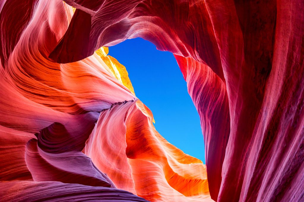
This is one of the best hikes in Arizona this is incredibly short. However, what this hike lacks in distance it makes up for with amazing scenery that is almost otherworldly.
So, embark on an easy, 0.5-mile hike through this slot canyon where you’ll make your way through narrow walls that only allow for small bands of light to hit the canyon floor.
Just know that you will be unable to hike here independently and must visit as part of a tour. Thankfully, though, the trip out to the canyon is quick and you are then free to do the hike at your leisure.
And while this hike is located near Page, if you’re based in Flagstaff then you can book a tour that will take you to both Antelope Canyon and Horseshoe Bend.
- Distance: 0.5 miles
- Elevation Gain: 98 feet
- Difficulty: Easy
- Estimated Time: 15 minutes
- Dog-friendly? No
- Permits and Fees: You must enter as part of a tour and can book a visit to either the Upper or Lower Canyon year-round. Most tours also last an hour and are around $90.00 each, although prices do vary.
Bull Pasture and Estes Canyon Loop Trail
Looking for one of the best hikes in Arizona that isn’t packed with people? If so then check out Organ Pipe Cactus National Monument.
See, this gorgeous park is an amazing hidden gem in southern Arizona that is home to both the Bull Pasture and Estes Canyon Loop Trail.
Now, both of these hikes will take you past Saguaros and the state’s famous organ pipe cactuses, a plant that is only found in this part of the state.
However, other highlights include epic views of the mountains in Mexico and plenty of chances to admire local wildlife.
So, once you’re at the parking lot head left to hop on the Estes Canyon Trail and right to tackle the Bull Pasture Trail.
Eventually, these two routes will converge at a steep spur that ascends upward for about a half-mile. Therefore, it is possible to enjoy these two hikes as part of one loop trail.
- Distance: 4.1 miles
- Elevation Gain: 865 feet
- Difficulty: Hard
- Estimated Time: 1-3 hours
- Dog-friendly? No
- Permits and Fees: $15 for individuals and $25 for vehicles
Lava Flow Trail
Head to Sunset Crater Volcano National Monument near Flagstaff and check out one of the all-time best hikes in Arizona.
Because while this trail is only a mile long, it is filled with incredible scenery that includes a cinder cone and a collapsed lava tube.
So, walk through the youngest volcanic area in the state and enjoy the well-paved, easy-to-follow Lava Flow Trail at the base of the cinder cone before embarking on a longer hike to the rim of the cinder cone.
- Distance: 0.8 miles
- Elevation Gain: 72 feet
- Difficulty: Easy/Moderate
- Estimated Time: 20 minutes to 1 hour
- Dog-friendly? No
- Permits and Fees: $25 per week for a vehicle.
Broken Arrow Trail to Chicken Point
This epic loop hike in Arizona can be accessed at the Broken Arrow parking lot. Just leave your car there and hike in a counter-clockwise direction.
This way you hit the hog wash, hog heaven, and the twin buttes as you approach Broken Arrow approach.
Just watch out for bikers on narrow parts of this Sedona trail and marvel at all the juniper, pinyon pines, and cypress trees along the way.
This is also a great area for a bit of off-roading.
- Distance: 4.6 miles
- Elevation Gain: 557 feet
- Difficulty: Moderate
- Estimated Time: Just under 2 hours
- Dog-friendly? Yes, but must be on a leash.
- Permits and Fees: None
Devil’s Bridge Trail (Via Dry Creek Road)
Located in the Coconino National Forest, this gorgeous out-and-back hike is best done between September and June.
It also takes you to the single largest sandstone arch in the area and offers sweeping views of the red rock landscape that has made this area famous. You’ll also see tons of Juniper and Prickly Pear Cactus.
While the trail is pretty quick, it does include a steep climb towards the end. You’ll also need a high-clearance vehicle to access Dry Creek Road.
Pro Tip: Parking at the Dry Creek Vista and the Mescal trailhead is super limited. So, make use of the free shuttle service from a park-and-ride in central Sedona.
Just be sure to arrive early since this is one of the best hikes in Arizona that is quite popular.
- Distance: 3.9 miles
- Elevation Gain: 521 feet
- Difficulty: Moderate
- Estimated Time: Just under 2 hours
- Dog-friendly? Yes, but must be on a leash.
- Permits and Fees: None
Shoshone Point
If you’re planning to visit the Grand Canyon during your trip to Arizona then be sure to do this easy, out-and-back hike.
It’s a lovely, family-friendly trail that takes you through vast pine forests and to a great picnic area where you can look out at Shoshone Point.
If you visit during the winter than you can even go snowshoeing on this trail in Arizona.
- Distance: 2.1 miles
- Elevation Gain: 154 feet
- Difficulty: Easy
- Estimated Time: 45 minutes
- Dog-friendly? Yes, but must be on a leash.
- Permits and Fees: Standard entrance passes are $20 – $35 for Grand Canyon National Park.
Tom’s Thumb
Hidden away near Rio Verde, this hike starts at the Tom’s Thumb Trailhead. You’ll tackle a series of switchbacks up Tom’s Thumb and then hit an intersection with the Windgate Trail.
Along the way, you’ll enjoy stellar panoramas of the Mcdowell Mountains, Phoenix, and see a wide variety of plants and animals.
Just be sure to bring plenty of water since there are no water fountains near or around the trail.
- Distance: 4.0 miles
- Elevation Gain: 1217 feet
- Difficulty: Moderate
- Estimated Time: 2.5 hours
- Dog-friendly? Yes, but must be on a leash.
- Permits and Fees: None
Bell Rock Trail
This short and sweet out-and-back hike in Arizona takes you up an exposed ridge and to stunning views of the area.
So, bring your camera and enjoy cool red rock formations along this well-marked trail. Just be aware that the trail markers disappear after the start of the hike.
Also, wear shoes with good grip since you’ll need them at the summit.
Pro Tip: Download an offline map that you can use towards the end of the hike.
- Distance: 0.8 miles
- Elevation Gain: 203 feet
- Difficulty: Moderate
- Estimated Time: 30 minutes
- Dog-friendly? Yes, but must be on a leash.
- Permits and Fees: Must have a $5.00 Red Rock Pass
Catch me on YouTube!
Want more secret backpacking trips? Ultralight hacks that every hiker can adapt? Experience the top outdoor destinations in the world without the crowds? If you want to get insider knowledge of all things outdoors, then you’ll wanna subscribe to my YouTube channel, where I am giving away my DECADES of knowledge as an outdoor professional. I’ll see ya there!
What to Pack
Take a look at this list of desert hiking essentials that are an absolute must-have on your next hike in Arizona!
- Plenty of water – I like to use a water container for the car. Budget at least 4 liters per person per day, more if you’re out in the summer months.
- Sunscreen, sunhat with a wide brim, sunglasses
- Sunshirt
- First Aid Kit with tweezer (for cacti)
- Noncotton socks
- Breathable footwear that you feel comfortable wearing all day
- Non-cotton shorts for hiking
- Non-cotton, lightweight pants for hiking. Pants protect you against aggravating foliage.
- Non-cotton, breathable t-shirt for hiking (the sun can really beat you up if you wear tank tops, so be aware)
- Electrolyte powder
- A water bladder capable of carrying at least 2 liters of water.
- Salty snacks
- Camera
- Camera clip to strap to your back
- Beanie – the desert can get cold at night so warm clothes are great to have
- Glove liners
- Fleece layer (fall through spring)
- Puffy layer (fall through spring)
- Hiking poles (optional)
- A hiking pack. I love the REI Flash series for something mutli-use and economical
- A toilet kit: shovel, WAG Bag (most national parks require this), hand sanitizer, TP/baby wipes, a small plastic baggy to pack out TP and sanitary items
- Pee funnel – optional
- Pee rag – optional
- A plastic baggy for trash (wrappers, fruit peels, etc). I like to use compostable dog waste bags.
- Headlamp
- GPS navigation
- emergency communication device
- Wind/rain layer
- Pocket knife
NOTE: These are affiliate links. Meaning I get a small kickback from every purchase, no matter the purchase, at no additional cost to you. This is a small way you can show support for my channel and it means a lot, so thank you!
Best Hikes in Arizona FAQ
What City in Arizona has the Best Hiking?
The city in Arizona that has the best hiking is Phoenix. After all, this metropolis is famous for trails up Camelback Mountain and Piestewa Peak.
However, if you’re looking for less intense hikes in Arizona then Phoenix has tons of other options too. You could also head to Kanab and check out the hikes there too.
Does Arizona have Good Hiking?
Yes! Arizona has amazing hiking and is home to some of the best trails in the country.
So, whether you want to enjoy stunning panoramas from the rim of the Grand Canyon or would like to stand in awe of the red cliffs around Sedona, Arizona has an epic trek for you.
In fact, you can venture further south to enjoy warm weather and to explore incredible waterfalls and stunning swimming holes.
What is the Most Beautiful Hike in Arizona?
The most beautiful hike in Arizona is Bright Angel Trail in the Grand Canyon. Because this awesome hike will take you on a mesmerizing journey from the South Rim of the Grand Canyon and into the heart of the canyon itself.
What is the Best Time of Year to Hike in Arizona?
The best time of year to hike in Arizona is either the spring or fall since the summer is way too hot – unless you want to walk around in the dark.
Similarly, winter means cold temperatures and unpredictable winter storms that can drop tons of snow on the state within a short amount of time.
Quick Tips for Hiking in the Desert
Desert hiking can be enjoyable, or it can be a total suffer-fest depending on your preparations. Here are a few quick tips to make the most of your Arizona hiking adventure.
Practice Leave No Trace. Seriously. Nothing breaks down here – that’s why you see animal poop all over the place. Bring a baggy for your trash (including dog poop, human waste, hygiene products, fruit peels, bar wrappers, and anything else that isn’t absolutely natural to the environment). Follow all wilderness regulations.
Don’t Bust the Crust! The bumpy, black soil you see smearing the desert floor is an ESSENTIAL part of the ecosystem. This stuff slows erosion and enables plant life to grow. It’s alive and it’s called crypto biotic soil. Stick to marked trails and let it be.
Leave ruins and artifacts where you found them. The deserts of Arizona are an exceptionally rich place, home to thousands of years of human habitation by Natives who are both still in existence and vast civilizations of the past. It is absolutely illegal by FEDERAL law to touch, move, or remove ANY of these artifacts. This includes arrowheads, potshards, ruins, pictographs, and petroglyphs. Leave only footprints, take only photos.
Plan for the sun. Bring a sun shirt, long sleeves, sunscreen, sun hat, and sunglasses. If you’re hiking in the summer, carry a damp cotton t-shirt in a sealed baggie for a quick air-conditioner. Bring a minimum of 3 liters of water for all hikes (far more if you’re going for more than 10 miles), and keep water in the car. Pack salty snacks. Hike early in the morning or in the evening and avoid hiking from 11 am through 4 pm in the summer.
Watch the weather. Never enter a canyon system if rain is anywhere in the forecast within a 75 mile radius. Canyons, especially slot canyons are prone to flash-flooding. Never climb wet sandstone, it’s exceptionally dangerous.
Plan for variable conditions. The desert is just as cold as it is hot. Packing a jacket, wind layer, beanie, and gloves isn’t a bad idea from fall through spring.
PIN THIS POST