Last Updated on September 19, 2025 by foxintheforest
The Wind River High Route is a crown jewel amongst shorter through hikes. Towering mountains, glistening alpine lakes, and high passes collide with rugged miles, unstable rock, and a whole lotta grit.
This is not an easy backpacking route. Not even an intermediate one. The Wind River High Route is one of the great traverses across an unforgiving mountain range. It’s reserved for those that like to suffer. Hard.
My friend Quota and I decided that we were going to attempt this 7-day journey across the mighty Wind River Range. And we spent 5 full days along the route. Eventually, one bad step took our plans and chucked them right out the window – we’ll get into that later.
These are some of the hardest miles we’ve ever hiked. And we are both mountaineers. Alpine climbers. Type 2.5-fun addicts with a badass streak. And it was still difficult.
However, we had just as much fun challenging ourselves as we did suffering through it. And the unmatched beauty of this incredible place is forever etched in our souls. For better…or worse…
So what does it take to tackle this mighty high route? A lot of skill. A lot of prep. And a humble attitude, cuz this place will rock you to your core.

The Wind River High Route (Alan Dixon Variation) at a Glance
There are two “routes” for the Wind River High Route. The Skurka Route and the Alan Dixon Route. We chose the Alan Dixon variation. This was mostly due to time, but also due to the fact that pointlessly summiting peaks just wasn’t something we wanted to add to an already challenging journey. Maybe next time, Skurka! (And ya, despite the rescue, there will be a next time for the rugged backcountry of the Winds).
Here are a few rapid-fire stats about the route. Since we unwillingly opted-out of the last 1.5 days, I will note our stats up to our stop point. We waited for rescue at the large, unnamed lake (10,566′) on the south side of Raid Pass.
Mileage (approximate): 83 miles (we clocked right around 69 miles)
Elevation Gain: 23,000 feet. The original route setters say 19,000′. We were just above 18,500 feet of gain when we stopped – we had two major passes left. We did at least 3,000 feet of elevation gain each day.
Cross Country Miles: Approximately 40-45. This means miles without a trail. At times, it’s hard to tell what is a use trail from a regular trail. Alan Dixon says 60, but that isn’t accurate.
Nights: 6 is reasonable. 5 is possible, but you’d likely not really enjoy yourself
Highlights: Indian Peaks Basin, Alpine Lakes Basin, Middle Fork Basin, Knifepoint Glacier. Incredible alpine lakes, glaciers, and dramatic peaks. A few short scrambling sections.
Lowlights: The section between Alpine Lakes Basin and Long Lake – particularly the Camp Lake Area. Overgrown trees, precarious passes with highly unstable rock. The fact that you have to move through so much terrain means you really don’t get to linger at some stunning areas.
Best for: HIGHLY EXPERIENCED BACKPACKERS ONLY! Must have navigation skills, rock navigation skills, off-trail navigation skills, be able to read weather, and be able to put down double-digit very hard miles every day.
Mileages and elevation gains are approximate. This is largely because there are very few trails along this route. Meaning, you’re picking your own path each day. That makes mileage vary. We used a few planning methods, and we found one person who had a GPS track. The GPS was surprisingly accurate with mileage – but not so accurate with elevation gain (expected).
What to Expect
The most important thing to expect is talus. Lots and lots of talus. Endless talus. You will eat, sleep, and breathe unstable, rocky terrain.
One of the bigger downsides of the route is the rock isn’t exactly stable. The big exception of Alpine Lakes Basin. That rock was excellent. Many people grumble about that section, but I thought once you got past the ridge on the first lake, it was actually nice to have rock that didn’t move on you with every step.
You want to prepare your stabilizers and ankles to be on talus for 3 hours a day at least, every single day.
Another thing, camping wasn’t the easiest. Reading descriptions, it sounded like there would be ample camp sites at each location, but that wasn’t necessarily the case.
Oftentimes, times you’d show up to an area and there would be one piece of flat ground. Other flat ground would have talus, rocks, or be a little too hilly for a tent (but not picked up on the topo). Coming from Colorado, this took us by surprise.
All of that to say, finding camping isn’t a huge issue. You can stop at other places than what has been listed on other people’s trip reports – we saw (and sometimes did) plenty of that. Water is everywhere so that makes camping quite simple.
Best Time of Year to Hike the Wind River High Route
This will vary year by year, but there is a sweet spot – a window where the snow and the mosquitoes are not an issue, but neither are snow storms, smoke/fires, and cold temps. We went in mid-August during an average snow year. I would happily do that again.
Earlier in the season, you’ll want an ice ax and proper traction (don’t worry, you still need microspikes). July is mosquito season.
We hardly saw any mosquitoes until we got much further south. Middle Fork Lake/Bonneville Lakes was the first time we really saw any mosquitoes during our trip.
Recommended Gear
I am certainly not in the business of telling people what their baseweight should be, but you should have your gear pretty dialed. And be as close to ultralight as possible.
For transparency, I’m not ultralight – but darn close (I’m bougey with my sleep system. Happy sleep = happy hike). But be very diligent – the terrain is rough and you’ll need to carry 7 days’ worth of food. The lighter your baseweight, the easier this trip will be.
You can check out my Lighterpack to get insights into what I brought and didn’t bring. Overall, I’m very happy with my kit.
I used almost everything in there (except the bear spray).
Here are a few notable wins and fails.
- (-) We had issues with our Durston X-Mid, which I wasn’t thrilled about. Performed like ass in windy conditions – the linelocs kept failing. We figured it out but, I just think these tents are a bit over-hyped. But overall, I was glad to have the lighter, more compact tent and would take it over my Copper Spur if I had to do it all over again.
- (+) DIY camp shoes. Utterly life-changing. For less than 2 oz, my feet got a breather. These held up amazingly well and were such a nice little luxury.
- (+) Kathoola Ghost Traction System. These worked soooo well. I was mega-impressed! I have an older version that weighs an ounce more than the new ones. Expensive, but worth it (especially if you trail run in winter like me!)
- (+/-) Adotec Grizzly Locker. Probably was a dumb idea, but we ended up sleeping with our food because hangs were rarely possible and we were most worried about mini bears. I loved the grizzly locker, but fitting 7 days of food in there was a bit difficult, and it wasn’t always possible to get everything in there the first several nights – so I used an OpSack. No critter issues, but that could have been lucky.
Getting to the Trailhead
There isn’t an easy way to get to the trailheads. You’ll need a ride cuz this is a one-way route. Many people hitch, but we opted to schedule a ride.
And it was a disaster.
We used the Great Outdoor Transportation Company. To put it bluntly, they forgot to pick us up.
They got rave reviews, but we are not one of them. We paid for an early pickup and sat at our pickup location at the Big Sandy Trailhead for 3 freakin’ hours.
Can’t recommend them, but they are the only option.
It got insanely awkward when the driver was nearly asking for a tip.
I will note that they did refund 1/2 of our ride. But it really screwed up our day – and subsequent days – because of the mishap. And the fact that no one was available when we tried to contact them early in the morning was a huge disappointment.
Wind River High Route (Alan Dixon) South Bound Itinerary
We did a lot of research before heading on this journey and had a few planned options for each night. Once we got into it, we (mostly) made it to the furthest parts we wanted to be at, but it’s totally ok to keep your plans a little loose – as the terrain is a lot rougher and more unstable than most trip reports really touch upon.
Day One: Green River Lakes Trailhead to Peak Lake or Vista Pass (or somewhere in between!)
Well…the late 12:30 start wasn’t what we were hoping for, but we were determined to make up as much time as possible.
So we CRANKED IT UP and power hiked over 9 miles in less than 2 hours. With 28-30lb packs.
Woof!
The scenery is fantastic, though, and between all the huffing and puffing, we tried to remember to pick our heads up and take it all in.
The first 12 miles are fairly flat along the CDT, following the Green River. Then you turn up and start your climb.
We climbed for quite a while to reach Vista Pass. Todd, our ride buddy, was leapfrogging us on the same intense march that we were on. He peeled off at Vista Pass, and we were trying to make it to our goal – Peak Lake.
But as the light started fading and my toes were screaming (I got 5 blisters from the fast, sweaty hiking), we realized we just weren’t going to make it.
We stopped at the first flat-enough section of ground between Vista Pass and Cube Rock Pass. There was just enough for our X-Mid below the final pitch up to Cube Rock.
It was a small feat that we got the tent up. At 9 pm, we finally collapsed exhausted in the tent.
Rough Miles: 17.8 miles
Rough Elevation Gain: 3,400 feet
Approximate Time (hiking and breaks): 6h 50min
Off-trail miles: 0 miles
Day Two: Camp to Indian Peaks Basin Via Knapsack Col
We got a lazy start to the day – dragging our butts outta bed at around 7:45 am. Surprisingly, we felt fine – not even really that sore.
Thankful to have an extra 4 hours in our day today, we eagerly got started on Cube Rock Pass.
We passed a man who had an exceptionally long beard and carried two large wooden staffs (think like 8 feet tall). He was a bit of a sketchy character, according to other hikers.
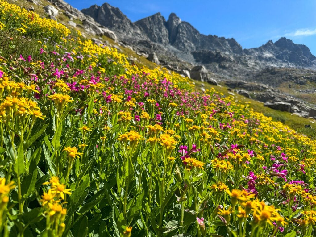
Peak Lake, on the backside of Cube Rock Pass, was lovely. Then we meandered through a steep, yet stunning field of wildflowers – quite the surprise for mid-August.
Gaining Knapsack Col wasn’t too intense – it felt like hiking a 14er except you were only at 12,000 feet, which was a welcome relief.
From there, we met up with Todd and hiked with him for most of the rest of the day.
Picking our way down Knapsack into Titcomb Basin took some time – more than we expected. But the beauty all around and silly conversations kept us entertained.
TItcomb was the most crowded place we saw on our trip, but there was plenty of room to spread out. The three of us were surprised at the stifling heat of the basin.
So Quota and I took a dip in the lake before setting out to Indian Peaks Basin.
After some more braiding uphill social trails, we made it to a stunning camp at around 6 pm. The luxury!
After a lovely sunset and leisurely camp chores, we called it a night.
Rough Miles: 12.8 miles
Rough Elevation Gain: 3,700 feet
Approximate Time (hiking and breaks): 8h 10min
Off-trail miles (estimated): 4 miles
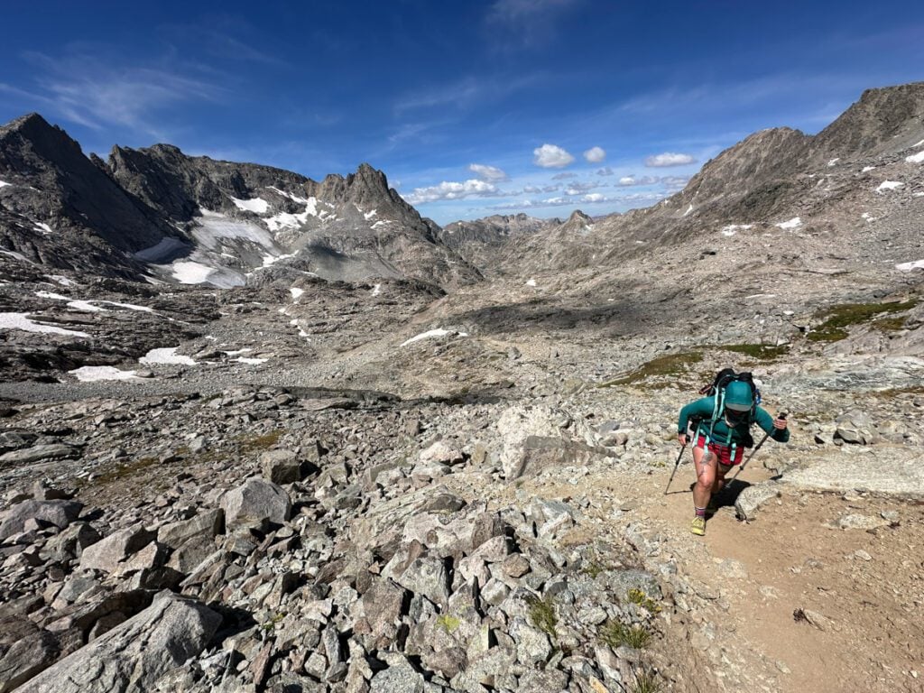
Day Three: Indian Peaks to Alpine Lakes Basin via Knifepoint Glacier
We woke up feeling excited, nervous, and mentally prepping for what we knew would be a tough day.
Although we didn’t have much ground to cover, we knew that soon after camp, we were going to be rock hopping for the entire day.
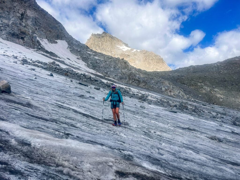
Our only break? A glacier. That we were crossing with running microspikes.
I’ve grown hesitant of snow and ice after I had to self-arrest coming off of the Skywalker Couloir in Colorado.
So I spent some time prepping my mind, running through how to self-arrest with trekking poles.
Gaining Indian Pass was really straightforward and almost nice. But as soon as we looked at the basin below us, we knew our day was about to get interesting.
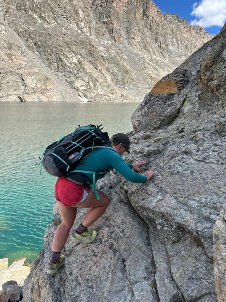
The Knifepoint Basin was…loose…mega loose. So loose in fact, we saw 2 sizeable rockfall events while we were in there.
Everything moved.
As everything threatened to roll our ankles or break our legs, we picked our way down to the glacier.
Slipping on our microspikes, we tiptoed across, trying not to anger the rockfall gods as the glacier groaned and creaked beneath us.
The end of the glacier delivered enough spice to get our hearts racing. Instead of the grippy, hole-riddled ice we were used to it smoothed out into a shiny, slippery slide. The end angle was at about 30 degrees and just pure, smooth ice.
Although it made us unhappy, we were somehow thankful to be back on the even more unstable ground.
As we contoured around the basin, trying not to lose elevation, we ended up face-to-face with a snowfield. This one didn’t threaten us with rockfall or moving ice, but still had a bit of a pitch. It looked less dubious than the beer-fridge-sized boulders that we were wobbling across, so we gave it a throw.
Oof. Was that a mild mistake!
The snow was soft enough to be slippery, but not soft enough to kick reliable steps. And we both ended up falling and sliding.
My worst nightmare – but thankfully, I had walked myself through the self-arrest steps just a few hours prior. The fall was delightfully slow, though, and I eventually stopped. By about the time I stood up and worked my way back up the boot pack, Quota had their turn taking a slide.
Frustrated and grumpy, we clawed our way up into a ditch between an enormous rock and the edge of the snow.
Quota hopped in as I struggled to keep my balance. I told myself that two rocks were going to catch me – fat chance! They didn’t, and I dumped myself into this 5-foot-deep ditch like a giraffe falling out of the womb.
Cursing, we swore off the snow and put our spikes away for good.
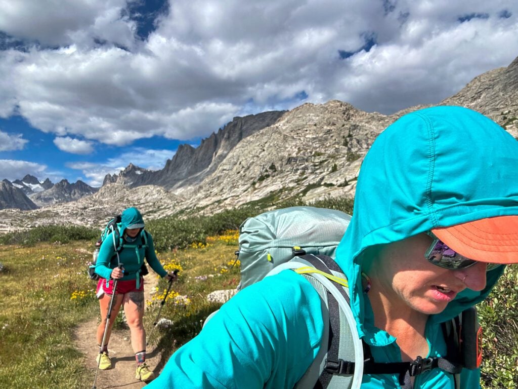
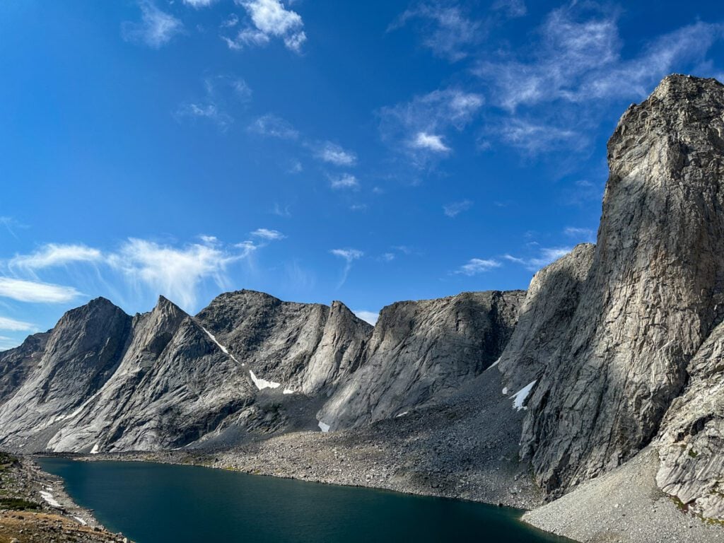
Eventually, we finally got to Alpine Pass, where we assumed the going would get easier. We spotted a group of 3, and the first 2 women we saw on our entire journey (out of 4 total, excluding us). They seemed to be moving quickly.
And although it was a bit faster going, we were now clawing our way up “class 5 dirt,” which is hiking slang for a loose dirt hill so steep you feel like you’re actually rock climbing.
Phew!
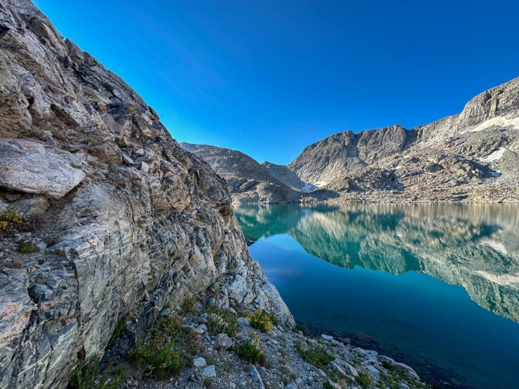
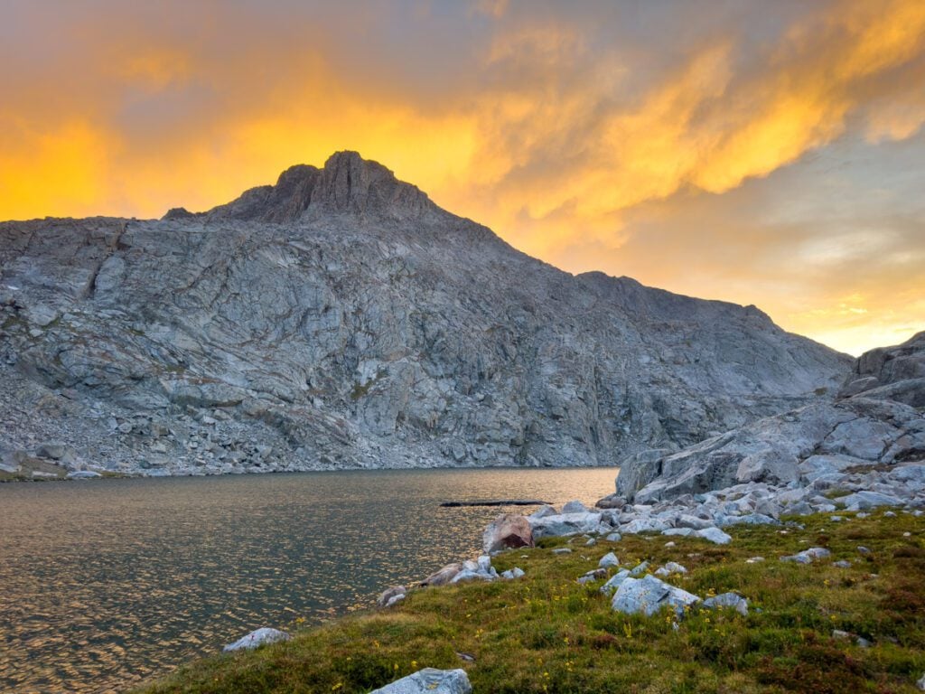
The top of Alpine Lakes Pass was one of my favorite views of the trip. Three lakes in one direction with not a patch of grass in sight. And the entirety of Knifepoint Basin in the other – with a shrinking, yet still long glacier. An enormous cascading waterfall flanking the far side.
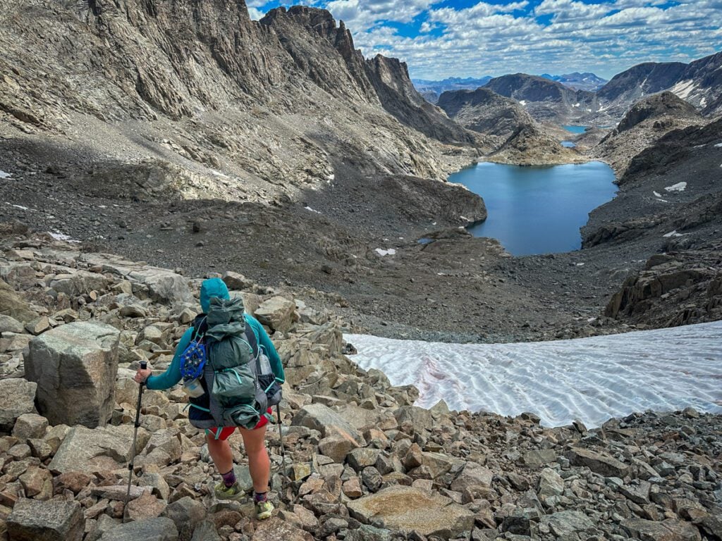
We prepped for the inevitable unstable talus in the Alpine Lakes Basin, but it never came.
This was by far the most solid rock of the entire trip.
It was tedious, but a welcome relief from the trash-pile conditions we had just come from.
We bumped into a lone hiker who seemed really annoyed and frustrated. Later, I saw his trip report on Reddit – and he claimed the route was “easy.” HA! Didn’t seem so easy when he was complaining about Alpine Lakes Basin. Ok bruh.
Up, down, and around was the name of the game as we dodged car-sized boulders and scrambled up and down a cliff face that dropped off into the water.
Eventually, we ran into a small patch of grass with the perfect view of Middle Alpine Lake.
It wasn’t too late in the day, but we decided to stop. Give ourselves a break from the last 3 days, enjoy chilling at camp, and have plenty of time to take as many dips as we would like in the lake.
It was a hard day – top 3 hardest terrain I’ve hiked (read: not scrambled or technically climbed). But it was worth it.
Rough Miles: 6.9 miles
Rough Elevation Gain: 2,680 feet
Approximate Time (hiking and breaks): 8h 15min
Off-trail miles (estimated): 5 miles all rock
Day Four: Alpine Lakes Basin to Long Lake and the Most Sandbagged Day of All-Time
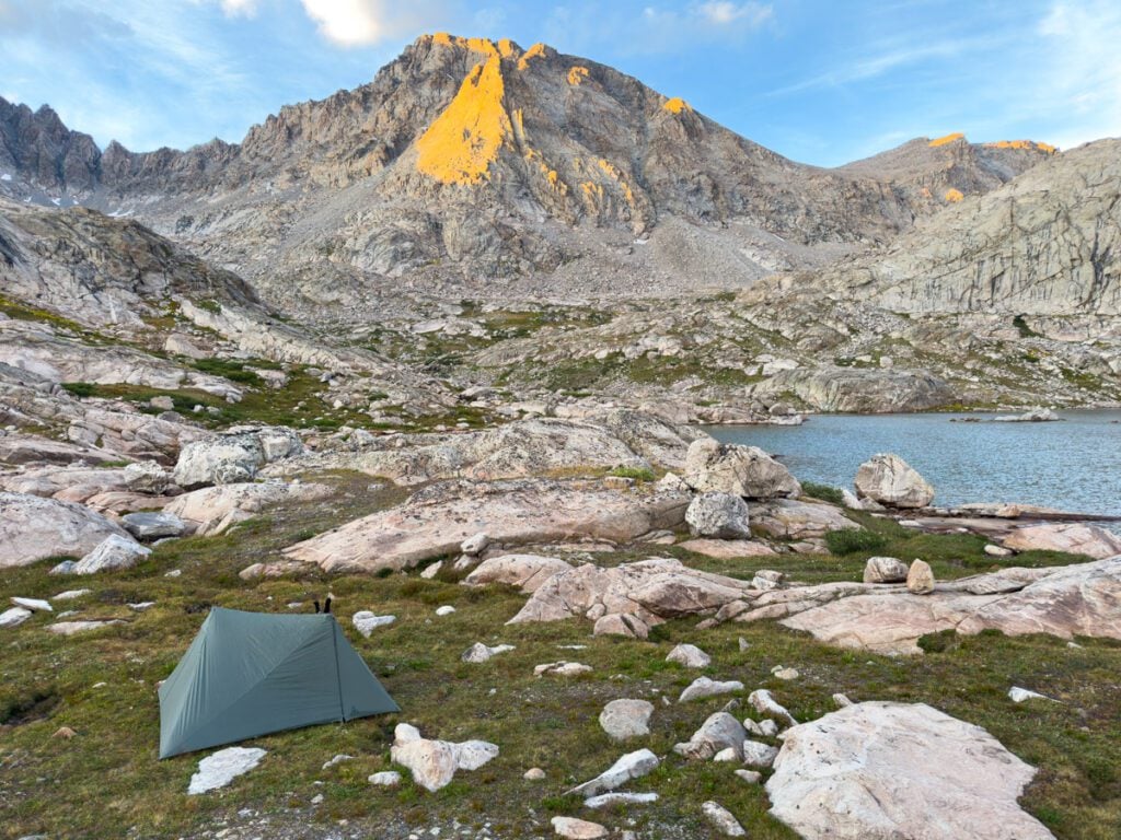
We awoke well rested and feeling good. It was hard to want to leave the unique perch we found, but we knew we had to get going because today was going to be a long one in terms of distance.
What we didn’t know was how sandbagged it would be.
This was the hardest day of the trip for me (day 1 was Quota’s hardest day…accident aside).
We got right back on the talus this morning. Although the last lake was calm, the views were stellar, and the rock was solid. We had 2 small sections of scrambling – opting to take the “red line” instead of the alternate. It was a great choice. Nothing felt hard or scary – although both of us scramble quite often.
At the end of Lower Alpine Lake, the sky opens up. It had been 2 days surrounded by nothing but steep peaks, and it felt like we were hanging out at nature’s best infinity pool.
We stopped and took a rest before diving into what I can only call the most convoluted, aggravating bushwhacking I’ve ever had to do.
The route description made it seem like it was not a big deal, but between navigating endless microterrain, gullies that didn’t show up on the map, poisonous plants, getting slapped by sap-riddled pines, and dodging small cliffs that couldn’t be bypassed, it was a rugged morning.
Everything just got ugly by comparison. And the so-called “social trails” would show up only to aggravatingly be gone 100 feet later.
It took us 3 hours to go 3 miles, but in reality, we really went nowhere. We did a U-turn into another basin. That was it.
And after reaching Camp Lake, it still didn’t improve. The details are fuzzy but Camp Lake Pass (unnamed on some maps) was hot, rocky, and obnoxious.
There was more talus hopping around other lakes.
And the terrain just didn’t get easier.
I started to feel sick to my stomach, and Quota lost their water filter thrashing through trees (it was carabinered to their pack with a climbing-rated carabiner AND in a pocket – sheesh).
There is a point in every trip where I wonder why the hell I do this for fun, but this was a step beyond that.
I wanted to quit…badly.
I took a break, tried not to vomit, and weighed my options.
Looking at a map we could have bailed to the CDT red line. But there were other areas I wanted to see, and we still had to get back to the car.
So I would lose elevation just to have to gain it all over again. There wasn’t an easy button.
My choice was simple. Go lower and then go higher again, or accept that this was a hard journey and surrender.
I chose the latter.
So off to Hay Pass we went. The winds started to bluster in the mid-30s. Storms threatened and retreated.
We dodged a particularly quick thunderstorm that chased us down Hay Pass.
Then we bopped into a sprawling bog. At least it was flat…sorta…lots of holes hidden in that marshy grass.
Dusk was approaching, and we had hardly seen anyone all day, but we could see the last mini pass to Long Lake.
Determined and running on processed sugar, we decided we were going to make it camp – long stint of even MORE talus be damned. About 1/2 way through Long Lake the talus relented, we found a flat piece of ground and called it quits.
But the weather had other plans. All was calm when we started, but the winds picked up, almost sending our tent off into the night. We went from stakes, to rocks, to even more rocks, to having the entire tent guyed out with 25lb rocks. The whole ordeal took 45 minutes, and in the interim, Quota slipped into the lake and got their camp socks soaking wet.
My only pair of good socks (since my blisters were so bad at this point, I could only wear my Injinji’s) was still trying to dry after being dragged through boggy terrain.
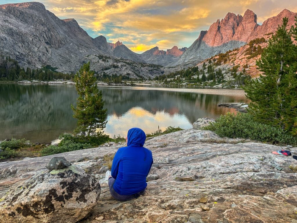
But alas, a delicious dinner awaited us. And the sunset was unbelievable.
We collapsed in a heap of exhaustion and hoped the wind wouldn’t keep us awake.
Rough Miles: 14.8 miles
Rough Elevation Gain: 4,050 feet
Approximate Time (hiking and breaks): 10h 15min
Off-trail miles (estimated): 11 miles, social use trail at times
Day 5: Long Lake to Lower Bonneville Lake via the Unbelievable Middle Fork Basin
We awoke to calm winds and bluebird skies. What a relief! I didn’t sleep the best, but it would have to do.
As we stretched with our morning coffee, we packed up camp and began our talus-filled trek.
A group we passed recommended staying high around the rest of Long Lake, so we opted to take their advice. This involved a small section of scrambling, which was rather enjoyable in the warm, still morning.
From there, the terrain got comparatively really mellow. We were making our way to Halls Lake, and the route description made it seem like it was going to be a willow-filled, soggy challenge.
That was nowhere near the case.
For the first time on the entire trip, we were making really good time on cross-country terrain.
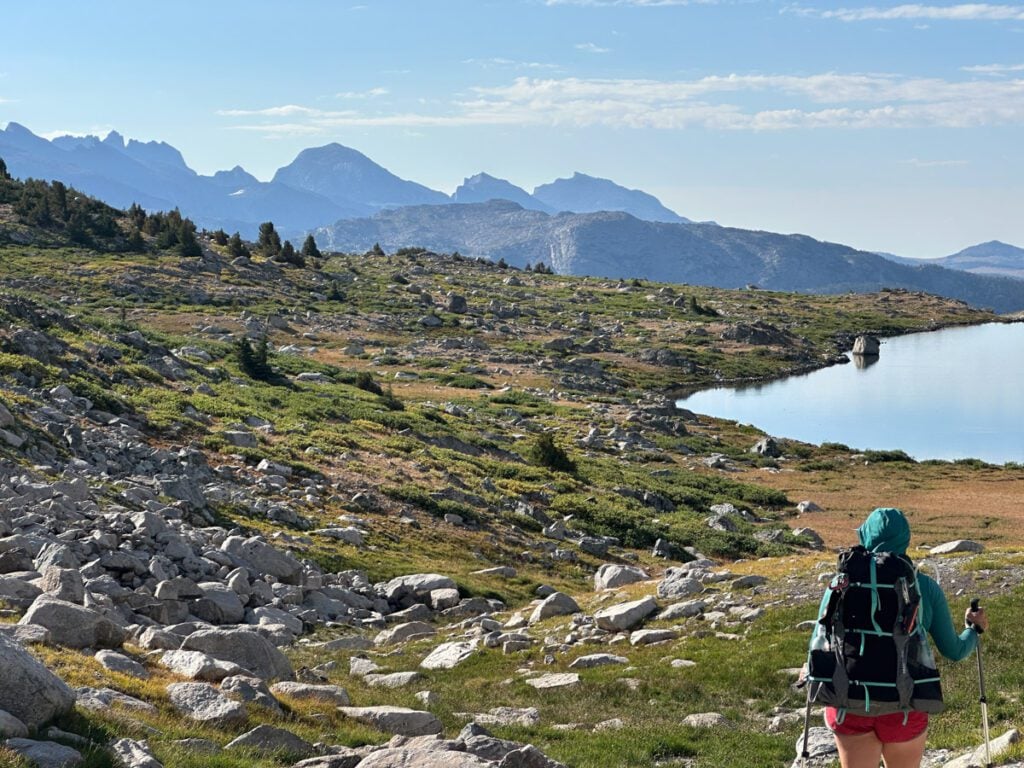
Generally, contouring and heading towards Halls. The willows were only knee-high at worst. The bogs were dried up for the season, and the terrain was mostly flat.
What a relief from yesterday’s hellscape.
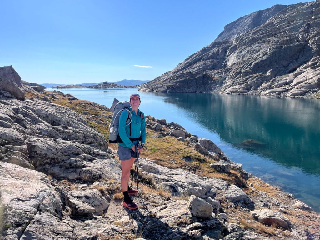
Near Halls Lake, we picked up the drainage and followed that directly, since the water was low. This made for a really quick jaunt. Halls was shockingly gorgeous. The water was unbelievably clear. Looked like the kind of place I wouldn’t mind stopping over at.
And to our surprise, we found a small use trail.
We peeled away from the trail as we made our way to the Middle Fork Lake and Basin.
This was again gentle. Slowing contouring and cruising down hill into the basin.
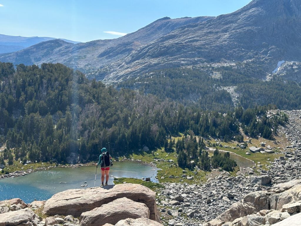
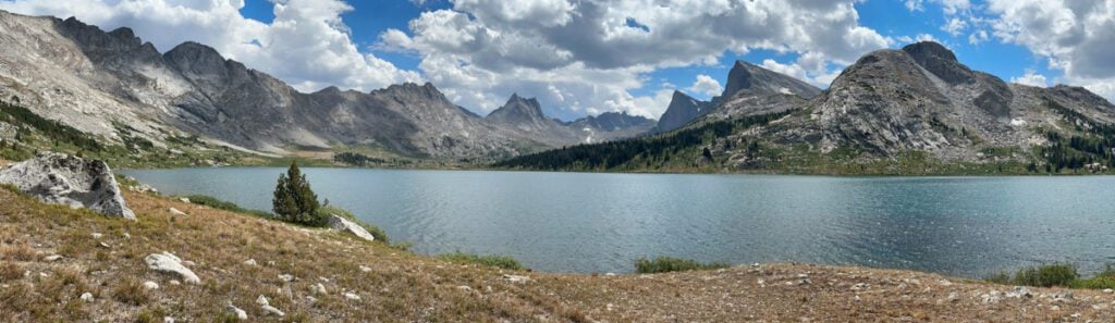
Middle Fork feels more like Middle Earth. It is a huge crescent-shaped lake with dramatic peaks at the far end. It feels like something out of a fairy tale.
We were excited to pick up a trail here for a mile or two. But our excitement was short-lived when we realized that the trail decided to go directly through boob-high willows.
So off to willow whacking land we went until we spotted the perfect lunch spot.
I wanted to linger here forever. We took at least an hour break just enjoying the incredible views, swimming twice (!!), and eating lunch.
But eventually, the High Route calls you onwards, and we still had another pass before our end destination.
Along the way to Lee’s Lake, we bumped into a woman having a very normal backpacking trip. Not trying to smash as many rock-jumbled passes and convoluted backcountry lake hopping in one day as possible. We hadn’t seen anyone like that since Titcomb, and it was really lovely to chat with her as we filtered water.
Then we made our way up Bonneville Pass (not sure if that’s its real name). We knew better at this point than to be lulled into a false sense of security.
The aggressive, type 2 fun had not been had yet today. Our talus quota hadn’t been met. We still had work to do.
This pass packed a punch.
It was impossible not to be distracted by Pronghorn Peak. From afar, it looks like an overhanging pyramid. Mighty, but not insane. Up close – it was mind-boggling!
The peak is actually two prominent points – granite walls soaring thousands of feet into the air surrounded by impregnable buttresses on both sides.
What. A. Wonder.

This kept us distracted up the first part of the pass, which was ascending either steep big boulder talus or 4-foot high willows, your choice.
Then you reach a small lakelette. And this is when we made a bad decision.
The peak was so large and imposing that it became really challenging to look at the map and the terrain in front of you and figure out where the pass was.
There wasn’t a hard line from the folks who set the route – it’s a high route after all, but I did have a GPS recording of someone who had done it. I thought I was on their line, but we weren’t.
It took us a little too long to realize we were actually climbing a sub-peak instead of the pass. But it was clear that the line I had was intentionally bypassing granite slabs.
We figured the slabs must be too steep.
But as we contoured around to the pass, trying not to slip on the terrain as it went from talus to loose, 60-degree dirt (gag), we decided the slabs were the way to go.
We had to descend to try to find stable ground (read: not possible) and eventually we made it to the slabs. Take our word for it – just scramble the darn slabs!
This pass wanted to tease us until the very end. Every time we thought we were on top of it, another small obstacle appeared. This went on for far too long, but mentally, I was ready (Quota wasn’t having it).
Eventually, we reached the pass.
Took a break, then descended down the still insanely steep grass ledges.
We had to scamper here because the clouds were getting darker. Although it never reminded us of impending thunderstorms, wet, steep grass and cliffs don’t really create ideal hiking conditions.
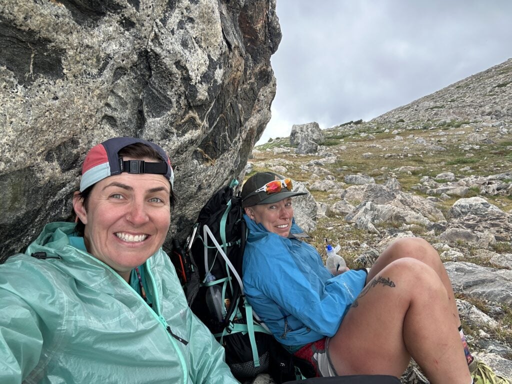
As we descended into Upper Bonneville Lake, Quota needed a break. Her bum ankle was bothering her so we sat under a boulder to wait out some rain.
From there, we picked up a faint use trail and finally descended into Lower Bonneville Lake. A stunning slice of mountain paradise.
Camping was harder to find here than we had anticipated, and again, we ran into a few more normal, some may say sane, backpackers. They had luxuries like camp chairs. I hadn’t seen a chair in 5 days. Their energy was almost alarming – so bubbly and silly, taking sunset photos on rocks.
We felt battle-hardened. Rugged. And a lot like hiker trash in our DIY camp booties made with duct tape. But it was warm and windless. We had trees at camp for the very first time. And life felt perfect.
Rough Miles: 14 miles
Rough Elevation Gain: 3,300 feet
Approximate Time (hiking and breaks): 9h 50min with a gloriously long lunch break
Off-trail miles (estimated): 11 miles
Day 6: Bonneville Lake to Raid Pass Calling Search and Rescue
It was another morning where we both wanted to linger. Bonneville Lake was so pretty – it was the first time we had a zoomed-out view of the terrain we had traveled through (well, part of it anyway).
But alas, the High Route had one more big adventure for us.
We started out as every morning starts out. Some talus and a big pass. But this one didn’t feel too bad. There was a use trail – what a treat!
We noticed the air felt a bit crisper today – almost as if fall was whispering in the early morning light.
At the top of this unnamed pass – let’s call it Raid Pass, cuz that’s the peak next door – we took a quick break and surveyed the land.
Below us lay nearly a mile of large to extra-large talus. The pass dipped down, was flat, then continued to descend.
Oh goody! Here is our 3 hours of rock hopping – at least we get it over early.
We got going, feeling strong. Both of us were surprised to never be sore on this trip. Sure, our feet would get tired and our ankles would groan by the end of the day, but we never felt weak or overly sore.
I was in front. Quota took a step, didn’t know their foot was caught, and fell. When they fell, their leading foot fell into a hole.
They couldn’t get up and were screaming.
I tried to lift them up by their armpits to get the weight of the pack off of their body. And she got upright, cursed some more, and wiped the blood from her banged-up shin.
And then started walking.
This was where things started to go downhill. Quota was unable to weight their right foot easily, and the situation did not improve. We were up on a high pass with no water and no flat, solid ground for shelter.
There was one choice, and one choice only. We needed to get down and call for help. The story about how we self-rescued off the pass and were rescued by helicopter is one worth reading.
Rough Miles: 3.4 miles
Rough Elevation Gain: 1,270 feet
Approximate Time (hiking and breaks): 3h 15min, including our self-rescue and getting to safe ground.
Off-trail miles (estimated): 3.4 miles
My trip may not have gone as planned, but we still managed to nearly complete the Wind River High Route. I don’t feel like I didn’t finish. We were 2 miles from the point where the High Route joined the trail when Quota got hurt.
Catch me on YouTube!
Want more secret backpacking trips? Ultralight hacks that every hiker can adapt? Experience the top outdoor destinations in the world without the crowds? If you want to get insider knowledge of all things outdoors, then you’ll wanna subscribe to my YouTube channel, where I am giving away my DECADES of knowledge as an outdoor professional. I’ll see ya there!
